Volusia County, Florida ~ Beaches
- National &
State Parks - County &
City Parks - Beaches
Volusia - Boat Ramps
Volusia - Fishing Piers
Volusia - Map of
Beaches - Beaches in
Adjoining
Counties
Find Public Beaches in Volusia County, Florida
Seach our site below
Ormond by the Sea & Ormond Beach Accesses
Wilbur by the Sea & Ponce Inlet Beach Accesses
Al Weeks North Shore Park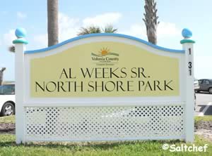 1631 Oceanshore Boulevard
Ormond-by-the-Sea, FL 32176
GPS 29° 20'00.07" N 81° 03'32.56" W
Go to map of beaches in Volusia County
|
|
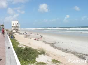
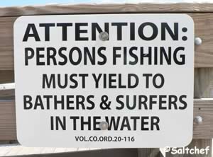
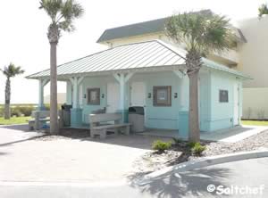
Al Weeks North Shore park offers; beach access, swimming, surf fishing with respect to swimmers, picnic area, grills, benches, rinsing showers and restrooms. The park itself has 27 parking spaces, an additional lot across the street has about 70 spaces.
Go to Video of Al Weeks North Shore Beach Park.
Andrinopoulos Park 2540 South Atlantic Avenue
Daytona Beach Shores, FL 32118
GPS 29° 11'08.76" N 80° 59'16.60" W
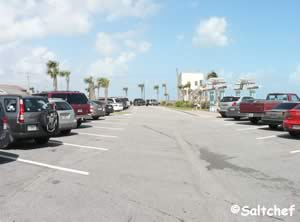
( Entrance into north parking area )
NOAA Daytona Beach Shores, FL 8721120
|
|
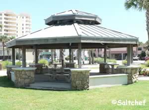
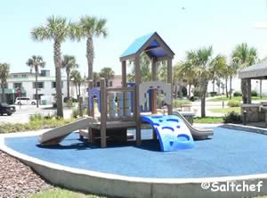
Andrinoplous Park in Daytona Beach Shores offers a nice gazebo for picnics, playground and about 65 off beach parking spaces. there are no restroom facilities at this location. Access to the beach is just across the street.
Andy Romano Beachfront Park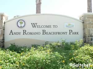 839 South Atlantic Avenue
Ormond Beach, FL 32176
386-676-3250
Sunrise to Sunset
GPS 29° 16'17.52" N 81" 01'47.06" W
NOAA Daytona Beach Shores, FL 8721120
|
|
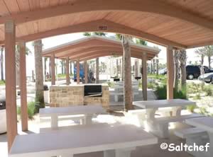
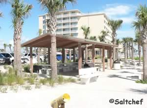
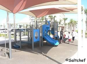
Andy Romano Beachfront Park in Ormond Beach Florida is a crisp new facility sitting on 4 beachfront acres and offers; Beach access, sunbathing, fishing with respect to swimmers and surfers, swimming, lifeguards ( Please check ), outdoor rinsing showers, pavilions, play fountain, playground and restrooms. There are about 180 parking spaces.
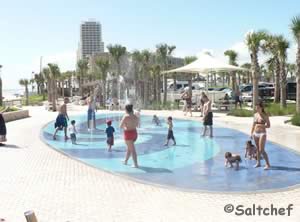
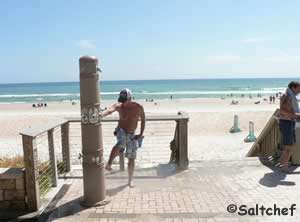
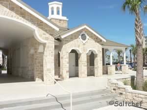
Beachcomber Park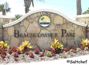 2608 South Atlantic Avenue
Daytona Beach Shores, FL 32118
GPS 29° 10'59.32" N 80° 59'11.98" W
( Entrance to parking )
NOAA Daytona Beach Shores, FL 8721120
|
|
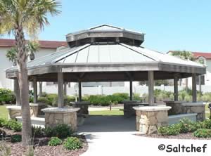
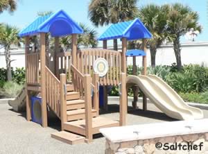
Bicentennial Park ~ Michael Crotty ~ Ocean Side
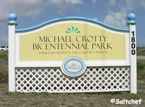 1800 North Oceanshore Boulevard
Ormond Beach, FL 32176
Hours:
Sunrise to Sunset
1-386-736-5953
GPS 29° 20'24.137" N 81° 03'43.61" W
Go to map of beaches in Volusia County
|
|
Michael Crotty Bicentennial Park stretches from the Atlantic Ocean to the Halifax River and offers an abundance of activities like; beach access, swimming, surf fishing with respect to swimmers, sunbathing, pavilions, grills, hand launching of kayaks or canoes into the Halifax River, rinsing showers and restrooms. About 70 parking spaces.
Click here to go to information on the fishing pier on the Intracoastal side of the park.
Go to Video of Michael Crotty Bicentennial Park.
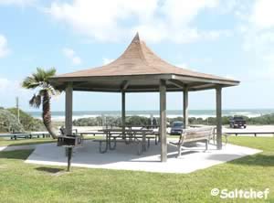
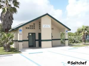
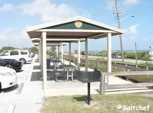
Birthplace of Speed Park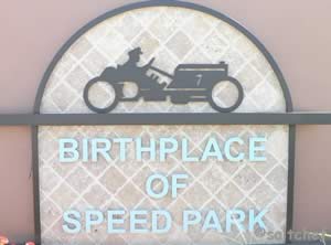 21 Ocean Shore Boulevard
Ormond Beach, FL 32176
1-386-676-3250
Hours: Sunrise to Sunset
GPS 29° 17'31.80" N 81° 02'22.67" W
NOAA Daytona Beach Shores, FL 8721120
|
|
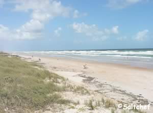
Birthplace of Speed park offers; Public beach access, swimming, pavilion, grill, outdoor rinsing shower and restrooms.
Go to Video of Birthplace of Speed Park.
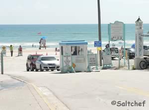

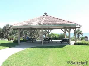
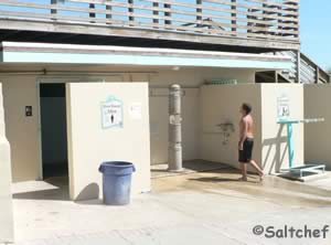
Cape Canaveral National Seashore Northern Access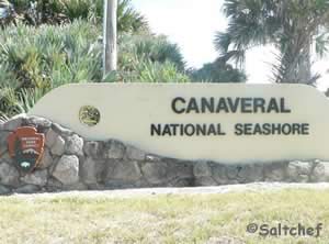 Closest intersection is;
Turtlemound Road and Trout Avenue
Bethune, FL 32169
Entrance is 1/4 mile south on Turtlemound Road from above intersection.
GPS 28° 56'12.47" N 80° 49'49.04" W
( Gate at north entrance to park )
Go to map of beaches in Volusia County
|
|
Access road is a bout 6.5 miles long to the end with 5 official beach access points, and lagoon access points along the way. Turtle Shores is at the very end. There are also two boat ramps in this section, the closest one to the gate is a modern design and the one at the end is primitive. There are also two fishing piers on the lagoon side.
| Area | Miles from Entrance | Parking Spaces | Restrooms | Disability Access to Beach |
| 1 | At Entrance | 82 Regular 6 Handicapped | Yes | Yes |
| Visitor Center | 7/10ths | Yes | No | |
| 2 | 2 - 1/10th | 23 Regular 2 Handicapped | Yes | Yes |
| 3 | 3 - 1/10th | 23 Regular 1 Handicapped | Yes | No |
| 4 | 4 - 2/10ths | 24 Regular 1 Handicapped | Yes | No |
| 5 | 6 - 5/10ths | 30 Regular 2 Handicapped | Yes | Yes |
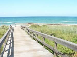
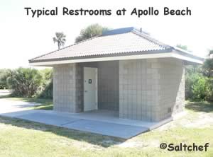
Dahlia Avenue Park 3629 South Atlantic Avenue
Daytona Beach Shores, FL 32115
GPS 29° 08' 51.63" N 80° 58' 01.78" W
( Entrance )
NOAA Daytona Beach Shores, FL 8721120
|
|
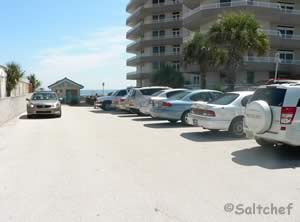
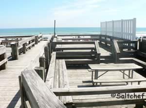
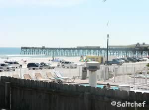
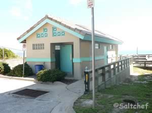
Dahlia Avenue Park offers; Beach access, swimming, picnic tables, rinsing showers and restrooms. 17 parking spaces.
Daytona Beach Area Drive On Beach Accesses
![]()
Drive on beach accesses at: Beach driving fees
| Road Name | GPS Coordinates |
| Granada Boulevard | 29° 17'31.23" N 81° 02'22.56" W |
| Cardinal Drive | 29° 16'31.56" N 81° 01'53.60" W |
| Williams Ave | 29° 15'32.79" N 81° 01'24.13" W |
| University Boulevard | 29° 14'32.31" N 81° 00'55.86" W |
| Seabreeze Boulevard ( You can drive NORTH from here ) |
29° 14'08.18" N 81° 00'44.49" W |
| Conservation area no beach driving | |
| International Speedway Boulevard ( You can drive SOUTH from here ) | 29° 13'19.07" N 81° 00'19.97" W |
| Silver Beach Boulevard | 29° 12'44.29" N 81° 00'04.01" W |
| Botefuhr Avenue | 29° 12'11.28" N 80° 59'47.01" W |
| Florida Shores Boulevard | 29° 10'53.64" N 80° 59'08.07" W |
| Minerva Road | 29° 11'30.90" N 80° 59'26.74" W |
| El Portal Street | 29° 09'32.60" N 80° 58'24.46" W |
| Dunlawton Boulevard | 29° 09'04.41" N 80° 58'08.05" W |
| Emilia Street | 29° 08'28.39" N 80° 57'49.05" W |
| Beach Street ( South bound towards Ponce Inlet) | 29° 05'04.48" N 80° 55'33.77" W |
| All ramps are subject to closure based upon tides | |
|
|
Esther Street Beachfront Park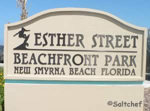 Esther Street & North Atlantic Avenue
New Smyrna Beach, FL 32169
GPS 29° 02'23.87" W 80° 53'51.16" W
NOAA Daytona Beach Shores, FL 8721120
|
|
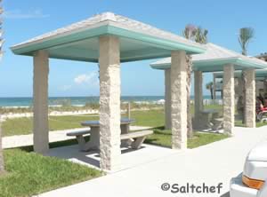
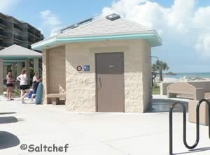
Esther Street Beachfront Park offers; 34 parking spaces, small pavilions, rinsing showers and restrooms.
Flagler Avenue Park
Closest intersection is;
Flagler Avenue & South Atlantic Avenue
New Smyrna Beach, FL 32169
GPS 29° 02'18.79" N 80° 53'45.85" W
Go to map of beaches in Volusia County
|
|
Flagler Avenue Park offers; 90+/- parking spaces, beach access, swimming, fishing with respect to swimmers, reservable pavilion and restrooms. The park is owned by the City of New Smyrna Beach and maintained by Volusia County's Coastal Division.
If you want to drive on the beach check out the fees and general regulations
Frank Rendon Park 2705 Atlantic Avenue
Daytona Beach Shores, FL 32118
GPS 29° 10'48.27" N 80° 59'05.39" W
Go to map of beaches in Volusia County
|
|
Frank Rendon Park is maintained by Daytona Beach Shores and offers; Sheltered picnic areas, grills, children's playground with padded floor, disability-accessible restrooms, water fountain, outdoor showers, 140 off-beach parking spaces, handicapped parking, fishing with respect to swimmers and surfers and a wooden observation deck.
Grayce Kenemer Barck North Beach Park 1100 North Atlantic Avenue
New Smyrna Beach, FL 32169
GPS 29° 02'45.62" N 80° 54'03.24" W
( Entrance )
Go to map of beaches in Volusia County
|
|
Grayce Kenemer Barck North Beach Park offers; beach access, swimming, pavilions, picnic tables, rinsing showers and restrooms.
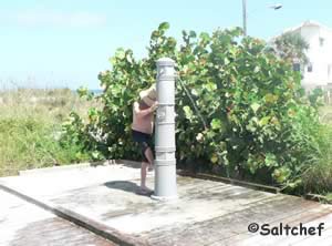
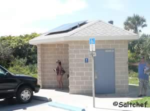
Larry Fornari Park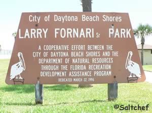 3259 South Atlantic Avenue
Daytona Beach Shores, FL 32115
GPS 29° 09' 23.53" N 80° 58' 19.14" W
( Entrance )
NOAA Daytona Beach Shores, FL 8721120
|
|
Larry Fornari park in Daytona Beach Shores offers; 14 parking spots + 2 handicapped spaces, beach access, swimming, surf fishing, picnic tables, grill, rinsing shower.
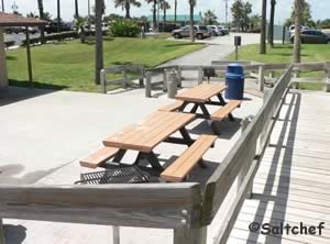
Lighthouse Point Park 5000 South Atlantic Avenue
Ponce Inlet, FL 32127
386-756-7488
GPS 29° 04'40.76" N 80° 55'19.09" W
Go to map of beaches in Volusia County
|
|
Hours:
6:00am - Sunset
Fees:
$5.00 per vehicle to access beach and jetty area.
No fee if you walk or bicycle in
Fees for lighthouse admission.
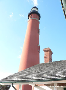
Access into the lighthouse is payable at the lighthouse visitor center.
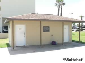
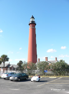
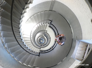
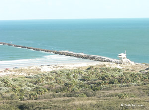
Lighthouse Point Park is 52 acres in size and offers; Beach access, surf fishing, jetty fishing, wildlife viewing, pavilions and restrooms. There is parking for 100 + cars in various location around the park. No dogs on the ocean beach or jetty. Dogs are only permitted on the Intracoastal beach while leashed. Fishing license is needed to fish whether on the jetty or from the beach.
Mary McLeod Bethune Beach Park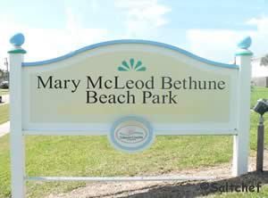 6656 South Atlantic Avenue
New Smyrna Beach, FL 32169
Hours:
Sunrise to Sunset
GPS 28° 57'05.93" N 80° 50'26.39" W
Go to map of beaches in Volusia County
|
|
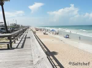
Mary McLeod Bethune Beach Park 6 acres in size and stretching from the Halifax River to the Atlantic Ocean offers; beach access, swimming, surf fishing with respect to swimmers, pavilions, grills, playground on Intracoastal side, volleyball courts, small fishing deck along Intracoastal, hand launch a canoe or kayak into the Intracoastal waterway.

Smyrna Dunes Park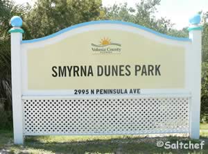 2995 North Peninsula Avenue
New Smyrna Beach, FL 32169
Fees do apply at this park click here
GPS 29° 03'56.79" N 80° 54'52.67" W
Go to map of beaches in Volusia County
|
|
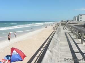
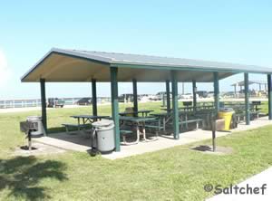
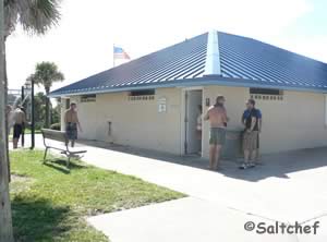
Smyrna Dunes park is 73 acres in size and offers; beach access, swimming, surf fishing with respect to swimmers, pavilion and restrooms.
New Smyrna Drive On Beach Accesses
![]()
| Road Name | GPS Coordinates |
| Beachway Avenue | 29° 03'05.24" N 80° 54'13.18" W |
| Flagler Avenue | 29° 02'18.77" N 80° 53'47.66" W |
| Third Avenue | 29° 01'45.96" N 80° 53'29.68" W |
| 27th Avenue | 29° 00'32.74" N 80° 52'44.86" W |
|
|
Sunsplash Park 611 South Atlantic Avenue
Daytona Beach, FL 32118
GPS 29° 13'03.25" N 81° 00'12.24" W
Go to map of beaches in Volusia County
|
|
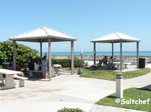
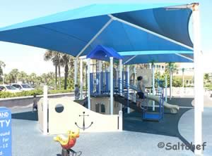
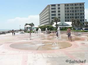
Sun Splash Park offers; Beach access, swimming, outdoor showers, parking for 140+/-, shaded playground, large water fountain and restrooms.
Tom Renick Park 1575 Ocean Shore Boulevard
Ormond-by-the-Sea, FL 32176
1-386-248-8072
GPS 29° 19'51.78" N 81° 03'31.56" W
Go to map of beaches in Volusia County
|
|
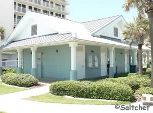
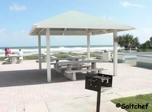
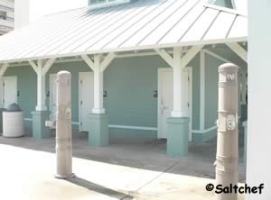
Tom Renick Park offers; Beach access, swimming, picnic areas, playground, outdoor showers and restrooms.
Go to Video of Tom Renick Beach Park.
27th Avenue Park
3701 South Atlantic Avenue
New Smyrna Beach, FL 32169
GPS 29° 00'32.74" N 80° 52'44.86" W
Go to map of beaches in Volusia County
|
|
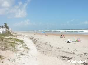
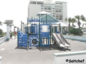
27th Avenue Park is 3.4 acres in size and offers; 150 +/- parking spaces, beach access, swimming, surf fishing with respect to swimmers, pavilion, rinsing showers and restrooms.
Van Avenue Park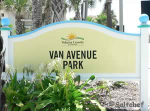 3101 South Atlantic Avenue
Daytona Beach, FL 32118
1-386-671-3402
GPS 29° 09'52.63" N 80° 58'34.34" W
( Entrance )
Go to map of beaches in Volusia County
|
|
Van Avenue Park offers; 12 parking spaces, beach access, swimming, surf fishing with respect to swimmers, picnic area, rinsing showers and restrooms.
Winter Haven Park
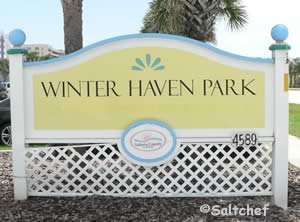 4589 South Atlantic Avenue
Ponce Inlet, FL 32127
GPS 29° 06'16.75" N 80° 56'30.84" W
Go to map of beaches in Volusia County
|
|
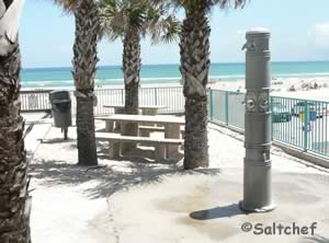
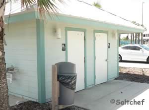
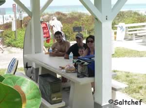
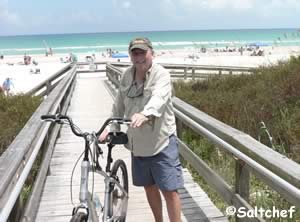
Winter Haven Park is 1.3 acres in size and offers; beach access, swimming, surf fishing with respect to swimmers, picnic tables and restrooms.
Volusia County beach driving fees are:
![]() $20.00 per day
$20.00 per day
$25.00 annual resident pass
$100.00 annual non-resident pass
Beach driving permits are required between Feb 1st - Nov 30th.
Beach is open to driving during daylight hours only.
Beach driving is subject to tidal conditions
Beach Pass Website
Bonfire rings on beach
Ring locations
Tom Renick Park, Cardinal Beach Ramp, Frank Rendon Park, Beachway Beach Ramp, Saphire Walkway, 27th Avenue beach Ramp and Hiles Beach Ramp.
Available by reservation November through April. call: 1-386-239-6414
Useful Links
| Beach Parks in Volusia County Florida |
| Areas in Volusia County Florida include; Daytona, Ormond by the Sea, Ormond Beach, Holly Hill, Daytona Beach, Daytona Beach Shores, Port Orange, Ponce Inlet, New Smyrna Beach, Edgewater, Deltona, Osteen, DeLand and Orange City. |
| Bodies of brackish and saltwater in Volusia County Florida include; Atlantic Ocean, Big Cove, Big Snapper Cut, Blind Spruce Creek, Botheration Creek, Bottle Island Creek, Browns Bay, Bulow Creek, Callalisa Creek, Canal Bradano, Canal Calore, Cedar Creek, Cook Creek, Dead End Creek, Elwinder Creek, Fox Slip, Gaines Slough, Halifax Canal, Halifax Creek, Halifax River, Hunter Creek, Indian River North, Inlet Creek, Intracoastal Waterway, Little Snapper Cut, Live Oak Creek, Lost Creek, Mill Creek, Mosquito Lagoon, Murray Creek, Orange Island Creek, Ponce de Leon Cut, Potts Creek, Rockhouse Creek, Rose Bay, Sheephead Cut, Shipyard Canal, Slippery Creek, Smyrna Creek, Snake Creek, Spruce Creek, Strickland Creek, Ten Mile Creek, Thompsons Creek, Tomoka Basin, Tomoka River, Turnbull Bay, Turnbull Creek, Turner Flats, Webster Creek and Wilbur Bay. |
![]() Home
Home ![]() About
About ![]() Sitemap
Sitemap ![]() Credits
Credits ![]() Privacy
Privacy ![]() Advertise
Advertise ![]() Contact
Contact ![]()
