St Lucie County, Florida ~ Fishing Piers
- National &
State Parks - County &
City Parks - Beaches
St Lucie - Boat Ramps
St Lucie - Fishing Piers
St Lucie - Map of
Fishing Piers -
Fishing Piers in
Adjoining
Counties
Public Fishing Piers & Docks in Fort Pierce & Port St Lucie, Florida
Seach our site below
Bear Point Sanctuary Fishing Piers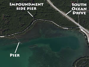 2601 South Ocean Drive
Fort Pierce, Florida 34949
GPS 27° 25'46.93" N 80° 16'52.54" W
( Parking and entrance )
GPS 27° 25'43.98" N 80° 17'16.85" W
( Foot of pier into Bear Point Cove )
Go to map of fishing piers in
St Lucie County
|
|
|
It is appox. a ½ mile walk to the Bear Cove Point pier, down the road / path with the gate. You will pass a pier about 180' in length on your right hand side on the which about 1700' down the same path. This first pier is located over the water impoundment side. The Bear Point Cove pier is another 1000' past this first pier. Bear Cove Point is about 450' in length.
There is a fair amount of parking along the road at this location. A hand launch / primitive ramp is located at the parking area. No restrooms at this location.
Black Pearl Boat Ramp Fishing Pier
414 Seaway Drive
Fort Pierce, FL 34950
GPS 27° 27'21.47" N 80° 19'23.92" W
( Foot of pier )
Go to map of fishing piers in St Lucie County
|
|
|
The Black Pearl fishing pier is about 1600' feet in length and runs parallel with the south causeway bridge on its northern side. Cleaning tables & restrooms are provided. This pier is quit long, so please check to make sure you have brought all your equiptment on the first trip.
A boat ramp is on site also.
Blind Creek Riverside North Fishing Pier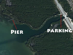 Approx. 2 miles north of the power plant on A1A.
34949
GPS 27° 22'46.51" N 80° 15'22.30" W
( Entrance )
GPS 27° 22'41.62" N 80° 15'35.26" W
( Foot of pier )
Go to map of fishing piers in
St Lucie County
|
|
|
The Blind Creek Riverside North fishing pier is near Little Mud Creek and is 240' in length. From the parking lot the pier is about a 1600' walk.
No restrooms at this location.
D.J. Wilcox Riverside Preserve Fishing Pier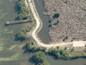 399 Wilcox Road
Fort Pierce, Florida 34946
GPS 27° 31'41.03" N 80° 20'55.22" W
Go to map of fishing piers in St Lucie County
|
|
|
Drop your canoe or kayak into the water and fish the Indian River Lagoon for Tarpon and Snook. If you do not have a canoe or kayak and want to fish there is a 125' long fishing pier at this location too. Watch beautiful shore birds while relaxing at this out of the way preserve.
No restrooms at this location.
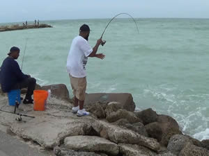
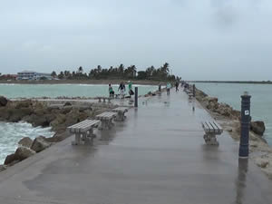
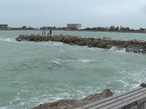
Jetty on South Side Fort Pierce Inlet ( Paved )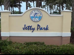 Seaway Drive & North Ocean Boulevard ( A1A )
Fort Pierce, FL 34949
GPS 27° 28'14.50" N 80° 17'24.53" W
( Foot of paved jetty )
Go to map of fishing piers in St Lucie County
|
|
|
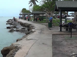
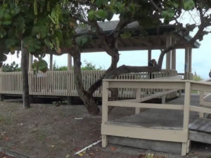
Adjacent to South Jetty Park the paved portion of the jetty is about 600' in length and offers the opportunity for species such as; Trout, Flounder, Snook, Bluefish and Red Drum can be caught at this area. The park has few oceanside picnic pavilions, swinging benches, some grills and restrooms.
Little Jim Fishing Pier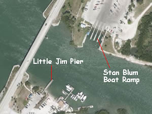 601 North Causeway Drive
Fort Pierce, FL 34949
Near the eastern end of the North Causeway Bridge
GPS 27° 28'43.14" N 80° 18'45.72" W
( Foot of pier )
Go to map of fishing piers in St Lucie County
|
|
|
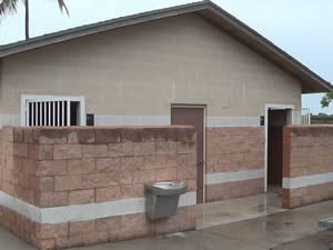
The Little Jim fishing pier located directly across the water from the Stan Blum boat ramp is 75 feet in length. The facility has a few single covered picnic tables and restrooms.
Melody Lane Fishing Pier
GPS 27° 26'46.70" N 80° 19'16.36" W
( Foot of pier )
The Melody Lane fishing pier is 200' in length with an area at the end measuring 14' x 24'.
Not on map or navigation yet.
Pepper Park Riverside Fishing Piers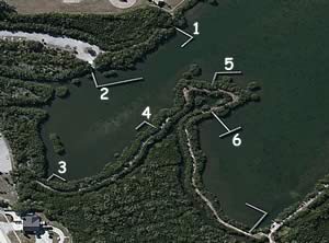 3302 North A1A
Fort Pierce, FL 34949
Go to map of fishing piers in St Lucie County
|
|
|
GPS 27° 29'40.61" N 80° 18'14.47" W |
GPS 27° 29'43.04" N 80° 18'10.96" W |
GPS 27° 29'49.33" N 80° 18'09.02" W |
GPS 27° 29'46.28" N 80° 18'13.70" W |
GPS 27° 29'44.07" N 80° 18'16.25" W |
GPS 27° 29'45.40" N 80° 18'16.27" W |
Six fishing piers at this park, all within a fairly close walking distance at Wildcat Cove. Wildcat Cove Preserve has an additional 2 piers within its boundaries. Pavilions, picnic tables, grills and restrooms.
River Park Marina Fishing Piers / Docks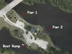 500 East Prima Vista Boulevard
Port St Lucie, FL 34983
GPS 27° 19'28.12" N 80° 19'59.01" W
( pier / dock 1 )
GPS 27° 19'25.82" N 80° 19'54.75" W
( pier / dock 2 )
Located along the North Fork St Lucie River, River Park Marina offers; 2 separate piers / docks running parallel with the shoreline, the one closest to the road is 140 feet in length, the second is 165 feet in length, picnic pavilion, grill, playground and restrooms.
A boat ramp on site also.
Queens Island Preserve Fishing Pier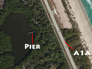 No address at this location
GPS 27° 31'16.23" N 80° 18'40.04" W
( Walkway at road to pier )
|
|
|
The Queens Island fishing pier is 90 feet in length over the waters of a tight alcove off of Blue Hole Creek.
No restrooms at this location.
South Causeway Park Fishing Pier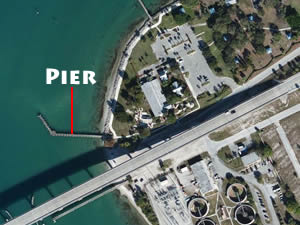 Northeastern side of the bridge / causeway
This road may be called;
A1A / Seaway Drive / North Ocean Boulevard
Fort Pierce, FL 34949
GPS 27° 27'32.98" N 80° 19'01.90" W
( Foot of pier )
Go to map of fishing piers in St Lucie County
|
|
|
Located on the far western side of the park near the bridge, the South Causeway Park fishing pier is about 325' in length. The area offers; a picnic area along beach portion and in main section of the park, playground & restrooms.
A
boat ramp on site also.
Veterans Park Fishing Pier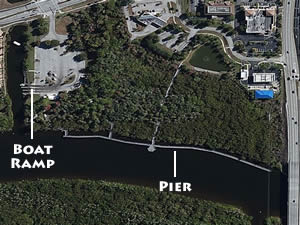 2200 Southeast Veterans Memorial Parkway
Port St. Lucie, FL 34952
GPS 27° 16'29.80" N 80° 19'14.50" W
( Pier )
Go to map of fishing piers in
St Lucie County
|
|
|
The fishing pier at veterans Park runs parallel with the shoreline is about 1100' in length. The area offers 1 large picnic pavilion with tables and grills, 3 smaller pavilions at entrances to the pier & restrooms.
A
boat ramp on site also.
Wildcat Cove Preserve Docks / Piers
3399 North SR A1A
Fort Pierce, Florida 34949
GPS 27° 29'53.35" N 80° 18'07.95" W
( Entrance )
GPS 27° 29'52.18" N 80° 18'17.95" W
( Pier 1 )
GPS 27° 29'43.11" N 80° 18'38.36" W
( Pier 2 )
Go to map of fishing piers in St Lucie County
|
|
|
Comprising 111 acres Wildcat Preserve offers, Birding, hiking trails, piers & docks, fishing and observation areas. Dogs are welcome at this park too. Walk down to the fishing dock / piers and drop a line into the Wildcat Cove and see what you can catch.
Vitolo Family Preserve North Fishing Pier
4101 South Ocean Drive
Fort Pierce, Florida 34949
GPS 27° 24'34.94" N 80° 16'20.37" W
( Entrance off A1A )
GPS 27° 24'41.60" N 80° 16'39.89" W
( Foot of north pier )
Go to map of fishing piers in St Lucie County
|
|
|
The Vitola Family Preserve North fishing pier is 70 feet in length over the waters of the Indian River.
Useful Links
| Public Fishing Piers in St Lucie County Florida |
|
|
| Areas in St Lucie County Florida include; Fort Pierce, Indian River Estates, Lakewood park, Port Saint Lucie, River Park, Saint Lucie and White City |
| Areas Brackish and Saltwater in St Lucie County Florida include; Atlantic Ocean, Big Mud Creek, Blue Hole Creek, Fort Pierce Cut, Fort Pierce Inlet, Indian River, Intracoastal Waterway, Snapper Cut and St Lucie Cut. |
![]() Home
Home ![]() About
About ![]() Sitemap
Sitemap ![]() Credits
Credits
![]() Privacy
Privacy ![]() Advertise
Advertise ![]() Contact
Contact ![]()
