Martin County, Stuart, Hobe Sound, Jensen Beach, Florida ~ Fishing Piers
- National &
State Parks - County &
City Parks - Beaches
Martin - Boat Ramps
Martin - Fishing Piers
Martin - Map of
Fishing Piers
Martin - Fishing Piers
in
Adjoining Counties
Local Public Fishing Piers in Martin County, Stuart, Hobe Sound, Jensen Beach, Florida
Seach our site below
Bath Tub Reef Park Pier / Dock ( Intracoastal side )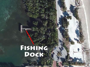 1585 Souitheast MacArthur Boulevard
Stuart, FL 34996
GPS 27° 11'08.76" N 80° 09'38.89" W
( Dock / Pier )
Go to map of fishing piers and bridges in Martin County
|
|
The Bath Tub Reef Park pier / dock is about 65' feet in length over the waters of the Indian River and has a 45' tee at the end. Restrooms are across the street at the beach access.
Clifton Perry Beach Intracoastal Side Fishing Pier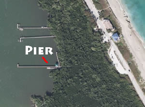 20 SE MacArthur Boulevard
Stuart, FL 34996
The Clifton Perry Beach fishing pier on the intracoastal side is about 300' in length over the water with a shaded portion at the shore.
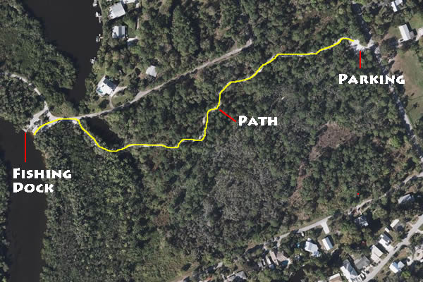
Delaplane Preserve Fishing Dock
Closest intersection to parking lot is;
SW Linden Street & SW Gaines Avenue
Stuart, FL 34997
From the above intersection go 700' south on SW Gaines Avenue, parking lot will be on the right.
GPS 27° 07'47.90" N 80° 15'51.75" W
( Foot of dock )
Delaplane Preserve offers; kayak launching, hiking, a small fishing dock. It is a 1700' walk from parking lot to the dock and the launching points.
Greenfield Park Fishing Dock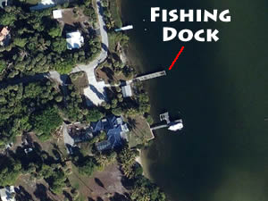 4900 Southeast Cabot Street
Hobe Sound, Florida 33455
GPS 27° 03'18.83" N 80° 07'16.75" W
( Foot of dock )
Go to map of fishing piers and bridges in Martin County
|
|
The Greenfield Park facility offers; fishing dock extending about 75 feet out over the western waters of the Indian River and a small picnic pavilion with tables. No restrooms at this location.
Indian Riverside Park Pier
1707 Northeast Indian River Drive
Jensen Beach, FL 34957
GPS 27° 13'28.89" N 80° 12'42.47" W
( Foot of pier )
Go to map of fishing piers and bridges in Martin County
|
|
Indian Riverside Park pier is about 725' in length, extending out over the western waters of the Indian River. Other amenities and activities include; shoreline fishing, picnic pavilions, interactive play fountain & restrooms
Jensen Beach Causeway Fishing Pier
889 Northeast Causeway Boulevard
Jensen Beach, FL 34957
GPS 27° 15'10.26" N 80° 13'18.80" W
( Foot of pier )
GPS 27° 15'06.04" N 80° 13'29.76" W
( Entrance heading westbound on causeway )
GPS 27° 15'04.41" N 80° 13'32.69" W
( Entrance heading eastbound on causeway )
Go to map of fishing piers and bridges in Martin County
|
|
The Jensen Beach Causeway pier is 300' in length over the Indian River. Pier is located on the northeastern side of the causeway. Picnic shelters, playground and restrooms are available.
A
boat ramp is on site also.
Joes River Park Fishing Pier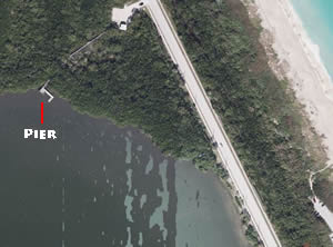 3500 NE Ocean Boulevard
Stuart, FL 34996
Joe's River Park offers; Fishing pier / dock on the intracoastal side, picnic pavilion, grill and parking for about 6 cars. Hand launch your kayak here. No restrooms at this location.
Kiplinger Nature Preserve Fishing Dock
Across the street from:
4181 S Kanner Hwy
Stuart, FL 34997
GPS 27° 09'23.35" N 80° 15'13.10" W
( fishing deck )
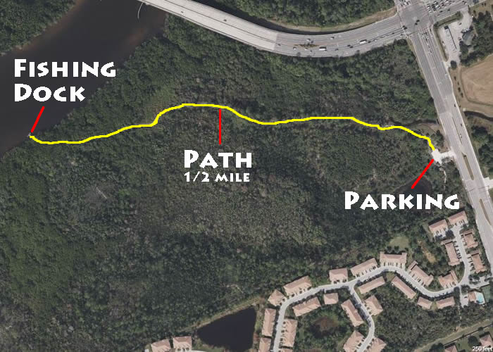
Kiplinger Nature Preserve pier / dock and launch is about a ½ mile walk on the trail that leads off the northern end of parking lot.
Sandsprit Park Fishing Piers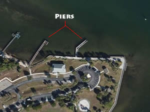 3443 Southeast St. Lucie Boulevard
Stuart, FL 34997
GPS 27° 09'46.34" N 80° 11'43.21" W
( Entrance )
GPS 27° 09'51.73" N 80° 11'36.89" W
( Foot of pier 1 )
GPS 27° 09'52.20" N 80° 11'33.92" W
( Foot of pier 2 )
Go to map of fishing piers and bridges in Martin County
|
|
The Sandsprit Park fishing piers are as follows;
Pier 1 is 160 feet in length.
Pier 2 is 120 feet in length.
Picnic shelters, playground & restrooms are available.
A
boat ramp is on site also
Shepard Park Fishing Dock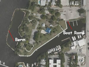 600 SW Ocean Boulevard
Stuart, FL 34997
GPS 27° 11'51.22" N 80° 15' 26.89" W
( Entrance )
NOAA South Fork,st. Lucie River, FL 8722376
|
|
Shepard Park offers; A fishing dock which runs about 500' along an area that is mostly enclosed by a berm type structure, you could also fish from atop the berm as there is a concrete path, picnic pavilion, playground and restrooms.
A boat ramp is on site also.
Twin Rivers Park Fishing Docks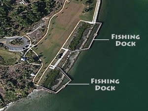 3805 SE Kubin Avenue
Stuart, FL 34997
772-288-5400
7am - Sunset
GPS 27° 09'47.66" N 80° 10'54.94" W
NOAA Great Pocket, St. Lucie Inlet, FL 8722381
|
|
The Twin Rivers Park fishing docks are located near the confluence of the St Lucie & Indian Rivers. The total length of the fishable area is 650' +/-. Restrooms are available.
Useful Links
| Public Fishing Piers in Martin County Florida |
|
|
| Areas in Martin County Florida include;Jupiter Island, Ocean Breeze Park, Sewall's Point, Stuart, Hobe Sound, Hutchinson Island, Indiantown, Jensen Beach, North River Shores, Palm City, Port Salerno, Rio and Port Mayaca. |
| Areas of Brackish and Saltwater in Martin County Florida include;Atlantic Ocean, Great Pocket, Hobe Sound, Hole in the Wall, Intracoastal Waterway, Jupiter Sound, Lake Francis, Manatee Pocket, Peck Lake, South Fork St Lucie River, St Lucie Inlet, St Lucie River and Willoughby Creek. |
![]() Home
Home ![]() About
About ![]() Sitemap
Sitemap ![]() Credits
Credits
![]() Privacy
Privacy ![]() Advertise
Advertise ![]() Contact
Contact ![]()
