Beaches
in
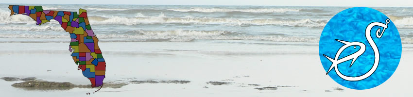
Duval County, Florida
Seach our site below

Click Here to go to Atlantic Beach Access Points Chart with Map
Go to map of beaches in Atlantic Beach.

Click Here to go to Neptune Beach Access Points Chart
Go to map of beaches in Neptune Beach.

Click Here to go to Jacksonville Beach Access Points Chart with Map
Go to map of beaches in Jacksonville Beach.
Huguenot Memorial Park
10580 Hecksher Drive
Jacksonville, FL 32226
1-904-251-3335
GPS 30° 24'39.07" N 81° 25'20.20" W
( Entrance )
Go to map of beaches in Duval County.
Fees:
$3.00 per vehicle up to six people
Beach Driving: Before 10:00am $1.00 per person
( max of $3.00 )
after 10:00am $3.00 per vehicle up to six people.
4 wheel drive required for beach driving.
Kite surfing is quite popular here.
357 acres
Picnic tables 75
Camping facilities 71
Car parking 91
Be careful not to confuse with Huguenot Park which is also in Jacksonville
|
|
|
0
Kathryn Abbey Hanna Park
500 Wonderwood Drive
Jacksonville, FL 32233
1-904-249-4700
1-904-247-8688 ( Fax )
GPS 30° 21'59.12" N 81° 23'58.87" W
( Entrance to park )
Go to map of beaches in Duval County.
Fees:
8am - 10am $1.00 per person
10am - closing $3.00 per vehicle up to six occupants ( each additional $1.00 )
$1.00 per motorcycle, pedestrian ( 6 or older ) and bicyclists
446 acres
Picnic tables 190
Camping facilities 293
Car parking 178
Grills 344
Cabins available for rental more information at 1-904-249-4700
|
|
|
0


Little Talbot Island State Park
( Address below are the administrative offices ~ NOT a park location.)
12157 Heckscher Drive
Jacksonville, FL 32226
1-904-251-2320
GPS 30° 27'29.88" N 81° 25'05.92" W
( Park entrance )
Hours:
8:00am till sundown 365 days a year.
Fees:
$5.00 per vehicle 2-8 people
$4.00 single occupant vehicle
$2.00 Pedestrians, bicyclists, extra passengers, extra passengers in vehicle with season pass holder.
Go to map of beaches in Duval County.
|
|
|
 Having approximately 5 miles of of wonderful sandy white beaches, Little Talbot offers an abundance of fishing opportunities due to the tidal streams, undisturbed salt marshes and surf.
Little Talbot Island State Park is one of the seven parks that make up what is collectively called Talbot Island State Parks.
The back half of the island boasts a great coastal salt marsh. You can catch black drum, flounder, redfish and trout. Or, just stay with the available 5 miles of surf fishing!
Please familiarize yourself with Florida Saltwater Fishing Regulations & Licenses.
There is full facility camping here

Oceanfront Park 6th Avenue South and Ocean Front Street
Jacksonville Beach, FL 32250
GPS 30° 16'58.33" N 81° 23'17.85" W
( Entrance to parking lot )
Go to map of beaches in Duval County.
2 dune walkovers, 2 acre oceanfront park, 4 picnic shelters, swimming, surfing, fly a kite and Port-O-Let.
|
|
|


Useful Links
| Beaches Near Jacksonville in Duval County, Florida |
| Areas in Duval County, Florida Include; Atlantic Beach, Arlington, Baldwin, Englewood, Jacksonville, Jacksonville Beach, Mayport, Mandarin, Neptune Beach, Pecan Park and Mayport Naval Station. |
| Bodies of Salt & Brackish Water in Duval County, Florida Include; Arlington River, Atlantic Ocean, Big Pottsburg Creek, Back River, Big Fishweir Creek, Boathouse Creek, Broward River, Browns Creek, Burton Creek, Butcher Pen Creek, Caney Branch, Cedar Creek, Cedar Point Creek, Chicopit Bay, Christopher Creek, Clapboard Creek, Craig Creek, Dames Point Fulton Cutoff, Deep Creek, Deese Creek, Drummond Creek, Dunn Creek, Durbin Creek, Edwards Creek, Fishing Creek, Fitzpatrick Creek, Fort George River, Garden Creek, Goddby's Creek, Gunnison Cut, Hannah Mills Creek, Horseshoe Creek, Intracoastal Waterway, Julington Creek, Little Clapboard Creek, Little Pottsburg Creek, Mill Cove, Mill Creek, Miller Creek, Mink Creek, Moncrief Creek, Mud River, Nassau River, Nassau Sound, Nichols Creek, Ninemile River, Old Bull Bay, Ortega River, Pablo Creek, Plummers Cove, Pottsburg Creek, Pumpkin Hill Creek, Ribault River, Rushing Branch, Samples Creek, San Carlos Creek, Sawpit Creek, Seaton Creek, Shad Creek, Sherman Creek, Simpson Creek, Sisters Creek, St. Johns River, Strawberry Creek, Terrapin Creek, Thomas Creek, Trout River and Williamson Creek. |
![]() Home
Home
![]() About
About
![]() Sitemap
Sitemap
![]() Credits
Credits
![]() Privacy
Privacy
![]() Advertise
Advertise
![]() Contact
Contact
![]()