St. Johns County, Florida ~ Fishing Piers & Bridges
Seach our site below
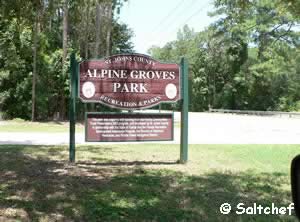
Alpine Groves Fishing Pier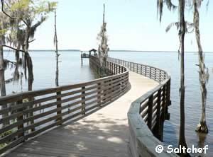
Closest intersection is;
CR 13 & Swiss Lane
Fruit Cove, FL 32259
Entrance to park is 200 feet south on CR 13 from the above intersection.
GPS 30° 04'51.55" N 81° 39'18.58" W
( Foot of pier )
Go to map of fishing piers and bridges in St Johns County
|
|
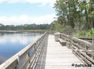
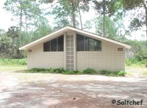
Alpine Groves Park sits on 54.5 acres along the St Johns River. The pier is 250 feet in length over the water and has a very nice shade structure for your comfort at the end. There is a also kayak / canoe launch that is on the left as you start onto the fishing pier. Pavilions are available for rent by calling St. Johns County 1-904-209-0655 ( Main # ) Mon-Fri 8am-5pm.
Go to: Video of Alpine Groves Fishing Pier.
Faver Dykes Fishing Dock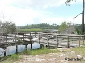 1000 Faver Dykes Road
St. Augustine, Florida 32086
1-904-794-0997
Hours: 8 am - Sundown
GPS 29° 40'07.17" N 81° 15'33.41" W
( Fishing dock )
Go to map of fishing piers and bridges in St Johns County
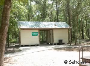
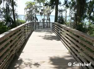
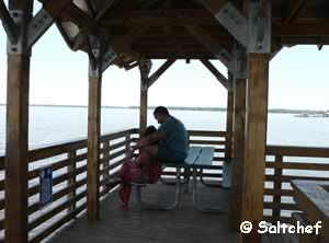
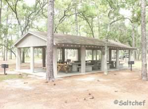
Faver Dykes State Park fishing dock sits along Pellicer Creek. The creek offers the possibility to catch both salt and fresh water species of fish. Please be sure to have the proper Florida fishing license in hand. The area directly around the dock offers a pavilion, picnic tables, grills, bait cutting station with running water and restrooms.
There is also a small boat ramp / hand launch along Pellicer Creek within the park.
Go to: Video of Faver Dykes State Park Fishing Dock.
|
|

Lighthouse Park Fishing Pier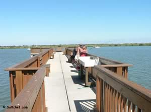 442 Ocean Vista Avenue
St Augustine, FL 32080
GPS 29° 53'10.45" N 81° 17'10.74" W
( Foot of fishing pier )
Go to map of fishing piers and bridges in St Johns County
|
|
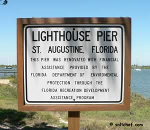
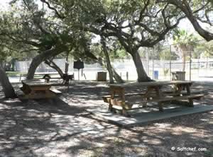
The Lighthouse Park fishing pier is about 300 feet in length over Salt Run. This is a free pier. This pier does not supply a fishing license, so be sure to have your Florida fishing license in hand. The park also offers; a picnic area, small playground, boat ramp and restrooms.
Go to: Video of Lighthouse Park Fishing Pier.
May Street Bridge St Augustine ( A1A )
Closest intersection is:
A1A & Magnolia Avenue
St Augustine, FL 32084
Bridge is 750 east of above intersection on A1A
GPS 29° 54'37.88" N 81° 18'49.57" W
( Middle of bridge )
Go to map of fishing piers and bridges in St Johns County
|
|
The May Street bridge goes over Hospital Creek off of the Matanzas River. The area is very close to the St Augustine Inlet. No restrooms directly at the bridge, although the Vilano Landing boat ramp is a short distance down the road and they have restrooms there.
Matanzas Inlet Bridge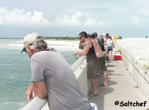 2.5 miles north of;
Marineland, FL 32086
GPS 29° 42'17.12" N 81° 13'40.92" W
( Middle of bridge )
Go to map of fishing piers and bridges in St Johns County
|
|
The bridge going over Matanzas Inlet offers some very good fishing opportunities. The water is fast moving here, position yourself on the correct side to use the water flow to your advantage. Parking is easiest and least hassle on the north side of the bridge, although the walk to the main fishing area is a bit further. Restrooms are not available at this location.
Palmetto Road Small Fishing Dock
Palmetto Road & 5th Street
Butler Beach, FL 32080
GPS 29° 47'26.56" N 81° 16'09.54" W
The Palmetto Road fishing dock is located along the shoreline of the alcove along the Matanzas River serving the Palmetto Road boat ramp. No restrooms at this location.
Joe Pomar Park Pier
1600 Masters Drive
St. Augustine, FL 32084
GPS 29° 54'49.01" N 81° 19'50.98" W
( Foot of pier )
|
|
The pier at Joe Pomar Park would be suitable for fishing at high tides only. The pier is on the northern side of the park. The pier would be about 80' in length over the water at higher tides. Restrooms are available near the ball fields.
Not on map or navigation yet.
Riverfront Park Pier
 Riverwalk Boulevard & Florida Route 13
St Johns, FL 32259
Entrance to park is 2/10ths of a mile north on Florida Route 13 from the above intersection.
GPS 30° 01'15.84" N 81° 38'27.04" W
( Entrance )
GPS 30° 01'09.81" N 81° 38'23.23" W
( Foot of pier )
Go to map of fishing piers and bridges in St Johns County
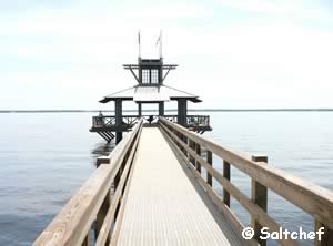
Rivertown parks pier is 270 feet in length over the eastern shore of the St. Johns River, shade cover at end of the pier, benches and restrooms. This is a catch and release pier.
Go to: Video of the Riverfront Park Fishing Pier.
Rose of Sharon Pier
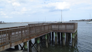 Located on the northwest side of the
Bridge of Lions
St Augustine, Fl 32084
GPS 29° 53'35.71" N 81° 18'37.57" W
( Foot of pier )
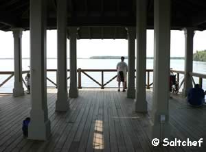
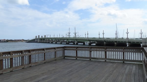
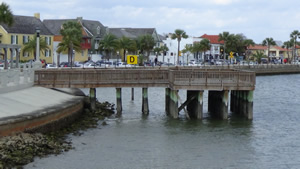
45' in length over the Matanzas River, at the end is a 20' x 30' open area. Enjoy the beautiful scenery here of the Bridge of Lions, Castillo de San Marcos and the river while relaxing the day away.
Go to: Video of Rose of Sharon Fishing Pier.
Shands Pier
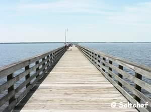 Florida Route 13 & Shands Pier Road
St Johns County, Fl 32259
GPS 30° 00'23.27" N 81° 36'52.22" W
( Foot of pier )
Go to map of fishing piers and bridges in St Johns County
|
|
The Shands pier is 500 feet in length over the eastern shore waters of the St Johns River. This pier does not supply a fishing license, please be sure to have your proper Florida fishing license in hand.
Port-O-Lets on site.
Go to: Video of the Shands fishing pier.
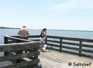

St Johns County Ocean Fishing Pier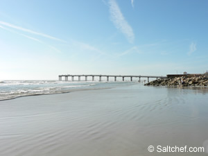 350 A1A Beach Boulevard
St Augustine, FL 32080
904-209-0326
GPS 29° 51'25.58" N 81° 15'57.09" W
Go to map of fishing piers and bridges in St Johns County
|
|
Fees:
Site seeing fees:
$1.00
Fishing Fees:
Children under 6 Free
SJC Residents over 60 years old – Free
Child fishing non resident $1.50
Persons with disability resident $1.00
Persons with disability non resident $1.50
Fishing resident $2.00
Non-resident $3.00
Hours: 7am - 9pm / 10pm Sat & Sun
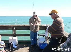
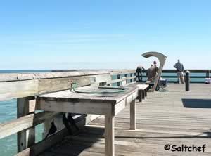
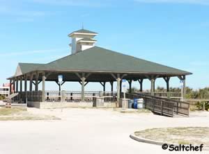
Sitting on 4 ocean front acres the St Johns County pier offers restrooms, outdoor rinsing showers, play fountain ( weather permitting ), picnic pavilion ( check for availability, as it does get rented 1-904-209-0333 ), bocce courts ( Bring own equiptment ) and a small playground. On Wednesday mornings there is a farmers market set up in the parking lot. No surfing or swimming is permitted within 400 feet of the pier. This pier has a fishing license with the state, it is not necessary to purchase a seperate license when fishing from this pier. This can be especially nice for out of state visitors that want to have a quick easy inexpensive way to fish in Florida.
| Video of the County Ocean Fishing Pier. |
 |
Usina Boat Ramp Fishing Pier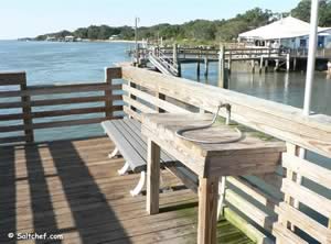 611 Euclid Avenue
St Augustine, FL 32084
GPS 29° 56'57.84" N 81° 18'36.08" W
( Foot of pier )
Go to map of fishing piers and bridges in St Johns County
|
|
The Usina fishing pier near Vilano Beach Florida offers Intracoastal fishing, fish cleaning table, bench and restrooms. Please be sure to have your proper Florida fishing license when fishing from this pier.
Go to: Video of the Usina Fishing Pier.
Vaill Point Park Fishing Pier 630 Vaill Point Road
St. Augustine, FL 32084
GPS 29° 49'31.70" N 81° 18'34.05" W
( Entrance to park )
GPS 29° 49'44.61" N 81° 18'32.82" W
( Foot of fishing pier )
Go to map of fishing piers and bridges in St Johns County
|
|
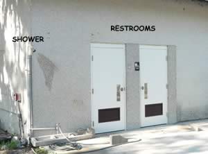
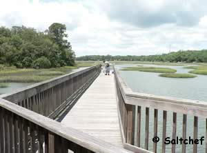
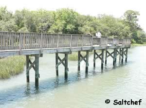
Vaill Point Park has a fishing pier that is along Moultrie Creek in St Augustine Florida, pier is a little bit of a walk from the parking lot down a black-top path. Restrooms are availble near the parking, playground and picnic areas. A picnic pavilion is on site with grills. Please be sure to have your proper Florida fishing license with you when fishing from this pier.
Go to: Video of Vaill Point Park and Fishing Pier.
Vilano Fishing Pier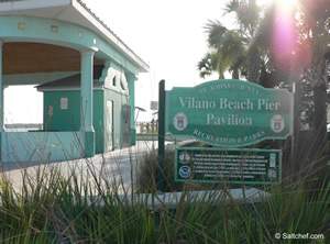 260 Vilano Road
St Augustine, FL 32084
GPS 29° 55' 00.11" N 81° 17'52.61" W
Go to map of fishing piers and bridges in St Johns County
No fees
|
|
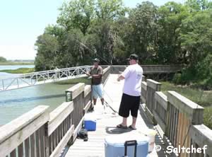
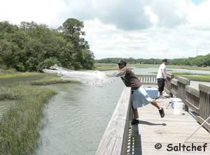
The Vilano fishing pier is about 700 feet long, no admission fee, restrooms, a small fountain at front. The county has added a boat dock to the south side of the pier, this dock is not for fishing. When fishing from this pier please be aware that it is a no fee pier and the proper Florida fishing license is required.
| Video of Vilano Fishing Pier. |
 |
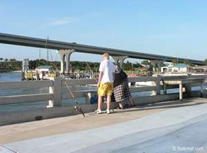
Under the East Side of the 206 Bridge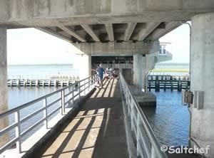 Closest intersection is;
Middleton Avenue & Coastal Drive
Crescent Beach, FL 32080
From the above intersection go 700 feet down Coastal drive to the area.
GPS 29° 46'08.82" N 81° 15'26.27" W
NOAA
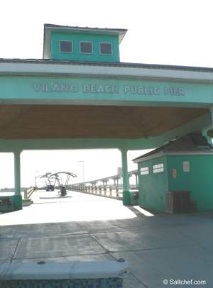
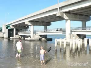
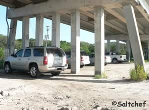
The pier is directly under the 206 drawbridge and can offer relief from the sun during the day, the pier is about 180 feet in length. No restrooms at this location. This area also is a decent place to launch a kayak in the Matanzas. It may also be educational for a youngster to see the opening and closing operation of the drawbridge from underneath while on the pier.
Go to: Video of Fishing Pier Under the 206 Bridge.
Useful Links
Saltchef.com
| Public Fishing Piers & Bridges in St. Johns County Florida |
| Areas in St. Johns County Florida include; St Augustine, Ponte Vedra, Vilano, St Augustine Beach, Nocatee, World Golf Village, Butler Beach, Palm Valley, Crescent Beach and Fruit Cove. |
| Bodies of brackish and saltwater in St. Johns County Florida include; Atlantic Ocean, Cabbage Creek, Capo Creek, Casa Cola Creek, Cunningham Creek, Cut Creek, Deep Creek, Durbin Creek, East Creek, Guana River, Hospital Creek, Intracoastal Waterway, Julington Creek, Matanzas Inlet, Matanzas River, Marshall Creek, Moultrie Creek, Pancho Creek, Pellicer Creek, Red House Branch, Robinson Creek, Salt Run, San Sebastian River, Six Mile Creek, Smith Creek, Sombrero Creek, St Augustine Inlet, St Johns River, Stokes Creek, Tolomato River, Ximanies Creek. |
![]() Home
Home ![]() About
About ![]() Sitemap
Sitemap ![]() Credits
Credits ![]() Privacy
Privacy ![]() Advertise
Advertise ![]() Contact
Contact ![]()
