St. Johns County, St Augustine, Florida ~ Boat Ramps & Hand Launches
- National &
State Parks - County &
City Parks - Beaches
St Johns - Boat Ramps
St Johns - Fishing Piers
St Johns - Map of
Boat Ramps - Boat Ramps
Adjoining
Counties
Public Boat Ramps and Kayak Launches in St. Johns County, Florida
Seach our site below
Boating Club Road Boat Ramp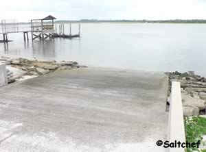 Boating Club Road & Laurel Street
Vilano Beach, FL 32084
GPS 29°56'34.59" N 81°18'30.99" W
( Waters edge at ramp )
Go to map of saltwater boat ramps in
St Johns County
Doug Crane Boat Ramp
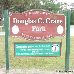 Just south of;
Shore Drive & Terrapin Road
St Augustine, FL 32086
GPS 29° 51'18.48" N 81° 18'43.77" W
( Waters edge at ramp )
Go to map of saltwater boat ramps in
St Johns County
Minimal facilities here, port-o-let, parking, scenic, boat launch or hand launch
Watch the tidal conditions as low tides may impact your ability to launch or land your watercraft.
Go to: Video of Douglas Crane Park Boat Ramp.
Faver Dykes Small Boat ~ Hand Launch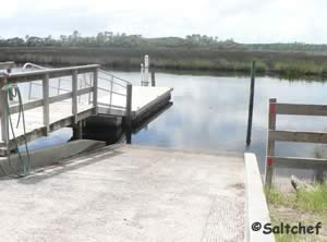 1000 Faver Dykes Road
St. Augustine, Florida 32086
904-794-0997
GPS 29° 40'01.73" N 81° 15'26.24" W
( Waters edge at hand launch ramp )
The boat launch at Faver Dykes State Park is suitable for small boats and hand launching into Pellicer Creek. Pellicer Creek has both salt and freshwater species, Black drum, red drum, sheepshead and spotted sea trout are common catches. Please be sure to have your proper Florida fishing license in hand. A combination saltwater / freshwater fishing license would be the safests. A floating dock is adjacent to the ramp. Restrooms are on-site.
There is also a fishing dock along Pellicer Creek within the park.
Go to: Video of Faver Dykes State Park boat ramp.
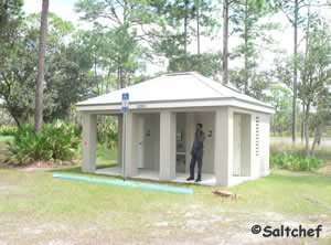
Frank Butler Park West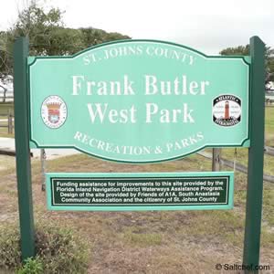 399 Riverside Boulevard
St Augustine, Fl 32080
GPS 29°47'15.23" N 81°16'03.91" W
( Waters edge at ramp )
Go to map of saltwater boat ramps in
St Johns County
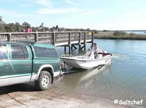
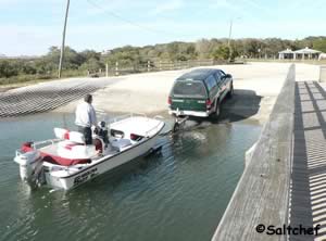
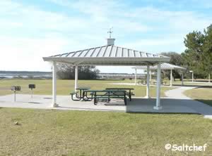
Frank Butler Park West is a very nice scenic facility with picnic pavilions, grills, restrooms, large parking area, handicapped parking, floating courtesy dock, shoreline fishing and a water faucet is near the restrooms at the fence. Beautiful windswept trees on property.
Go to: Video of Frank Butler Park West boat ramp.
Call the A1A scenic highway cell phone tour at:
1-904-596-0029 and enter code 326 for more information on Butler Parks East and West.
Green Road Boat Ramp Green Road & Middleton Avenue
Crescent Beach, FL 32086
South of Route 206 just off A1A
GPS 29°45'44.78" N 81°15'13.71" W
( Waters edge at ramp )
Go to map of saltwater boat ramps in
St Johns County
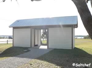
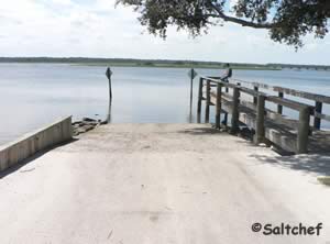
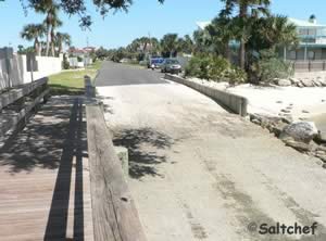
Easy access to the Intracoastal Waterway at this location. A good place to hand launch a kayak and explore the areas around the 206 bridge.
No restrooms or Port-O-Lets at this location. Small fishing pier here also.
Go to: Video of Green Road Boat Ramp
Guana Tolomato Matanzas Reserve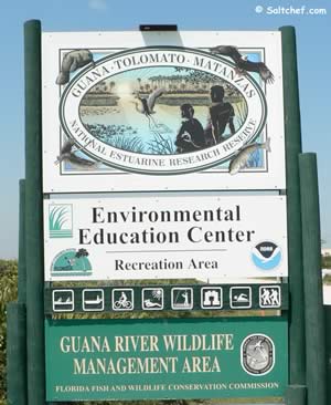
Approxiamately 8 miles north of Vilano on the left.
Approxiamately 10 miles south of Mickler beachfront park on the right
Entrance GPS
30° 01'25.88" N 81" 19'25.42" W
Lake Boat Ramp GPS
30° 01' 24.91" N 81° 19'39.19" W
Tidal Water Boat Ramp GPS
30° 01'21.73" N 81° 19'40.19" W
Go to map of saltwater boat ramps in
St Johns County
Fees:
$3.00 per vehicle up to 8 people
$1.00 per Pedestrian, Bicyclists, and extra persons in vehicle above 8
Hours:
8:00am - Sunset
Guana River Dam Use Area opens at 4:00am - 11:00pm
At the Dam you can choose to focus on the fresh water of the lake on the northern side or you can choose the tidal waters on the southern side. Small boats can be launched into either at this location. Watch the tides on the tidal side to prevent yourself from being stranded at low tide conditions. Please see the check the tides near here button we have provided for information from closest NOAA Station. Please, be aware that your actual locations tides times will vary depending on distance from station, winds and other factors. The tidal creek is NOT maintained for navigation small boats only.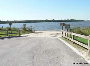
The trails abound at Guana Tolomato Matanzas Reserve for biking, horseback riding and hiking, bring plenty of water for yourself!
National Estuarine Research Reserve is directly on the left as you enter Guana Tolomato Matanzas Reserve.
Lighthouse Park Ramp into Salt Run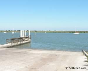
442 Ocean Vista Avenue
St Augustine, FL 32080
GPS 29° 53'08.84" N 81° 17'08.53" W
( Waters edge at the ramp )
Go to map of saltwater boat ramps in
St Johns County
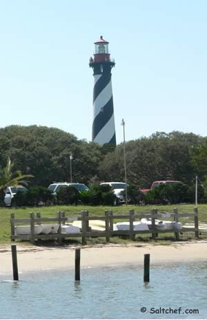 A nice facility that allows access into Salt Run, scenic, wind surfing, kayaking, shoreline fishing, fishing pier, picnic area, grills, 9 tables, 2 ramps and courtesy dock. Send the family to St Augustine to see the sights and take some fishing time for yourself. The family can go to the Castillo de San Marcos, shopping on historic St. George Street, skate boarding at the park just down the street. Alligator Farm is always a great place, Fort Matanzas National Monument, Anastasia State Park and a whole host of other interesting places.
Go to: Video of the Lighthouse Park boat ramp.
Palm Valley East Boat Ramp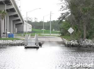 Closests intersection is;
South Roscoe Boulevard & Palm Valley Road
Ponte Vedra Beach, FL 32082
GPS 30° 07’57.88" N 81 23’6.20" W
( Waters edge at ramp )
Go to map of saltwater boat ramps in
St Johns County
The Palm Valley boat ramp offers; Single lane ramp into the Intracoastal Waterway, courtesy docks, parking for about 30 boat trailers and portolets.
Go to: Video of Palm Valley Intracoastal Waterway Boat Ramp.
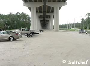
Palmetto Road Boat Ramp
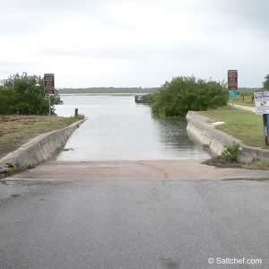 Palmetto Road & 5th Street
Butler Beach, FL 32080
GPS 29°47'27.02" N 81°16'06.93" W
( Waters edge at ramp )
Go to map of saltwater boat ramps in
St Johns County
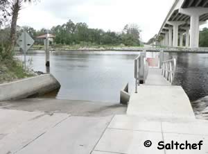
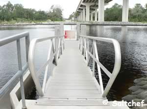
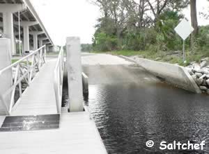
This ramp is about as self service as ramps can get, no restrooms, limited parking, no running water, etc. A trash can is on site and it does have a small fishing dock.
Bring your dog along in a canoe go out fishing and leave the stress of the materialistic world behind.
Palmo Boat Ramp
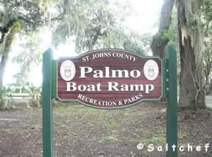 River Road & Palmo Fish Camp Road
St Augustine, FL 32092
GPS 29°57'59.87" N 81°34'04.39" W
( Entrance )
GPS 29°58'01.73" N 81°34'02.24" W
( Waters edge at ramp )
Go to map of saltwater boat ramps in
St Johns County
The Palmo Road boat ramp offers; single lane ramp, port-o-let, courtesy dock, shoreline fishing and trash receptacles.
Go to: Video of Palmo Road boat ramp.
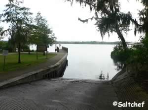
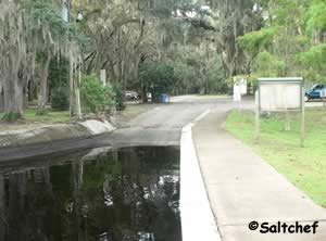
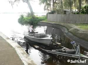
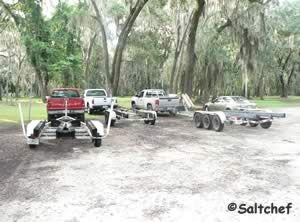
River to Sea Preserve Hand Launch
Closest intersection is;
North Ocean Shore Boulevard & Mc Bride Lane
Marineland, FL 32137
From the above intersection which is at Marineland go 700' north on A1A launch is on the Intracoastal side.
GPS 29° 40'18.69" N 81° 12'52.73" W
( Hand Launch )
Go to map of public boat ramp and hand launches in
St Johns County
River to Sea Preserve hand launch along A1A just north of Marineland, Florida offers easy access into the Matanzas River for fishing and other recreational activities. Parking for about 6 vehicles. No restroom directly at this area. Restrooms would be available at The River to Sea Preserve beach access about 4/10ths of a mile south on A1A.
Riverdale Park Boat Ramp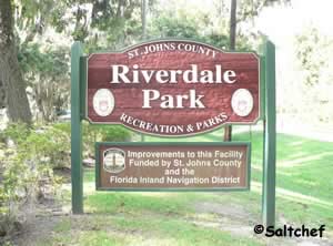 981 CR. 13 South
St. Augustine, FL 32092
GPS 29° 49'26.24" N 81° 33'10.47" W
( Entrance )
Go to map of saltwater boat ramps in
St Johns County
Riverdale Park along Route 13 in St Augustine, Florida offers easy access into the St Johns River for fishing and other recreational activities. The park has restrooms, multiple individual covered picnic tables, courtesy dock and boat trailer parking.
Go to: Video of Riverdale Park Boat Ramp.
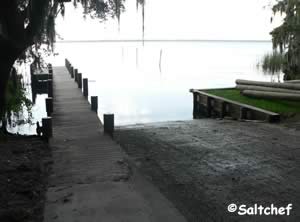
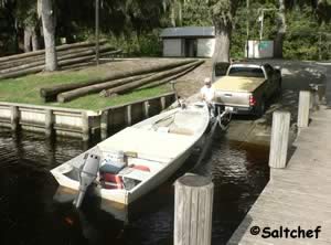
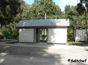
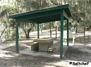
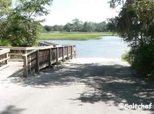
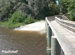
Shore Drive Boat Ramp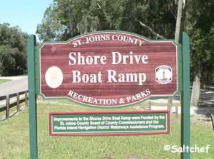 Gentain Road & Shore Drive
St Augustine, FL 32086
GPS 29°49'44.38" N 81°18'49.59" W
( Waters edge at ramp )
Go to map of saltwater boat ramps in
St Johns County
Go to: Video of Shore Drive Boat Ramp and Hand Launch.
Six Mile Boat Ramp ~ Freshwater Lake Ponte Vedra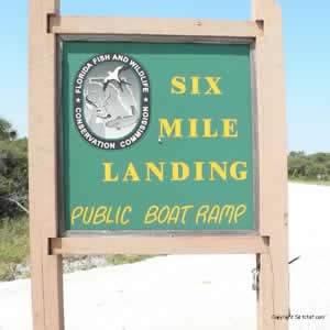
GPS 30° 06'36.13" N 81° 20'42.74" W
( Waters edge at ramp )
Go to map of saltwater boat ramps in
St Johns County
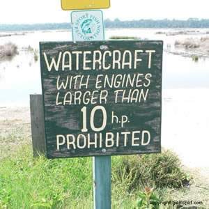
Located on the freshwater Lake Ponte Vedra and operated by the State of Florida. Six Mile boat ramp is a fabulous place to launch your kayak, canoe or small boat. remember to keep with-in the regulations and to not have a motor that exceeds 10hp. Wildlife abounds at Guana and your trip on the water should yield many opportunities to view. Please utilize the registration box located at the ramp to register your itenary, this practice helps officials quickly determine or at least focus any search that may be needed. Please limit your parking in this lot to boat ramp use only.
Trout Creek Park Boat Ramp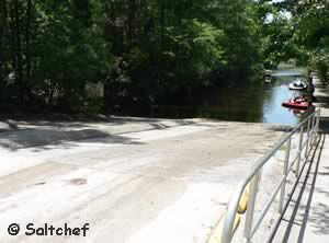 Closests intersection is;
SR 16 & Collier Road
St Augustine, FL 32092
Entrance for park is 300 feet down Collier Road from above intersection.
GPS 29° 59'01.49" N 81° 33'38.16" W
( Entrance )
GPS 29° 59'04.64" N 81° 33'48.60" W
( Waters edge at ramp )
Go to map of boat ramps in
St Johns County
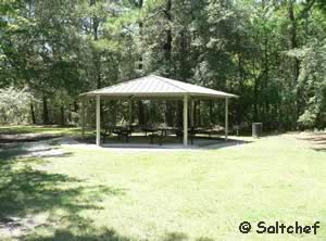
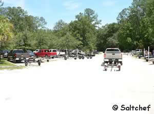
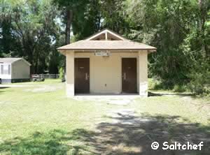
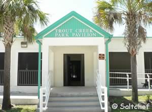
Trout Creek Park offers; 2 launching lanes, courtesy docks, parking for about 50 boat trailers, restrooms, kayaking, canoeing, fishing, leashed pets, grills, picnic shelters, enclosed pavilion ( rent ), picnic areas, trash, playground and potable water. Operated by St Johns County.
Go to: Video of Trout Creek Park Boat Ramp.
Usina Park Boat Ramp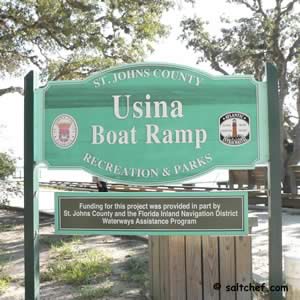
611 Euclid Avenue
St Augustine, FL 32084
GPS 29° 56’56.42" N 81° 18’36.07" W
( Waters edge at ramp )
Go to map of saltwater boat ramps in
St Johns County
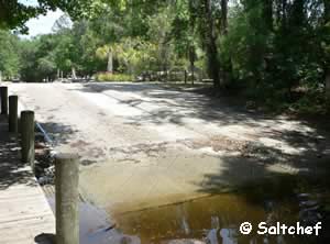
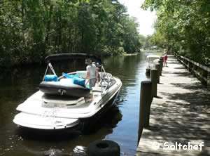
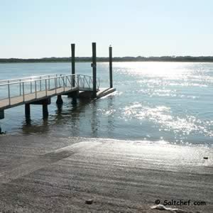
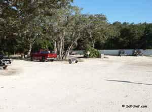
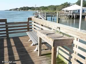
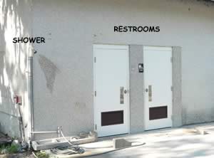
A very nice facility with a fair amount of parking, a small fishing pier is also on site, which has a cleaning table. Restrooms are available along with an outdoor rinsing shower which is adjacent to the restrooms. Drop your kayak or canoe into the water here and enjoy a good morning, day or evening of fishing.
Go to: Video of Usina boat ramp.
 Vilano Landing Boat Ramp
101 Vilano Causeway
St Augustine, Fl 32084
On the southwestern side of the Vilano bridge.
GPS 29° 54'42.37" N 81°18'30.56" W
( Waters edge at ramp )
Go to map of saltwater boat ramps in
St Johns County
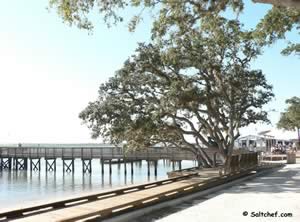
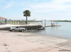
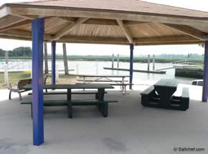
The Vilano boat ramp offers; restrooms when bait shop is open, picnic pavilion, fishing, kayaking, large parking lot, boat launch or hand launch, birding and beautiful scenery.
Go to: Video of the Vilano boat ramp.
Allen "Bucky" Powers Boat Ramp - Coming Soon
Northwest Side 312 Bridge
St Augustine, FL 32084
St Johns County has approved 17.5 million dollars for the purchasing land for a new park and boat ramp sitting on 31 acres. along the San Sebastian River.
Useful Links
| Public Boat Ramps St. Johns County Florida |
| Areas in St. Johns County Florida include; St Augustine, Ponte Vedra, Vilano, St Augustine Beach, Nocatee, World Golf Village, Butler Beach, Palm Valley, Crescent Beach and Fruit Cove. |
| Bodies of brackish and saltwater in St. Johns County Florida include; Atlantic Ocean, Cabbage Creek, Capo Creek, Casa Cola Creek, Cunningham Creek, Cut Creek, Deep Creek, Durbin Creek, East Creek, Guana River, Hospital Creek, Intracoastal Waterway, Julington Creek, Matanzas Inlet, Matanzas River, Marshall Creek, Moultrie Creek, Pancho Creek, Pellicer Creek, Red House Branch, Robinson Creek, Salt Run, San Sebastian River, Six Mile Creek, Smith Creek, Sombrero Creek, St Augustine Inlet, St Johns River, Stokes Creek, Tolomato River, Ximanies Creek. |
![]() Home
Home ![]() About
About ![]() Sitemap
Sitemap ![]() Credits
Credits ![]() Privacy
Privacy ![]() Advertise
Advertise ![]() Contact
Contact ![]()
