Jasper County, South Carolina ~ Boat Ramps
- National &
State Parks - County &
City Parks - Beaches
Jasper - Boat Ramps
Jasper - Fishing Piers
Jasper - Map of
Boat Ramps - Boat Ramps in
Adjoining Counties
Public Boat Ramps in Jasper County, South Carolina
Seach our site below
Becks Ferry Boat Ramp
Closest intersection is;
Becks Ferry Road & State Road S-27-34
Hardeeville, South Carolina 29927
The ramp is 4/10ths of a mile south on Becks ferry Road from the above intersection.
GPS 32° 20'20.73" N 80° 07'41.30" W
( Waters edge at ramp )
The Becks Ferry boat ramp along the Savannah River offers; 2 launching lanes, courtesy docks, and 21 parking spaces.
Not on map or navigation yet.
Bolan Hall Boat Ramp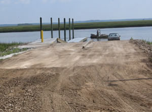 Closest intersection is;
Lowcountry Drive & Bolan Hall Road
Ridgeland, SC 29936
The ramp is 2.8 miles down Bolan Hall Road from the above intersection.
GPS 32° 25'09.24" N 80° 51'05.17" W
( Waters edge at ramp )
|
|
|
The Bolan Hall ramp on Euhaw Creek offers 2 launching lanes, 25 parking spaces, courtesy docks and portable toilets.
A fishing pier is on site also.
Cooks Landing Boat Ramp
Closest intersection is;
 Cook Landing Road & Docks Corner Road
Hardeeville, SC 29927
Ramp is 9/10 of a mile down Cook Landing Road from the above intersection.
GPS 32° 11'40.04" N 80° 59'56.39" W
( Waters edge at ramp )
|
|
|
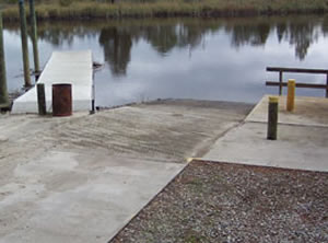
The Cooks Landing boat ramp is on the New River and offers; Single launching lane and courtesy dock.
No restrooms at this location.
A fishing pier is on site also.
Dawson Creek Boat Ramp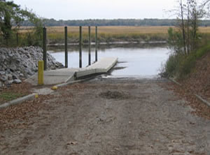 Closest intersection is;
Coosaw Scenic Drive & Dawson Landing Road
Ridgeland, SC 29936
Ramp is 1/3 of a mile down Dawson Landing Road from the above intersection.
GPS 32° 33'39.95" N 80° 54'29.58" W
( Waters edge at ramp )
|
|
|
The Dawson Creek boat ramp offers; 1 launching lane, courtesy dock, parking for about 8-10 trailers, small picnic shelter and portable restrooms.
Millstone Landing Boat Ramp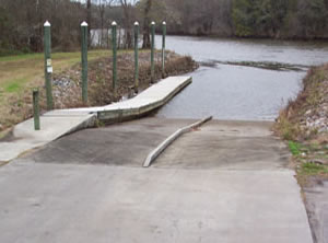 Purrysburg Road & Purrysburg Landing Road
Hardeeville, SC 29927
GPS 32° 17'12.39" N 81° 07'06.81" W
NOAA S.C.L. RR. bridge 8670073
|
|
|
The Millstone Landing boat ramp is managed by the Town of Hardeeville and offers; 2 launching lanes, 21 parking spaces and courtesy docks. No restrooms or port-o-lets at this location.
New River Boat Ramp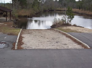 Closest intersection is;
South Okatie Highway & Plantation Drive
Jasper County, SC 29927
From the above intersection the ramp is 4/10ths of a mile east on S. Okatie Hwy ( 46 ) on the left before the bridge.
GPS 32° 14'10.11" N 81° 00'49.54" W
NOAA Cook Landing Cemetery 8669277
|
|
|
The New River boat ramp offers; Single launching lane, parking for about 10 boat trailers and a pavilion ( no tables ). No courtesy docks or restrooms at this location.
Turn Bridge ~ Hand Launch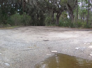 Closest intersection is;
South Okatie Highway & State Road S-27-92
Hardeeville, SC 29927
From the above intersection travel about 3.7 miles down State Road S-27-92 to the ramp area.
GPS 32° 07'46.92" N 81° 00'48.70" W
|
|
|
The Turn Bridge hand launch area is on the Wright River in southern Jasper County, SC. The area offers an unimproved launch area really only suitable for small boats & hand launching. No restrooms at this location.
Tutens Boat Ramp
Closest intersection is;
Tutens Landing Road & Marsh Point Lane
Ridgeland, SC 29936
Ramp is 2/10ths of a mile down Tutens Landing Road from the above intersection.
GPS 32° 31'06.02" N 80° 52'17.64" W
( Waters edge at ramp )
|
|
|
The Tutens boat ramp is located on Boyd Creek and is managed by Jasper County. The area offers; 1 launching lane, picnic pavilion ( fenced ), parking is just up the road near the pavilion. Hand launch your kayak or canoe here. No courtesy docks or restooms at this location.
Useful Links
| Public Boat Ramps in Jasper County, South Carolina |
| Areas in Jasper County South Carolina include; Coosawhatchie, Gillisonville, Grahamville, Grays, Levy, Hardeeville, Limehouse, Pineland, Purrysburg, Ridgeland, Switzerland, Savannah National Wildlife Refuge, Tillman and Tybee National Wildlife Refuge. |
| Bodies of water in Jasper County South Carolina include; Atlantic Ocean, Back River, Coosawhatchie River, Little Back River, Mud River, New River, Savannah River, Steamboat River and The Wright River. |
![]() Home
Home ![]() About
About ![]() Sitemap
Sitemap ![]() Credits
Credits ![]() Privacy
Privacy ![]() Advertise
Advertise ![]() Contact
Contact ![]()
