Beaufort County, South Carolina ~ Boat Ramps
- National &
State Parks - County &
City Parks - Beaches
Beaufort - Boat Ramps
Beaufort- Alljoy Boat Ramp
- Bluffton Oyster Factory
- Brickyard Creek Boat Ramp
- Broad River Boat Ramp
- Buckingham Boat Ramp
- Buddy & Zoo Boat Ramp
AKA ~ Station Creek - Butches Island
Landing Boat Ramp
Small Boats - C.C. Haigh Boat Ramp
- Cross Island Boat Ramp
AKA Broad Creek Ramp - Eddings Point Boat Ramp
- Edgar Glenn Boat Ramp
- Freedom Mall Boat Ramp
- Grays Hill Boat Ramp
- H.E. Trask Senior Boat Ramp
- Marshland Boat Ramp
Small Boats - Paige Point Boat Ramp
- Parris Island Boat Ramp
- Pigeon Point Boat Ramp
- Port Royal Landing Boat Ramp
"The Sands" - Russ Point Boat Ramp
- Sams Point Boat Ramp
- Steel Bridge Boat Ramp
- Sugar Hill Boat Ramp
- Wallace Boat Ramp
- White Hall Boat Ramp
- Wimbee Boat Ramp
- Fishing Piers
Beaufort - Map of
Boat Ramps - Boat Ramps
Adjoining Counties
Boat Ramps in Bluffton, Hilton Head, St Helena Island, Seabrook, Yemasssee, Beaufort County, South Carolina
Seach our site below
Alljoy Boat Ramp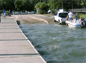 265 Alljoy Road
Bluffton, SC 29910
GPS 32° 12'51.36" N 80° 50'48.79" W
( Waters edge at ramp )
The Alljoy boat ramp located on the May River offers two launching lanes, courtesy docks and portolets. Alljoy gives easy access to Calibogue Sound and the Atlantic waters. There is parking for about 20 vehicles with trailers.
This can be a heavily used location, best to plan accordinaly.
Hand launch your kayak here and explore and fish the Bull Island area across the river.
Bluffton Oyster Factory Boat Ramp
75 Wharf Street
Bluffton, SC 29910
GPS 32° 13'54.26" N 80° 52'02.91" W
( Waters edge at ramp )
The Bluffton Oyster Factory boat ramp offers; single launching lane, courtesy dock, parking for about 35-40 boat trailers at the lot up further on Wharf Street, picnic pavilion and restrooms at the pavilion area.
Brickyard Creek Boat Ramp
 275 Brickyard Point Road
Lady's Island, SC 29907
GPS 32° 30'03.96" N 80° 40'42.71" W
( Waters edge at ramp )
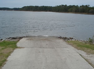
The Brickyard Point Ramp is located along Brickyard Creeks mouth near the Coosaw River. The facility has a single concrete launching lane and parking for about 10 boat trailers. No courtesy docks or restrooms at this location. Ramp is in rough condition.
Broad River Boat Ramp
 Closest intersection is;
Robert Smalls Parkway 170 & Savannah Highway
Burton, SC 29906
At the above intersection make a left off of Robert Smalls Parkway if traveling east, make a right if traveling west on 170 boat ramp is about 6/10ths of a mile down this side road.
Physical Address
1050 Robert Smalls Parkway
Burton, SC 29906
GPS 32° 23'31.06" N 80° 46'33.32" W
( Waters edge at ramp )
Video of the Broad River Landing Public Boat Ramp
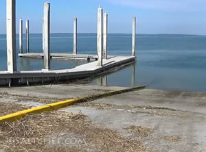
The Broad River ramp in Burton SC offers; 2 launching lanes, courtesy docks, parking for about 35 boat trailers, lighting & restrooms. You could also launch your kayak here to explore and or fish.
A 1800' fishing pier is on site also.
Buckingham Boat Ramp
 Closest intersection is;
Fording Island Road Exd & SR 240
Hilton Head Island, SC 29926
Ramp area is 400' down Fording Island Road
from the above.
GPS 32° 13'49.39" N 80° 47'57.01" W
( Waters edge at ramp )
Know the channel when using this ramp!
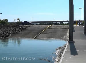
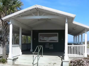
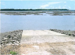
The Buckingham ramp provides access to MacKay Creek and Calibogue Sound and offers;
A single launching lane and parking for about 5 vehicles with trailers.
No restrooms at this location.
Buddy and Zoo Boat Ramp ~ AKA ~ Station Creek
Closest intersection is;
Seaside Road & Station Creek Drive
St Helena Island, SC 29920
Ramp area is 1000' down Station Creek Drive from the above intersection.
GPS 32° 19'15.85" N 80° 36'18.30" W
( Waters edge at ramp )
The Buddy and Zoo boat launching ramp gives easy access to the Atlantic waters. The area has 3 launching lanes, courtesy dock and about 100 trailer spots when including overflow lot. This is a heavily used area, especially on weekends.
A portolet is available at the overflow parking area.
Butches Island Landing Boat Ramp ~ Small Boats ~ Shallow Creek ~ Hand Launch
 Closest intersection is;
Sea Island Parkway & Butches Road
St Helena Island, SC 29920
600 feet down Butches Road
from the above intersection.
GPS 32° 24'28.64" N 80° 27'59.91" W
( Waters edge at ramp )
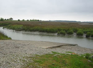
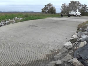
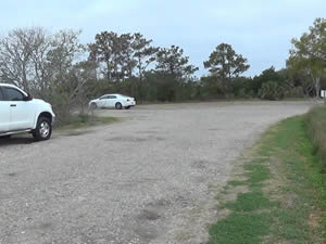
The Butches Island boat ramp along Ward Creek has a single concrete launching lane. Parking for about 10-15 boat trailers in a gravel lot. No other amenities at this location. Suitable for for small boats only as the ramp is very shallow at low tide. Tides have a very large range in this section of South Carolina, please plan accordinally with your launching and loading times.
C.C. Haigh Boat Ramp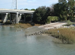 Pinckney Wildlife Refuge & William Hilton Parkway
Hilton Head Island, SC 29926
The entrance is across from the above intersection.
GPS 32° 13'43.48" N 80° 47'16.62" W
( Waters edge at ramp )
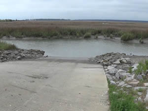
The C.C. Haigh boat launching ramp offers; 2 launching lanes, courtesy docks and port-o-lets, parking for about 90 boat trailers and access to the Mackay and Skull Creeks.
There is also a fishing pier on site.
Cross Island Boat Ramp ~ AKA Broad Creek Ramp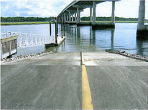 68 Helmsman Way
Hilton Head Island, SC 29928
GPS 32° 10'38.08" N 80° 46'11.68" W
( Waters edge at ramp )
Cross Island boat ramp in Hilton Head Island offers; 2 launching lanes, 45 boat trailer parking spaces and floating courtesy docks for loading and unloading ease, provides access to Broad Creek & Calibogue Sound. The Charles Fraser bridge does provide some shaded parking also.
No restrooms at this location
Daufuskie Island Boat Ramp - No Direct Vehicle Access to Island
13 Haig Point Road
Daufuskie Island, SC 29915
GPS 32° 02'21.02" N 80° 53'38.39" W
( Waters edge at ramp )
The Daufuskie Island boat ramp offers; Single launching lane, courtesy dock, restroom shared with Marshside Mama's and about 10 parking spaces for boat trailers. Daufuskie Island is a boat in only destination.
A fishing pier is on site also.
Not on map or navigation yet.
Eddings Point Boat Ramp
511 Eddings Point Road
St Helena Island, SC 29920
GPS 32° 26'16.40" N 80° 33'01.05" W
( Waters edge at ramp )
The Eddings Point boat ramp offers; 2 launching lanes, courtesy dock and 20 boat trailer parking spaces. Watch drop off at ramp at low tides.
Edgar Glenn Boat Ramp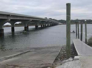 North Okatie Highway & Mudbar Road
Port Royal, SC 29909
GPS 32° 22'25.66" N 80° 50'12.21" W
( Waters edge at ramp )
Edgar Glenn boat ramp at the western side of the Chechessee River Bridge ( SC 170 ) offers 2 launching lanes, courtesy docks, 64 boat trailer parking spaces and port-o-lets. The ramp provides access to the Chechessee River, Broad River and Port Royal Sound.
Hand launch your kayak here for good paddles and fishing opportunities.
Freedom Mall Boat Ramp ~ At Henry Chambers Waterfront Park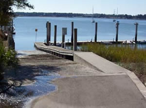 Bay Street & Newcastle Street
Beaufort, SC 29902
GPS 32° 25'51.80" N 80° 40'29.46" W
( Waters edge at ramp )
The Freedom Mall boat ramp along the Beaufort River offers; single launching lane, courtesy dock and restrooms at the park. A few boat trailer parking spaces in the lot, they are marked and appear to be shared with other types of larger vehicles.
Grays Hill Boat Ramp
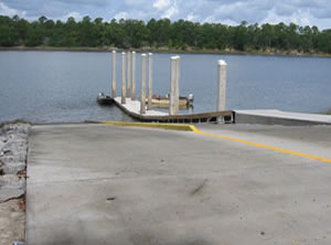 395 Clarendon Road
Beaufort, SC 29906
GPS 32° 30'13.23" N 80° 47'04.31" W
( Waters edge at ramp )
Grays Hill boat ramp on the Whale Branch River offers; 2 launching lanes, courtesy docks and 18 unpaved parking spaces for trailers.
No restrooms at this location.
H.E. Trask Senior Boat Ramp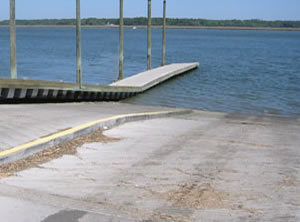 325 Sawmill Creek Road
Bluffton, SC 29910
GPS 32° 17'22.07" N 80° 48'30.83" W
( Waters edge at ramp )
The H.E. Trask Senior boat ramp along the Colleton River offers; 2 launching lanes, courtesy dock, about 55 unpaved spaces for boat trailers and access to the Colleton, Okatie, and Chechessee Rivers. Locals say the waters can be rough here at times due to the long fetch. No restrooms at this location.
Marshland Boat Ramp ~ Small Boats ~ Hand Launch ~ Gravel
97 Marshland Road
Hilton Head Island, SC 29926
GPS 32° 11'57.02" N 80° 43'05.44" W
( Waters edge at ramp )
The Marshland gravel boat ramp is for small boats or hand launching. Parking for a bout 20 trailers.
Paige Point Boat Ramp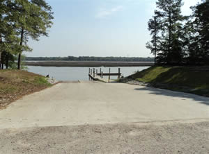 99 Paige Point Landing
Seabrook, SC 29940
GPS 32° 33'00.17" N 80° 45'40.14" W
( Waters edge at ramp )
Paige Point ramp along Huspa Creek offers; 2 launching lanes, floating courtesy docks, 15 trailer parking spaces and access to Huspa Creek and the Whale Branch River.
Parris Island Boat Ramp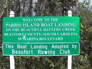 50 Marina Boulevard
Beaufort, SC 29902
GPS 32° 22'40.13" N 80° 43'03.67" W
( Waters edge at ramp )
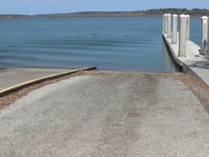
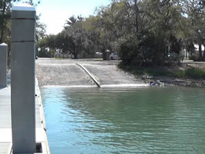
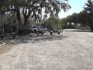
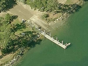
Parris Island boat ramp located along Battery Creek with access to the Beaufort River offers; 2 launching lanes, courtesy docks and port-o-lets.
Pigeon Point Boat Ramp
Closest intersection is;
Pigeon Point Road & Wilson Drive
Beaufort, SC 29902
Boat ramp is 1/10 th of a mile down Pigeon Point Road from the above intersection.
GPS 32° 27'08.86" N 80° 40'12.74" W
( Waters edge at ramp )
The Pigeon Point boat ramp along the Harbor River offers; Single launching lane, courtesy dock & about 8-10 boat trailer parking spaces. No restrooms at this location. A fishing pier is on site also
Port Royal Landing Boat Ramp ~ The Sands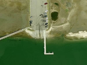 50 Sands Beach Road
Port Royal,SC 29935
GPS 32° 22'13.68" N 80° 41'12.86" W
( Waters edge at ramp )
The Port Royal Landing boat ramp along Battery Creek near the Beaufort River offers; 3 launching lanes, courtesy dock and parking for about 30 boat trailers.
A fishing pier is on site also.
Russ Point Boat Ramp
Russ Point Boat Landing
St Helena Island
Beaufort, South Carolina 29920
This address may not populate well into navigation systems, use GPS coordinates.
GPS 32° 20'45.65" N 80° 28'10.63" W
( Waters edge at ramp )
The Russ Point ramp has 2 lanes, central courtesy dock, 16 unpaved parking spots for trailers & a portolet toilet. This area gives easy access to Fripp Inlet and the Atlantic waters beyond.
Sams Point Boat Ramp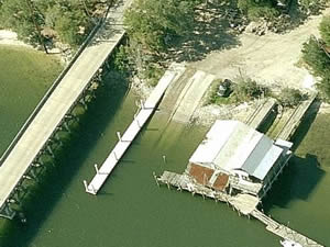 1009 Sams Point Road
Beaufort, SC 29907
GPS 32° 29'03.73" N 80° 36'01.62" W
( Waters edge at ramp )
Sams Point boat ramp along Lucky Point Creek near the Coosaw River offers; 2 launching lanes, courtesy dock. Parking is limited at this location.
Steel Bridge Boat Ramp
Closest intersection is;
Charleston Highway & Nemours Plantation Drive
Yemassee, SC 29945
Entrance to ramp is 1/3 of a mile down Charleston Highway from the above intersection.
GPS 32° 39'10.21" N 80° 41'01.84" W
( Waters edge at ramp )
The Steel Bridge boat ramp along the Combahee River offers; 2 launching lanes, courtesy dock and parking for about 20 boat trailers.
No restrooms at this location.
Sugar Hill Boat Ramp
40 Sugar Hill Landing Road
Yemassee, SC 29945
GPS 32° 39'58.93" N 80° 45'16.52" W
( Waters edge at ramp )
Sugar Hill boat ramp Combahee River is acceptable for smaller boats or hand launching. Ramp is not in the best of shape and has a steep drop off at end of ramp especially at low tides. Appox. 50 boat trailer parking spots, can be busy during duck hunting season.
No restrooms at this location.
Wallace Boat Ramp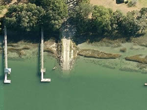 245 Sam Doyle Drive
St Helena Island, SC 29920
GPS 32° 22'51.65" N 80° 36'02.72" W
( Waters edge at ramp )
Video of the Wallace Landing Public Boat Ramp
The Wallace boat ramp along Cowen Creek offers; Single launching lane, courtesy dock and 10 parking spaces.
No restrooms at this location.
White Hall Boat Ramp
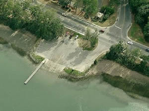 33 Sea Island Parkway
Beaufort, SC 29907
GPS 32° 25'13.99" N 80° 39'44.53" W
( Waters edge at ramp )
The White Hall boat ramp located along the Beaufort River offers; Wide single lane ramp, courtesy dock, parking for about 15 boat trailers. Sometimes there are portable restrooms at this location..
Wimbee Boat Ramp
550 Wimbee Landing Road
Seabrook, Beaufort, SC 29940
GPS 32° 34'41.10" N 80° 40'10.92" W
( Waters edge at ramp )
Wimbee Boat Landing provides boating access to Wimbee Creek. The area offers; single launching lane, courtesy dock and 15 unpaved trailer parking spaces.
No restrooms at this location.
A fishing pier is on site also.
Useful Links
| Public Boat Ramps Beaufort County, South Carolina |
| Areas in Beaufort County, South Carolina include; Beaufort, Burton, Bluffton, Dale, Frogmore, Hilton Head Island, Laurel Bay, Lobeco, Parris Island, Pocotaligo, Port Royal, Pritchardville, Sheldon, Sun City Hilton Head, Seabrook andf Yemassee. |
| Bodies of brackish and saltwater in Beaufort County, South Carolina include; Albergottie Creek, Archers Creek, Atlantic Ocean, Ballast Creek, Bass Creek, Battery Creek, Beaufort River, Big Island Creek, Bird Island Creek, Boatswain Pond Creek, Brickyard Creek, Broad River, Broomfield Creek, Bull River, Calibogue Sound, Cat Island Creek, Chechessee Creek, Chechessee River, Coffin Creek, Colleton River, Combahee River, Cooper River, Coosaw River, Cowen Creek, Distant Island Creek, Eddings Point Creek, Euhaw Creek, Fripp Inlet, Habersham Creek, Harbor River, Haulover Creek, Hazzard Creek, Hoophole Creek, Huspa Creek, Jenkins Creek, Lucky Point Creek, May River, McCalleys Creek, Moon Creek, Morgan Back Creek, Morgan River, Moss Creek, Mulligan Creek, Old House Creek, Parrot Creek, Pocotaligo River, Port Royal Sound, Ribbon Creek, Rock Skull Creek, Savage Creek, Springs Creek, Staion Creek, St Helena Sound, Story River, Trenchards Inlet, Village Creek, Ward Creek, Whale Branch, Wimbee Creek and Williman Creek. |
![]() Home
Home
![]() About
About
![]() Sitemap
Sitemap
![]() Credits
Credits
![]() Privacy
Privacy
![]() Advertise
Advertise
![]() Contact
Contact
![]()
