Jasper County, South Carolina ~ Fishing Piers
- National &
State Parks - County &
City Parks - Beaches
Jasper - Boat Ramps
Jasper - Fishing Piers
Jasper - Map of
Fishing Piers - Fishing Piers
Adjoining Counties
Find Public Fishing Piers in Jasper County, South Carolina
Seach our site below
Bolan Hall Fishing Pier Closest intersection is;
Lowcountry Drive & Bolan Hall Road
Ridgeland, SC 29936
The pier is 2.8 miles down Bolan Hall Road from the above intersection.
GPS 32° 25'10.22" N 80° 51'06.16" W
( Foot of pier )
|
|
|
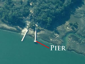
The Bolan Hall pier is located along Euhaw Creek and is 175 feet in length. Plenty of parking and portable restrooms.
A boat ramp is on site also.
Cooks Landing Fishing Pier
Closest intersection is;
Cook Landing Road & Docks Corner Road
Hardeeville, SC 29927
Pier is 9/10 of a mile down Cook Landing Road from the above intersection.
GPS 32° 11'40.04" N 80° 59'56.39" W
( Foot of pier )
|
|
|
Cooks Landing fishing pier is about 30 feet in length over the waters of the New River.
No restrooms at this location.
A boat ramp is on site also.
Knowles Island Fishing Pier
Closest intersection is;
Old Tressle Road & Broadview Drive
Ridgeland, SC 29936
Pier is 1.1 miles down Old Tressle Road from above intersection.
GPS 32° 31'08.99" N 80° 50'31.97" W
The Knowles Island fishing pier is 230' in length over the waters of the Broad River. No restrooms at this location.
Useful Links
| Public Fishing Piers in Jasper County, South Carolina |
| Areas in Jasper County South Carolina Include; Coosawhatchie, Gillisonville, Grahamville, Grays, Levy, Hardeeville, Limehouse, Pineland, Purrysburg, Ridgeland, Switzerland, Savannah National Wildlife Refuge, Tillman and Tybee National Wildlife Refuge. |
| Bodies of Water in Jasper County South Carolina Include; Atlantic Ocean, Back River, Coosawhatchie River, Little Back River, Mud River, New River, Savannah River, Steamboat Riverand The Wright River. |
![]() Home
Home
![]() About
About
![]() Sitemap
Sitemap
![]() Credits
Credits
![]() Privacy
Privacy
![]() Advertise
Advertise
![]() Contact
Contact
![]()
