Beaufort County, South Carolina ~ Fishing Piers
- National &
State Parks - County &
City Parks - Beaches
Beaufort - Boat Ramps
Beaufort- Alljoy Boat Ramp
- Bluffton Oyster Factory
- Brickyard Creek Boat Ramp
- Broad River Boat Ramp
- Buckingham Boat Ramp
- Buddy & Zoo Boat Ramp
AKA ~ Station Creek - Butches Island
Landing Boat Ramp
Small Boats - C.C. Haigh Boat Ramp
- Cross Island Boat Ramp
AKA Broad Creek Ramp - Eddings Point Boat Ramp
- Edgar Glenn Boat Ramp
- Freedom Mall Boat Ramp
- Grays Hill Boat Ramp
- H.E. Trask Senior Boat Ramp
- Marshland Boat Ramp
Small Boats - Paige Point Boat Ramp
- Parris Island Boat Ramp
- Pigeon Point Boat Ramp
- Port Royal Landing Boat Ramp
"The Sands" - Russ Point Boat Ramp
- Sams Point Boat Ramp
- Steel Bridge Boat Ramp
- Sugar Hill Boat Ramp
- Wallace Boat Ramp
- White Hall Boat Ramp
- Wimbee Boat Ramp
- Fishing Piers
Beaufort - Map of
Fishing Piers - Piers in
Adjoining Counties
Fishing Piers in Beaufort County, South Carolina
Seach our site below
Broad River Fishing Pier
Robert Smalls Parkway ( 170 ) & Savannah Highway
Burton, SC 29906
At this above intersection make a left off of Robert Smalls Parkway if traveling east, make a right if traveling west on 170. Fishing pier will be about 6/10ths of a mile down this side road.
GPS 32° 23'25.36" N 80° 46'28.93" W
( Foot of pier )
The Broad River fishing pier near Burton, South Carolina is 1800' in length running adjacent to the new Okatie Highway bridge. Restrooms are available.
Please keep this pier clean by using the trash cans.
A boat ramp on site also.
Calhoun Street Fishing Pier
Closest intersection is;
Calhoun Street & Water Street
Bluffton, SC 29910
From the above intersection go 300' south on Calhoun Street to the pier.
GPS 32° 13'51.36" N 80° 51'48.27" W
( Foot of pier )
NOAA 8669103 BLUFFTON, MAY RIVER, SC
The Calhoun Street fishing pier is along the May River. This area also serves as a boat dock. Restrooms are available.
Camp St. Marys Fishing Pier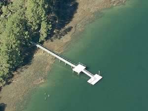 130 Camp St Marys Road
Okatie, SC 29909
GPS 32° 20'32.94" N 80° 54'04.94" W
( Foot of pier )
NOAA Baileys Landing, Okatee River, SC 8668482
The Camp St Mary's fishing pier is 140' in length over the Okatee River. There is a pavilion on site ( no tables ) The "park" is an old camp with abondoned buildings and an old wooden church.
C.C. Haigh Fishing Pier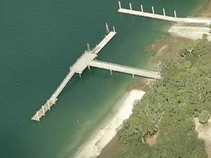 Pinckney Wildlife Refuge &
William Hilton Parkway ( US 278 )
Hilton Head Island, SC 29926
The entrance is across from the above intersection.
GPS 32° 13'41.97" N 80° 47'16.57" W
( Foot of pier)
NOAA Pinckney Island, Mackay Creek 8668944
The C.C. Haigh pier is 150 feet in length over the waters of Mackay Creek and has a 45 foot "T" at the end. Port-o-lets are available.
There is also a boat ramp on site.
Factory Creek Fishing Pier
33 Sea Island Parkway
Beaufort, SC 29907
GPS 32° 25'11.51" N 80° 39'41.26" W
( Foot of pier )
The Factory Creek fishing pier is about 115 in length over the water ( tide dependent ) and has a floating "T" at the end which is 100' in length. A shaded area is on the pier prior to the gang plank going down to the floating section.
Hunting Island State Park Fishing Pier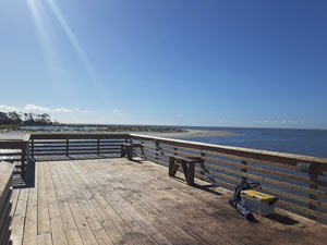 Tarpon Boulevard & SR S-7-439
St Helena Island, SC 29920
This address may not populate well into navigation systems, use GPS coordinates.
GPS 32° 20'35.03" N 80° 27'41.98" W
NOAA Fripps Inlet, SC 8668498
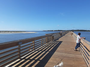
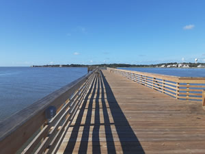
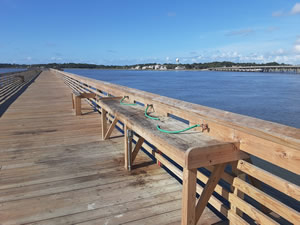
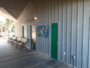
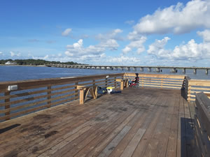
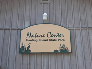
The Hunting Island State Park pier at the southern end of Hunting Island is 1100 feet in length over the waters of Fripp Inlet. The pier offers; small unique seating areas along the pier, bait cutting / fishing cleaning station with running water, restrooms and mostly shaded parking.
Jenkins Island Fishing Pier
43 Jenkins Island Road
Hilton Head Island, SC 29926
GPS 32° 13'24.44" N 80° 46'15.09" W
( Foot of pier )
NOAA Skull Creek South, SC 8669133
The Jenkins Island pier is 175 feet in length over the waters of Skull Creek. Parking for about 10 cars. No restrooms at this location.
Old House Creek Fishing Pier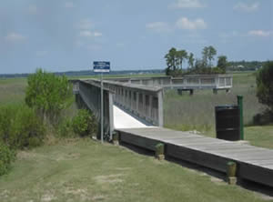 Closest intersection is;
Sterling Point Drive & Silver Oak Drive
Hilton Head, SC 29926
Pier area is 500 feet down Sterling Point Drive from the above intersection.
GPS 32° 11'58.73" N 80° 46'04.86" W
( Foot of pier )
NOAA North Bull Island, May River, SC 8669262
Old House Creek fishing pier has parking for about 5-6 vehicles. Crabbing and fishing are popular activities at this location. Please be sure to have the proper South Carolina fishing license in hand while using this location. No restrooms at this location.
Roger Pinckney Fishing Pier
Closest intersection is;
Pigeon Point Road & Wilson Drive
Beaufort, SC 29902
Pier is 300' down Pigeon Point Road on the left from the above intersection.
GPS 32° 27'06.55" N 80° 40'15.31" W
( Foot of pier )
The Roger Pickney fishing pier is along the Brick Yard Creek / Harbor River and offers; A small staionary deck with benches, other benches on the land, parking at the boat ramp area and scenic views. No restrooms at this location.
Squire Park Fishing Pier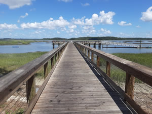 137 Squire Pope Road
Hilton Head Island, SC 29926
GPS 32° 13'27.60" N 80° 45'026.31" W
( Foot of pier )
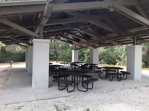
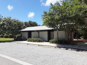
The Squire Park fishing pier is 200 feet in length out over the water, the pier has a large "T" at the end measuring 90 feet in length and 18 feet wide. A fish cleaning / bait cutting station is on the pier also. Picnic pavilion with tables, grills, fire pit, swing, water and restrooms are also availble.
Whale Branch Fishing Pier / Old Railroad Bridge
216 Seabrook Point Drive
Seabrook, SC 29940
GPS 32° 31'51.54" N 80° 46'01.50" W
( Foot of pier )
NOAA Clarendon Plantation, SC 8667633
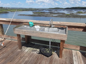
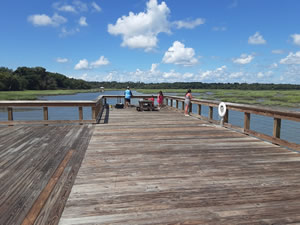
The Whale Branch pier is 450' in length over the Whale Branch River. Can be hard to figure your way back to this pier. Part of old Port Royal Railroad.
Wimbee Fishing Pier
550 Wimbee Landing Road
Seabrook, Beaufort, SC 29940
GPS 32° 34'40.36" N 80° 40'10.58" W
( Foot of pier )
NOAA Wimbee Creek, SC 8667199
The Wimbee Creek fishing pier has 200 feet of fishable length, a portion of the end is fenced off.
No restrooms at this location.
A boat ramp is on site also.
Useful Links
| Public Fishing Piers in Beaufort County, South Carolina |
| Areas in Beaufort County, South Carolina include; Beaufort, Burton, Bluffton, Dale, Frogmore, Hilton Head Island, Laurel Bay, Lobeco, Parris Island, Pocotaligo, Port Royal, Pritchardville, Sheldon, Sun City Hilton Head, Seabrook andf Yemassee. |
| Bodies of brackish and saltwater in Beaufort County, South Carolina include; Albergottie Creek, Archers Creek, Atlantic Ocean, Ballast Creek, Bass Creek, Battery Creek, Beaufort River, Big Island Creek, Bird Island Creek, Boatswain Pond Creek, Brickyard Creek, Broad River, Broomfield Creek, Bull River, Calibogue Sound, Cat Island Creek, Chechessee Creek, Chechessee River, Coffin Creek, Colleton River, Combahee River, Cooper River, Coosaw River, Cowen Creek, Distant Island Creek, Eddings Point Creek, Euhaw Creek, Fripp Inlet, Habersham Creek, Harbor River, Haulover Creek, Hazzard Creek, Hoophole Creek, Huspa Creek, Jenkins Creek, Lucky Point Creek, May River, McCalleys Creek, Moon Creek, Morgan Back Creek, Morgan River, Moss Creek, Mulligan Creek, Old House Creek, Parrot Creek, Pocotaligo River, Port Royal Sound, Ribbon Creek, Rock Skull Creek, Savage Creek, Springs Creek, Staion Creek, St Helena Sound, Story River, Trenchards Inlet, Village Creek, Ward Creek, Whale Branch, Wimbee Creek and Williman Creek. |
![]() Home
Home ![]() About
About ![]() Sitemap
Sitemap ![]() Credits
Credits ![]() Privacy
Privacy ![]() Advertise
Advertise ![]() Contact
Contact ![]()
