Horry County, Myrtle Beach Area of South Carolina ~ Fishing Piers
- National &
State Parks - County &
City Parks - Beaches
Horry - Boat Ramps
Horry - Fishing Piers
Horry - Map of
Fishing Piers - Fishing Piers in
Adjoining Counties
Find Public Fishing Piers, Horry County, Myrtle Beach, South Carolina
Seach our site below
Apache Ocean Fishing Pier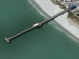 9700 Kings Road
Myrtle Beach, SC 29572
The sign reads Apache Campground follow road straight back for 1/2 mile at end make left and pier parking is straight ahead.
GPS 33° 45'50.75" N 78° 46'55.81" W
|
|
|
NOAA Myrtle Beach, SC 8661000
The Apache Ocean fishing pier in Myrtle Beach is 1150' in length over the Atlantic waters. The pier has a 110' "T" at the end. Midway out the pier is a shaded area also.
Cherry Grove Fishing Pier at Boat Ramp
53rd Avenue North & Heritage Drive
North Myrtle Beach, NC 29582
GPS 33° 50'31.14" N 78° 37'03.06" W
( Foot of pier )
|
|
|
NOAA Cherry Grove ( inside ), SC 8660265
Managed by the City of North Myrtle Beach the Cherry Grove fishing pier along Williams Creek is about 100' in length parallel with the shoreline. The pier is about 20' off the waters edge.
A boat ramp is on site also.
Cherry Grove Ocean Fishing Pier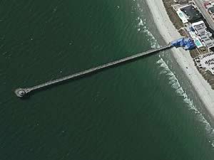 3502 North Ocean Boulevard
North Myrtle Beach, SC 29582
Open 7am - 11pm
1-843-249-1625
GPS 33° 49'47.29" N 78° 37'59.64" W
( Foot of pier )
NOAA Myrtle Beach, SC 8661000
|
|
The Cherry Grove Ocean fishing pier is 985' in length over the Atlantic waters. The pier has a 2 story observation deck at the end of pier, Full service bait and tackle shop, When you purchase a paid fishing admission the license to fish is included a great way for "out of state" fishermen to enjoy a day of hassle free fishing.
Garden City Ocean Fishing Pier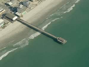 110 South Waccamaw Driver
Garden City, SC 29576
843-651-9700
GPS 33° 34'35.90" N 78° 59'54.32" W
NOAA Garden City Pier, Murrells Inlet, SC 8661437
The Garden City ocean fishing pier is 625 feet in length.
Heritage Shores Nature Preserve Fishing Piers
Closest intersection is;
Heritage Drive & 55th Avenue North
North Myrtle Beach, SC 29582
Make a right at this intersection for the parking area(s),
GPS 33° 50'37.26" N 78° 36'41.02" W
( Foot of pier 1 )
GPS 33° 50'34.18" N 78° 36'41.89" W
( Foot of pier 2 )
NOAA Cherry Grove, Inside, SC 8660265
Parking at Cherry Grove, it is about a 1000 foot walk to the entrance.
• The foot of pier 1 is about 1400 feet in from the entrance. Pier 1 is about 200 feet in length
with only about the last 1/3rd over the waters of Williams Creek.
• The foot of pier 2 is about 1200 feet in from the entrance. Pier 2 is about 30 feet in length
over a small tidal pond.
A boat ramp is very nearby also.
Myrtle Beach State Park Ocean Fishing Pier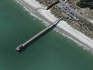 4401 South Kings Highway
Myrtle Beach, SC 29575
Above address may not accurately load in devices.
843-238-5325
GPS 33° 38'54.71" N 78° 55'42.88" W
NOAA Myrtle Beach, SC 8661000
The Myrtle Beach State Park Ocean Fishing pier is 650 feet in length.
Pier 14 Ocean Fishing Pier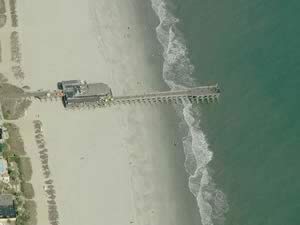 1306 North Ocean Boulevard
Myrtle Beach, SC 29577
GPS 33° 41'41.89" N 78° 52'31.37" W
NOAA Myrtle Beach, SC 8661000
The Pier 14 fishing pier is 650 feet in length.
Springmaid Ocean Fishing Pier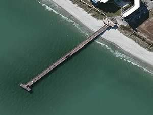 3200 South Ocean Boulevard
Myrtle Beach, SC 29577
GPS 33° 39'25.48" N 78° 55'06.41" W
NOAA Springmaid Pier, SC 8661070
The Springmaid Ocean fishing pier is 960 feet in length with a 100 foot "T" at the end.
Surfside Ocean Fishing Pier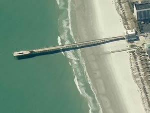 11 North Ocean Boulevard
Surfside Beach, SC 29575
843-238-0121
GPS 33° 36'18.12" N 78° 58'18.96" W
NOAA Garden City Pier, Murrells Inlet, SC 8661437
The Surfside Ocean fishing pier is 660 feet in length.
2nd Avenue Ocean Fishing Pier 110 North Ocean Boulevard
Myrtle Beach, SC 29577
843-626-8480
GPS 33° 41'02.42" N 78° 53'10.09" W
NOAA Myrtle Beach, SC 8661000
The 2nd Avenue Ocean fishing pier is 775 feet in length.
Useful Links
| Public Fishing Piers in Horry County South Carolina |
| Areas in Horry County, South Carolina include; Allsbrook, Atlantic Beach, Aynor, Baxter Forks, Bayboro, Briarcliff Acres, Bucksville, Burgess, Carolina Forest, Cedar Branch, Cherry Grove, Cool Spring, Conway, Crescent Beach, Daisy, Forestbrook, Galivants Ferry, Garden City, Glass Hill, Green Sea, Gurley, Hand, Hickory, Homewood, Ingram Beach, Ketchuptown, Konig, Lakewood, Little River, Longs, Loris, Nixonville, Nixons Crossroads, North Myrtle Beach, Ocean Drive Beach, Pine Island, Polecat Landing, Poplar, Red Bluff Crossroads, Red Hill, Shell, Socastee, Springmaid Beach, Surfside, Toddville, Wampee and Windy Hill. |
| Bodies of brackish and saltwater in Horry County, South Carolina include; Atlantic Ocean, Coquina Harbor, Dunn Sound, Enterprise Creek, Hog Inlet, Intercoastal Waterway, Little River, Main Creek, Mullet Creek, Prince Creek, Socastee Creek, Waccamaw, Williams Creek |
![]() Home
Home ![]() About
About ![]() Sitemap
Sitemap ![]() Credits
Credits ![]() Privacy
Privacy ![]() Advertise
Advertise ![]() Contact
Contact ![]()
