
Boat Ramps
in
Beaufort County
North Carolina
Seach our site below
Aurora Boat Ramp
1 East Main Street
Aurora, NC 27806
GPS 35° 18'16.02" N 76° 46'46.85" W
( Waters edge at ramp )
NOAA Ocracoke Inlet TEC2793
|
|
|
The Aurora boat ramp on South Creek in Aurora, North Carolina offers; Single launching lane, 20 boat trailer parking spaces and courtesy docks. No restrooms at this location.
A fishing pier is on site also.
Belhaven Boat Ramp
Water Street and Haslin Street
Belhaven, NC 27810
GPS 35° 32'20.32" N 76° 37'31.12" W
( Waters edge at ramp )
|
|
|
The Belhaven boat ramp offers; 2 launching lanes, courtesy docks, parking for about 30 boat trailers and restrooms. Operated by the North Carolina Wildlife Resources Commission, the Belhaven ramp sits along Pantego Creek, a short distance from the Pango River.
Blounts Creek Boat Ramp
350 Crisp Landing Road
Chocowinity, NC 27817
GPS 35° 24'27.23" N 76° 57'45.73" W
( Waters edge at ramp )
|
|
|
The Blounts Creek boat ramp in Chocowinity, North Carolina offers; 27 boat trailer parking spaces and courtesy docks.
A fishing pier is on site also.
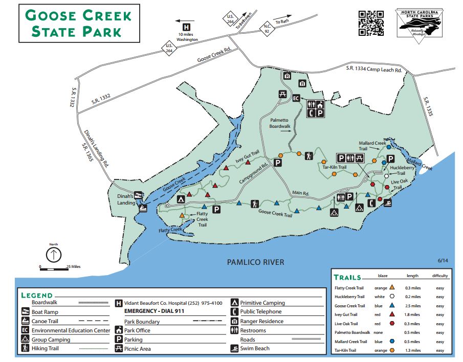
Dinahs Landing Boat Ramp ~ Within Goose Creek State Park
2190 Camp Leach Road
Washington, NC 27889
or;
Closest intersection is;
Goose Creek Road & Dinah's Landing Road
Washington, NC 27889
From the above intersection go on Dinahs Landing Road for 1.5 miles to the ramp at the end.
GPS 35° 28'46.76" N 76° 55'54.54" W
( Waters edge at ramp )
Go to map of Goose Creek State Park.
|
|
|
Dinahs Landing boat ramp on Goose Creek offers; 2 launching lanes, courtesy docks, picnic table, pit toilets and parking for about 25 boat trailers.
There is a fishing pier on site also.
Havens Gardens Boat Ramp
1053 East Main Street
Washington, NC 27889
GPS 35° 32'11.67" N 77° 02'21.45" W
( Waters edge at ramp )
NOAA Ocracoke Inlet TEC2793
|
|
|
The Havens Gardens boat ramp operated by the City of Washington, NC sits near the mouth of Runyon Creek and offers; 2 launching lanes, about 20 boat trailer parking spaces, courtesy docks and restrooms. Access to the Pamlico River is under a bridge with 14 feet of vertical clearance.
There is a fishing pier and picnic shelters within the same complex.
Masons Landing ~ Tranters Creek Boat Ramp
625 Clarks Neck Road
Washington, NC 27889
GPS 35° 33'45.52" N 77° 05'10.28" W
( Waters edge at ramp )
NOAA Ocracoke Inlet TEC2793
|
|
|
The Masons Landing boat ramp on Tranters Creek offers; 2 launching lanes, courtesy docks and 30 boat trailer parking spaces. Hand launch your kayak, jon boat or canoe from this location. Access to the Pamlico River is under the Highway 17 Bridge with 18 feet of vertical clearance.
Smith Creek Boat Ramp
Closest intersection from the west side is;
N Carolina 33 & Cypress Swamp Road
Richland, NC 27806
Go 3.8 miles East on 33 and ramp entrance is on the left, immediately after the small bridge.
GPS 35° 16'10.34" N 76° 37'53.78" W
( Waters edge at ramp )
NOAA Ocracoke Inlet TEC2793
|
|
|
Smith Creek boat ramp offers a single lane ramp, courtesy dock and parking for about 20 boat trailers.
Wrights Creek Boat Ramp
Closest major intersection is;
Old Pamlico Beach Road & Wilkins Road
Bath, NC 27810
Go 1.2 miles East on Wilkins Road to the ramp area
GPS 35° 24'51.38" N 76° 35'30.64" W
( Waters edge at ramp )
Wilkins Creek boat ramp offers 2 launching lanes, courtesy dock and paved parking for about 23 boat trailers.
Useful Links
| North Carolina Saltwater Fishing Regulations | Safe Handling of Self Caught Seafood |
| Videos of Fishing Knots | Fish of the Atlantic |
| Seafood Recipes |
| Public Boat Ramps in Beaufort County, North Carolina |
| Areas in Beaufort County, North Carolina Include; Aurora, Bath, Belhaven, Bunyan, Chocowinity, Gaylord, Hackney, Pamlico Beach, Pantego, Pinetown, River Road, Smithtown, Washington, Washington Park and Yeatesville. |
| Bodies of Brackish and Saltwater in Beaufort County, North Carolina Include; Bath Creek, Bear Creek, Blounts Bay, Blounts Creek, Broad Creek, Chocowinity Bay, Durham Creek, Goose Creek, ICW, Muddy Creek, North Creek, Pamlico River, Pantego Creek, Pungo Creek, Pungo River, South Creek and Upper Goose Creek |
![]() Home
Home
![]() About
About
![]() Sitemap
Sitemap
![]() Credits
Credits
![]() Privacy
Privacy
![]() Advertise
Advertise
![]() Contact
Contact
![]()