
Public Boat Ramps
in
Camden County, Georgia
Seach our site below
Crooked River State Park Boat Ramp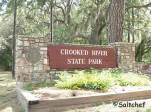 6222 Charlie Smith Sr. Highway
St. Marys , GA 31558
1-912-882-5256
Hours; 7 am ~ 10 pm
GPS 30° 50' 43.28" N 81° 33' 35.57" W
( Waters edge at ramp )
|
|
|
Crooked River State Park sitting on 500 acres on the south bank of the Crooked River offers; 26 paved boat trailer parking spaces. A is fee required to utilize park, the payment box and envelopes are located near the ramp. There is also a fresh water hose bib near the top of the ramp. Launch a kayak here and enjoy a day of paddling and fishing. A fishing pier adjacent to the ramp, restrooms are located passed the bait and tackle shop near the office. BBQ grill at shelter which is heated and has AC ( rentable by calling the park ).


Harriett's Bluff Boat Ramp
 Closest intersection is;
Crooked River Drive & Pine Street
Woodbine, GA 31569
300 feet south on Crooked River Drive from the above intersection.
GPS 30° 52' 04.06" N 81° 35' 04.37" W
( Waters edge at ramp )
|
|
|
Harriets Bluff boat ramp is single lane ramp with minimal parking for trailers. Good spot to hand launch a canoe or kayak. There is a water faucet for rinsing near the top of the ramp. No restrooms at this facility. Fishing, shrimping and crabbing from the floating dock.
When your going down Harriets Bluff Road from I-95, Harriets Bluff bears off to the right about 5.5 miles down.


Howard Gilman Memorial Waterfront Park Boat Ramp ~ AKA Waterfront Park St Marys Street West & St Marys Street
St Marys, GA 31558
1-912-510-4041 ( City of St. Marys )
GPS 30° 43' 11.86" N 81° 33' 01.21" W
( Waters edge at ramp )
|
|
|
Howard Gilman Memorial Waterfront Park offers; Wide single lane ramp, courtesy docks, 55 boat trailer parking spaces at street,
playground, restrooms, water fountain, picnic areas, benches along waterfront and throughout park. Launch your canoe or kayak and enjoy some peaceful time fishing or paddling on the river from this location. Located adjacent to the Cumberland Island Vistor Center.
A fishing pier at 180 feet in length on site also.


Little Satilla River Boat Ramp ~ Spring Bluff Closest intersection is;
Ocean Highway & Dover Bluff Road
Waverly, GA 31565
From the above intersection the entrance to the ramp area is 6/10ths of a mile north on Ocean Highway on the right.
When exiting here the visibility is poor please be careful.
GPS 31° 06' 37.30" N 81° 37'01.77" W
( Entrance off Ocean Highway / Route 17 )
GPS 31° 06' 49.40" N 81° 36'49.98" W
( Waters edge at ramp )
NOAA ~ 8 miles above mouth Station 8677566
|
|
|
The Little Satilla River boat has minimal amenities, these include a floating courtesy dock that can be fished from and a trash can. This area is suitable for hand launching of canoes and kayaks. Please watch drop offs on either side of the ramp when backing in and pulling out. Lock your vehicles at this location, and keep valuables out of sight, as it is not an overly busy place.


North River Boat Ramp - AKA Meeting Street
 Meeting Street East
Saint Mary, GA 31558
GPS 30° 43' 59.84" N 81° 32' 19.79" W
( Waters edge at ramp )
NOAA tides ~ St. Marys, St. Marys River, GA Station 8679964
|
|
|
The North River boat ramp in St. Marys Georgia offers; 48 boat trailer parking spots and a courtesy dock. Launching of kayaks or canoes can be done here also, but please watch the currents and boat traffic.
Satilla River Waterfront Park Boat Ramp 103 East 1st Street
Woodbine, GA 31569
GPS 30° 58' 24.02" N 81° 43' 26.03" W
( Waters edge at ramp )
NOAA ~ Todd Creek entrance Station 8678412
|
|
|
The Satilla River Waterfont Park in Woodbine, Georgia offers; boat ramp, courtesy dock, pavilions, restrooms, shoreline fishing, freshwater wash down near ramp, a beautiful riverwalk, scenery, There is a fishing pier that was once an old railroad trestle at the other end of the riverwalk from the ramp area.


St. Marys River Boat Ramp Closest intersection is;
Route 95 & Ocean Way
2.5 north on Ocean Way ( Route 5 ) from the overpass at Route 95 and Route 5. Cross the river and entrance is on the right ( east side ).
GPS 30° 44' 31.52" N 81° 41' 16.01" W
( Waters edge at ramp )
|
|
|
The St. Marys River boat ramp offers; single launching lane, no courtesy dock and parking for about 5 boat trailers. No restrooms at this location.
White Oak Creek Boat Ramp Closest intersection is;
Ocean Highway & Burnt Fort Road
White Oak, GA 31568
From the above intersection travel north on Ocean Highway ( 17 ) for 4/10ths of a mile cross small bridge, entrance to ramp area will be on the right. Can be a rough ride into parking area watch potholes!
GPS 31° 02' 11.42" N 81° 43' 47.75" W
( Waters edge at ramp )
NOAA Ceylon 8678466
|
|
|
White Oak Creek boat ramp offers parking for 15 boat trailers, courtesy dock and trash receptacles. There is a converted trestle bridge used for fishing on the western side of the current highway bridge, click here for more information.


Dark Entry Creek Hand Launch
Coastal Georgia Greenway Canoe Trail Closest intersection is;
Kingsland St Marys Road & Shadowlawn Drive
St. Mary's, GA 31558
Entrance is 650 feet east of the above intersection on Kingsland St Marys Road
GPS 30° 45' 12.57" N 81° 35'00.97" W
NOAA St. Marys, St. Marys River, GA 8679964
|
|
|
The Dark Entry Creek / Coastal Georgia Greenway Canoe Trail area offers; 6 paved parking spaces, floating dock. Portage is about 300' from parking area to the water. No restroom facilities at this location.
Catfish Creek Hand Launch
Closest intersection is;
US 17 & Vacuna Road
Kingland, GA 31548
About 5/10ths of a mile south on US 17 from the above intersection
GPS 30° 46'25.03" N 81° 41'13.19" W
NOAA Crandall, St. Marys River, FL 8720004
|
|
|
The Catfish Creek area is along the roadside near the bridge, no amenities of any type at this location.
Crooked River Hand Launch
Closest intersection is;
US 17 & Harriets Bluff Road
Woodbine, GA 31569
About 6/10ths of a mile south on US 17 from the above intersection
GPS 30° 50'00.15" N 81° 41'48.64" W
NOAA Harrietts Bluff, Crooked River 8679083
|
|
|
The Crooked River hand launch area is along the roadway ( route 25 ) at a small bridge. No amenities at this location.
Useful Links
| Public Boat Ramps in Camden County, Georgia |
| Areas in Camden County, Georgia include; Colesburg, Halifax, Harrietts Bluff, Hickory Bluff, Kings Bay Submarine Base, Kinlaw, Scotchville, Seals, St Marys, Woodbine, White Oak and Waverly. |
| Bodies of brackish and saltwater in Camden County, Georgia include; Atalntic Ocean, Bailys Cut, Bearskull Creek, Black Point River, Brickhill River, Brockington Creek, Brokehook Creek, Burrells Creek, Catfish Creek, Crooked River, Cumberland River, Cumberland Sound, Dark Entry Creek, Deep Creek, Delaroche Creek, Denver Cut, Dover Creek, Floyd Creek, Gowrie Creek, Gum Branch, Hawkins Creek, Heads Creek, Honey Creek, Kings Bay, Kirby Creek, Little Satilla River, Maiden Creek, Malknitooh Creek, Marianna Creek, Mill Creek, Millers Branch, Mud Creek, Mumford Creek, North River, Noyles Cut, Point Peter Creek, Sadlers Creek, Saint Andrews Sound, Saras Landing Creek, Satilla River, Shelbine Creek, Shell Creek, Sweeney Creek, Todd Creek, Umbrella Creek, Waverly Creek and White Oak Creek, |
![]() Home
Home
![]() About
About
![]() Sitemap
Sitemap
![]() Credits
Credits
![]() Privacy
Privacy
![]() Advertise
Advertise
![]() Contact
Contact
![]()