Pinellas County, Florida ~ Fishing Piers
- National &
State Parks - County &
City Parks - Beaches
Pinellas - Boat Ramps
Pinellas - Fishing Piers
Pinellas - Map of
Fishing Piers - Fishing Piers
Adjoining Counties
Public Fishing Piers & Bridges in Pinellas County, Florida
Seach our site below
Bay Vista Park Fishing Pier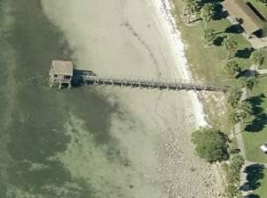 7000 4th Street South
St. Petersburg, FL 33705
1-727-893-7441
Hours; ½ before sunrise - ½ after sunset
GPS 27° 42'17.58" N 82° 38'27.76" W
( Park entrance )
GPS 27° 42'13.14" N 82° 38'27.46" W
( Foot of fishing pier )
NOAA Point Pinellas, FL - Station ID: 8726454
Video of Bay Vista Park Fishing Pier.
|
|
|
The Bay Vista Park fishing pier along Tampa Bay is 160 feet in length, with a shaded area at the end. The park has a picnic pavilion with bbq grills, playground and restrooms. Boat ramp is on site also.
Belleair Causeway Fishing Pier 3900 West Bay Drive
Belleair Bluffs, FL 34640
727-582-2100
Hours; Open 24 hours
GPS 27° 55'01.41" N 82° 49'31.19" W
( Entrance )
GPS 27° 55'02.68" N 82° 49'40.37" W
( Foot of pier )
|
|
|
The Bellaire Causeway fishing pier is 85 feet in length with a 50 foot tee at the end. A parking fee is charged. Shade can be had under the causeway bridge. Port-O-Lets.
Boat ramp on site also.
Coachman Park / Drew Street Fishing Pier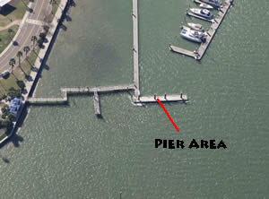 301 Drew Street
Clearwater, FL 33755
GPS 27° 58'05.11" N 82° 48'12.74" W
( Foot of pier )
|
|
|
The Coachman Park / Drew Street fishing pier sits out the walkway going to a boat slip area. The pier area is about a 100' in length. Coachman Park offers restrooms.
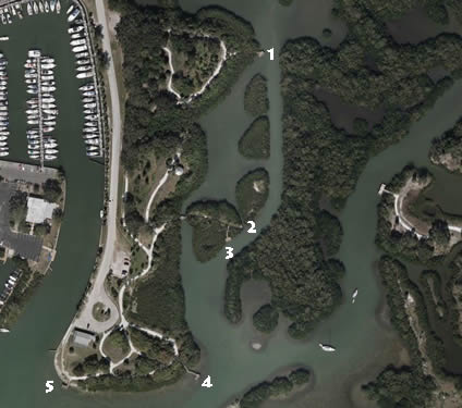
Clam Bayou Nature Park Fishing Docks / Piers
29th Ave South & Miriam Street South
Gulfport, FL 33711
GPS 27° 44'27.57" N 82° 41'41.19" W
( Entrance )
|
|
|
Clam Bayou Nature Park offers; 5 fishing piers in various locations around the park.
Clearwater Beach Fishing Pier 60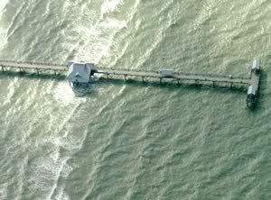 25 Causeway Boulevard
Clearwater, FL 33767
727-462-6466
Hours:
Oct thru Mar, Sun - Thurs - 6am to 9:30pm
Fri - Sat - 24 hours.
Apr thru Sep, 24 hours
GPS 27° 58'37.97" N 82° 49'43.74" W
( Foot of pier )
|
|
|
Clearwater Beach Pier 60 is 1100 feet in length with a 100 foot "T" at the end and is managed by the City of Clearwater Marine and Aviation Dept. The pier holds a fishing license which will allow anyone to fish from the pier without having to obtain a seperate Florida fishing license, this is great for out of state people wanting to drop a line. The pier offers; cleaning tables, shade structures at various points along pier, bait shop, picnic area, freshwater and restrooms. Hours vary by season, check above or best to call ahead to confirm.
Crystal Beach / Live Oak Park Fishing Pier
299 N Gulf Drive
Crystal Beach, FL 34681
GPS 28° 05'34.42" N 82° 46'51.36" W
( Foot of pier )
The Crystal Beach / Live Oak Park fishing pier is 240' in length, area at end measures about 20' x 10'. No restrooms at this location.
Not on map or navigation yet.
Daneman Point Fishing Pier ~ Northern portion of Wall Springs Park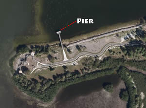 Closest intersection is;
Palm Harbor Boulevard & Wai Lani Road
Palm Harbor, FL 34683
Entrance to the parking lot is 1000' west on Wai Lani, entrance on the right.
GPS 28° 07'03.69" N 82° 46'49.52" W
( Foot of pier )
|
|
|
The Daneman Point pier is another pier located at the other end of Wall Springs Park. The pier is about 115' in length over the waters of the Klosterman Bayou, at the end of the pier is an area that is about 12' x 30'. It is about a 3300' walk back to the pier from the parking lot. Restrooms are at the parking lot area.
Del Bello Park Fishing Pier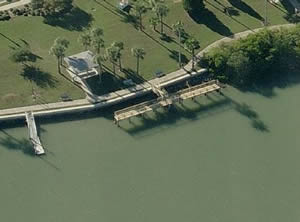 17957 Gulf Boulevard
Redington Shores, FL 33708
1-727-397-5538
Hours; open 24 hours
GPS 27° 49'51.53" n 82° 49'52.16" W
( Foot of pier )
|
|
|
The Del Bello Park pier is out over the bay 20 feet and has an 80 foot "T" on the end running parallel with the shoreline.
Del Bello Park fishing pier is managed by the Town of Redington Shores. The pier is small as compared to others, as it is over water for 20 feet out and has an 80 foot section that runs parallel with the shore. This pier does not provide a fishing license and you must obtain one from Florida to fish here. A picnic area and fresh water are available. No restrooms at this location.
Egan Park Fishing Pier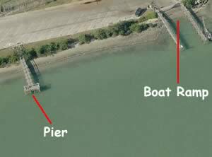 9101 Blind Pass Road
St. Pete Beach, FL 33706
GPS 27° 45'12.12" N 82° 45'26.45" W
( Entrance to park )
GPS 27° 45'15.92" N 82° 45'21.59" W
( Foot of pier )
|
|
|
Egan Park fishing pier is managed by the City of St. Pete Beach Parks Division. The pier is 70 feet in length over water, with a 20 foot "T" at the end. There is also a boat ramp at this park.
Fort De Soto Park Fishing Pier ~ Gulf Side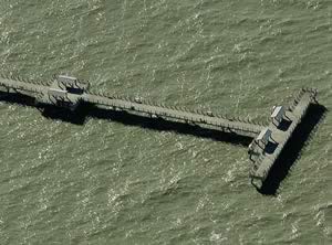 3000 Pinellas Bayway South
Tierra Verde, FL 33715
Above address is the toll booth area.
1-727-582-2267 information
Hours:
Fishing piers; Sunrise - 11pm
GPS 27° 36'47.10" N 82° 44'12.72" W
( Foot of pier )
Click here to go to map of Fort De Soto Park.
|
|
|
The Fort De Sota Park fishing pier on the gulf side is 1000 feet in length, with a 180 foot tee at the end. Has shaded pavilions at midway points along the pier and at the end. Lots of parking close to the pier. Check on restroom availability at this location prior to going.
Fort De Soto Park Fishing Pier / On the Bay Side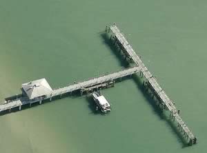 3000 Pinellas Bayway South
Tierra Verde, FL 33715
Above address is the toll booth area.
1-727-582-2267 information
Hours:
Fishing piers; Sunrise - 11pm
GPS 27° 36'58.38" N 82° 43'34.22" W
( Foot of pier )
Click here to go to map of Fort De Soto Park.
NOAA Mullet Key, Tampa Bay 8726364
|
|
|
The Fort De Sota fishing pier on the bay side is 500' in length, with a 300' tee at the end. Has shaded pavilion at midway point. Lots of parking close to the pier. Check on restroom availability at this location prior to going.
Grandview Park Fishing Pier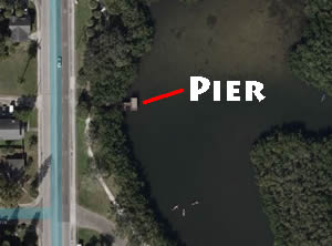 3800 6th Street South
St. Petersburg, FL 33705
GPS 27° 44'07.93" N 82° 38'26.28" W
( Foot of Pier )
NOAA St. Petersburg, Tampa Bay, FL - Station ID: 8726520
|
|
|
Grandview Park pier is about 25' out over the water with a platform at the end that measures 20' x 10'. No restrooms at this location.
There is also a boat ramp on site also.
Josiah Cephas Weaver Park Fishing Pier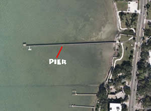 1249 Bayshore Boulevard
Dunedin, FL 34698
GPS 28° 01'16.69" N 82° 47'22.57" W
( Parking lot )
NOAA DUNEDIN CITY DOCK, FL - Station ID: 8726761
|
|
|
Josiah Cephas Weaver Park fishing pier is 720 feet in length over the eastern waters of the St Joseph Sound. The park also offers; kayak launch, 2 picnic pavilions, fitness trail and restrooms.
Jungle Prada Park Fishing Pier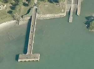 Park Street & Elbow Lane North
St. Petersburg, FL 33710
1-727-893-7441
Hours; Open 24 hours
GPS 27° 47'18.89" N 82°45'16.08" W
( Foot of fishing pier )
GPS 27° 47'19.00" N 82°45'09.68" W
( Entrance to park )
GPS 27° 47'17.92" N 82°45'15.77" W
( Waters edge at boat ramp )
NOAA Long Key Boca Ciega Bay 8726494
|
|
|
Jungle Prada Park is 5.4 acres in size and is managed by the City of St Petersburg. The fishing pier is 240' in length with a 55' "T" at the end. The pier has benches for resting. You must provide your own fishing license at this pier. The pier is considered to be handicapped accessible.
There is also a boat ramp at this park. No restrooms at this location.
Madeira Beach Causeway Park Fishing Piers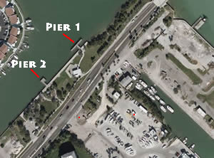 424 150th Avenue
Madeira Beach, FL 33708
GPS 27° 48'20.33" N 82° 47'49.01" W
( Foot of fishing pier 1 )
GPS 27° 48'18.46" N 82° 47'50.91" W
( Foot of fishing pier 2 )
NOAA BOCA CIEGA BAY, FL - Station ID: 8726574
|
|
|
Madeira Beach Causeway Park pier 1 is 30' out over the water with an 80' "T" at the end.
Madeira Beach Causeway Park pier 2 is 40' out over the water with a 20' x 20' area at the end.
Amenities include; Restrooms, picnic area, benches & tables.
McKenney Park Fishing Pier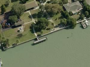 9300 Blind Pass Road
St. Petersburg, FL 33706
GPS 27° 45'18.59" N 82° 45'29.43" W
( Entrance )
GPS 27° 45'19.30" N 82° 45'35.51" W
( Foot of fishing pier )
NOAA Long Key, 0.5mi N. of Corey Causeway, FL - Station ID: 8726494
|
|
|
McKenney Park sits on 4.6 acres and offers; Picnic pavilion, grills, fishing pier, playground, restrooms and water fountain. Pier is 25 feet over the water with a 50 foot tee at the end.
Park Boulevard Fishing Pier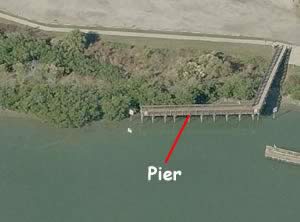 186th Avenue & Gulf Boulevard
Indian Shores, FL 33785
1-727-582-2100
Hours; Open 24 hours
GPS 27° 50'37.25" N 82° 50'19.69" W
( Foot of pier )
NOAA Indian Rocks Beach Inside 8726625
|
|
|
The Park Boulevard site sits on 6.5 acres. The pier is about 100 feet in length over the water and parallel to the shore on the southwest side of the Park Boulevard Bridge. Please be sure to have your fishing license in hand, as this pier does not provide one. Restrooms are available.
A boat ramp is on site also.
Pass A Grille Fishing Jetty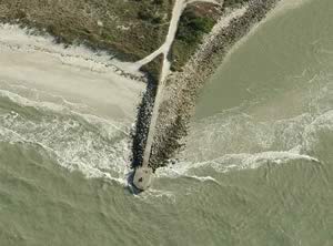 Gulf Way & 1st Avenue
St. Pete Beach, FL 33706
Hours; Open 24 hours
GPS 27° 40'59.55" N 82° 44'17.04" W
( Foot of jetty )
NOAA Egmont Key, Tampa Bay 8726347
|
|
|
The Pass A Grille fishing jetty is on the north side of the Pass A Grille Channel. The concrete area at the end is about 18' x 40' with clipped corners. The closest public restrooms is at Hurley Park, which is 7/10ths of a mile north on Gulf Way. Parking is along Gulf Way and fees are payable at the parking kiosks.
R.E. Olds Park Fishing Pier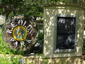 107 Shore Drive West
Oldsmar, FL 34677
813-749-1260
Hours; Dawn - 11pm
GPS 28° 01'52.28" N 82° 40'10.37" W
( Foot of pier )
Video of R.E. Olds Park Fishing Pier.
NOAA Safety Harbor, Old Tampa Bay 8726738
|
|
|
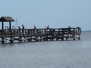
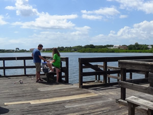
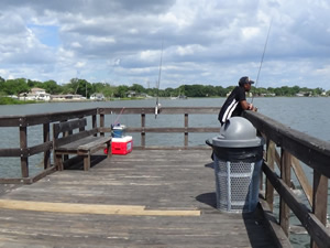
The R.E. Olds Park is managed by Oldsmar Leisure Services. R.E. Old Park offers a fishing pier 500' in length with a 40 foot "T" at the end and shaded areas along pier, picnic shelters, playgrounds, scenic views, open air amphitheatre, free parking and restrooms.
R.O.C. Fishing Pier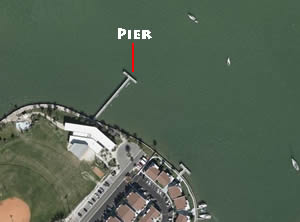 200 Rex Place
Madeira Beach, FL 33708
727-392-0665
GPS 27° 48'24.68" N 82° 47'56.16" W
( Foot of pier )
NOAA BOCA CIEGA BAY, FL - Station ID: 8726574
|
|
|
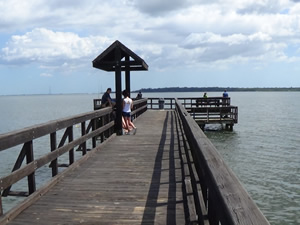
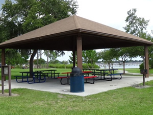
The R.O.C. Park fishing pier is 200' in length with a 60' "T" at the end. Restrooms: Located on the side of the recreation building facing the splash pad. Playground is near the parking lot at field #3.
Safety Harbor Fishing Pier ~ Marina Park ~ Veterans Memorial Park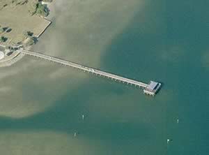 131 South Bayshore Boulevard
Safety Harbor, FL 34695
1-727-724-1545
GPS 27° 59'20.18" N 82° 41'09.72" W
( Foot of pier )
Video of Veterans Memorial Park Fishing Pier.
|
|
|
The Safety Harbor pier is within Marina Park / Veterans Memorial Park. The pier is 420' in length over Old Tampa Bay and has a 50' "T" at the end. A shaded area is at the end also. Restrooms are available.
A boat ramp is on site also.
Sand Key Park Fishing Piers - Closed - Removed 1060 Gulf Bloulevard
Clearwater, FL 33767
GPS 27° 57'20.12" N 82° 49'37.26" W
( Entrance )
GPS 27° 57'37.23" N 82° 49'27.52" W
( Foot of middle pier )
Due to deterioration and safety concerns, the two fishing piers ( Unsure of who was counting but there are 3 piers here), located near the Clearwater Pass at Sand Key Park, will be demolished beginning August 1, 2022. In 2021, a dock inspector completed an underwater inspection and determined that the docks were not in good condition due to rotting framing, hardware and pilings.
Shoreline / seawall fishing is still available!
The Sand Key Park offered 3 piers along the inlet to Clearwater Harbor. Each of the piers is about 50' in length. You can also fish from the seawall areas.
Skyway Fishing Pier North / In Pinellas County
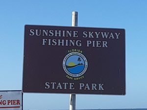 Located on either end of the Skyway Bridge. the following are directions for accessing the northern side located in Pinellas County.
Fees: Call 1-727-865-0668
Hours: 24/7 365 days of the year.
Coming south on 275 / 93
Once you go past through the toll booths the exit 1.8 miles on your right hand side. At the first intersection continue straight through for 750 feet, at that intersection turn right and you will then make almost an left, stay on this road for 6/10ths of a mile to the entrance gate for the pier.
Coming north on 275 / 93
Once you go past the large towers in center of the bridge the entrance is approx. 1.9 miles on your right hand side. At the first intersection after exiting make a left, go under roadway, at four-way intersection make a left, go up this road for 750 feet and then make a right with almost an immmediate left after that, stay on this road for 6/10ths of a mile to the entrance gate for the pier.
Note
It is best to be aware of where your going around this bridge and the exit points, if you miss a turn it will most likely result in significant additional driving and tolls.
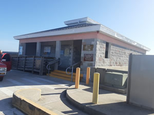
The northern side pier is about 6/10ths of mile in length. Restrooms at multiple locations, Baitshop is open 24/7, Lights. Operated by the Florida State Parks system. You can drive your vehicle onto the pier and pull right up to your fishing spot.
NOAA Point Pinellas, Tampa Bay 8726454
|
|
|
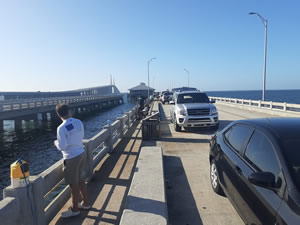
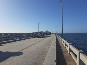
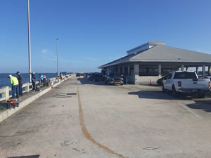
Skyway Fishing Pier South ~ Manatee County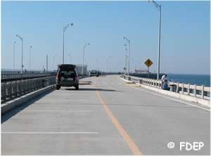 Located on either end of the Skyway Bridge. the following are directions for accessing the southern side located in Manatee County.
Fees: Call 1-727-865-0668
Hours: 24/7 365 days of the year.
Coming south on 275 / 93
Once you go past the large towers in center of the bridge the entrance is approx. 3.5 miles on your right hand side. at the first intersection after exiting make a right and head 1.2 miles up this road towards entrance gate of pier.
Coming north on 275 / 93
Once you go through the toll booths the exit to access the fishing pier is approx. 6/10ths of a mile on the right. When you get to the bottom of the exit ramp, make a left, go under roadway, next intersection continue straight. Fishing pier entrance gate is about 1.2 miles up this road.
Note
It is best to be aware of where your going around this bridge and the exit points, if you miss a turn it will most likely result in significant additional driving and tolls.
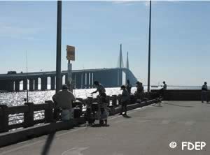
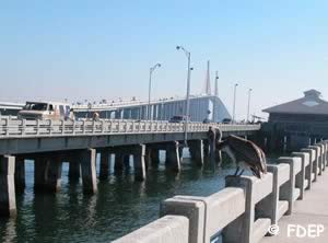
The southern side pier is pier is about 1.5 miles long. Restrooms, Baitshop is open 24/7, Lights. Operated by the Florida State Parks System. You can drive your vehicle onto the pier and pull right up to your fishing spot.
NOAA Point Pinellas, Tampa Bay 8726454
|
|
|
Spa Beach Pier
Eastern end of;
2nd Avenue Northeast
St Petersburg, FL 33701
GPS 27° 46'24.88" N 82° 37'34.61" W
|
|
|
Stansell Memorial Park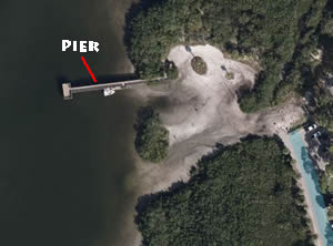 8th Street & Florida Avenue
Palm Harbor, FL 34683
GPS 28° 04'40.88" N 82° 46'12.47" W
( Entrance )
DUNEDIN CITY DOCK, FL - Station ID: 8726761
|
|
|
Stansell Memorial Park offers; Fishing pier about 120' in length with an area at the end measuring 24' x 15', picnic pavilion, hand launch area, primitive boat ramp, potable water and restrooms.
Town Square Nature Park Fishing Pier
191st Ave & Gulf Boulevard
Indian Shores, FL 33776
GPS 27° 50'41.03" N 82° 50'27.94" W
( Entrance )
GPS 27° 50'42.56" N 82° 50'22.53" W
( Foot of pier )
NOAA Indian Rocks Beach (inside), FL - Station ID: 8726625
|
|
|
The Town Square Nature Park pier is 100' in length. From the parking lot is about a 650' walk to the pier. There are picnic pavilions and restrooms up near the parking area.
Wall Springs Fishing Piers ( 4 )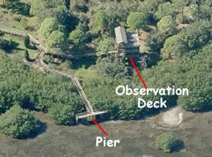 3725 De Soto Boulevard
Palm Harbor, FL 34683
GPS 28° 06'21.43" N 82° 46'14.52" W
( Entrance to park )
NOAA DUNEDIN CITY DOCK, FL - Station ID: 8726761
|
|
|
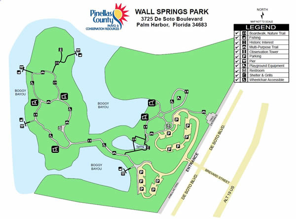
Wall Springs is a 210 acre park offering scenic views of the Gulf of Mexico, natural spring, an observation tower, playground, bike racks, 4 fishing piers, 5 picnic pavilions and grills. Contact Pinellas County Government at 1-727-464-3000 and ask to speak with someone about pavilion rental information. Please be sure to have your proper Florida fishing license.
Pier 1 is about 60' in length with a 50' "T". GPS 28° 06'21.26" N 82° 46'22.22" W
Pier 2 is about 15' in length with a 50' "T". GPS 28° 06'26.59" N 82° 46'33.37" W
Pier 3 is about 70' in length with a 50' "T". GPS 28° 06'31.07" N 82° 46'33.08" W
Pier 4 is about 10' in length with a 50' "T". GPS 28° 06'32.25" N 82° 46'29.05" W
Weedon Island Fishing Pier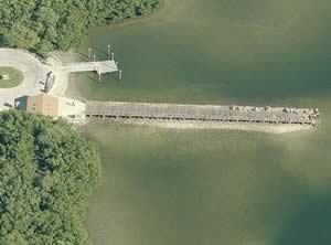 1800 Weedon Drive NE
St Petersburg, FL 33702
1-727-453-6800
Hours; 7am - sunset
In the Weedon Island Preserve.
GPS 27° 50'38.81" N 82° 36'40.68" W
( Foot of pier )
Video of Weedon Island Preserve Fishing Pier.
|
|
|
Weedon Island fishing pier is managed by Pinellas County Environmental Lands Division and offers; fishing pier about 225' in length on the southern edge of Riviera Bay, restrooms, water fountain, beautiful scenery and wildlife viewing.
Williams Fishing Pier 5400 Shore Boulevard South
Gulfport, FL 33707
1-727-893-1000
Hours; open 24 hours
GPS 27° 44'15.96" N 82° 42'23.66" W
( Foot of pier )
NOAA Gulfport Boca Ciega Bay 8726486
|
|
|
Managed by the City of Gulfport the Willliams pier is 500' in length with a 110' "T" at the end. Fish cleaning tables are available. Restrooms are available at the beach park ( please check the hours they are open ).
7th Avenue Fishing Pier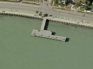 7th Avenue & Pass A Grille Way
St. Pete Beach, FL 33706
GPS 27° 41'14.06" N 82° 44'10.76" W
( Foot of pier )
NOAA Egmont Key, Tampa Bay 8726347
|
|
|
Parking along Pass A Grille Way and the side Avenues, No railings on the pier. Pier sticks out into the water about 75' and the "T" section is about 110 feet in length parallel with the shore. 5 benches to sit on and drop a line and relax. Trash receptacles are available, please place monofilament line in receptacles.
7th Street Fishing Pier
Harbor Drive & 7th Street
Belleair Beach, FL 33786
Open: 6 am to 11 pm
GPS 27° 54'51.03" N 82° 50'33.29" W
( Foot of pier )
NOAA CLEARWATER, CLEARWATER HARBOR, FL - Station ID: 8726706
A small neighborhood pier. Maybe 1 parking spot, had a difficult time confirming this.
11th Avenue Fishing Pier 11th Avenue & Pass A Grille Way
St. Pete Beach, FL 33706
GPS 27° 41'22.86" N 82° 44'08.38" W
( Foot of pier )
NOAA Egmont Key, Tampa Bay 8726347
|
|
|
Parking along Pass A Grille Way and the side Avenues, No railings on the pier. Pier sticks out into the water about 50 feet and the "T" section is about 50 feet in length parallel with the shore. 1 bench to sit and drop a line and relax. Trash receptacles are available, please place monofilament line in receptacles.
16th Street Park Fishing Pier
Closest intersection is;
16th Street & Gulf Boulevard
Belleair Beach, FL 33786
Park is 700' east on 16th street from the above intersection ( dead end street )
GPS 27° 55'17.01" N 82° 50'27.89" W
( Foot of pier )
NOAA CLEARWATER, CLEARWATER HARBOR, FL - Station ID: 8726706
|
|
|
The 16th Street pier is 25 feet out over the water with an area at the end measuring 9' x 11'. No restrooms at this location. No Parking at this location.
20th Street Park Fishing Pier
Closest intersection is;
20th Street & Gulf Boulevard
Belleair Beach, FL 33786
Park is 650' east on 20th street from the above intersection ( dead end street )
GPS 27° 55'27.67" N 82° 50'26.08" W
( Foot of pier )
NOAA CLEARWATER, CLEARWATER HARBOR, FL - Station ID: 8726706
|
|
|
The 20th Street pier is 30' out over the water with a 10' x 12' section at the end. No restrooms at this location. No parking at this location.
25th Street Park Fishing Pier
Closest intersection is;
25th Street & Gulf Boulevard
Belleair Beach, FL 33786
Park is 650' east on 25th street from the above intersection ( dead end street )
GPS 27° 55'40.48" N 82° 50'23.15" W
( Foot of pier )
NOAA CLEARWATER, CLEARWATER HARBOR, FL - Station ID: 8726706
|
|
|
No parking at this location.
Useful Links
| Public Fishing Piers in Pinellas County Florida |
|
|
| Areas in Pinellas County Florida Include; Bardmoor, Bay Pines, Bear Creek, Belleair, Belleair Beach, Belleair Bluffs, Belleair Shore, Clearwater, Dunedin, East Lake, Feather Sound, Greenbriar, Gulfport, Harbor Bluffs, Indian Rocks Beach, Indian Shores, Kenneth City, Largo, Lealman, Madeira Beach, North Redington Beach, Oldsmar, Palm Harbor, Pinellas Park, Redington Beach, Redington Shores, Ridgecrest, Safety Harbor, Seminole, South Highpoint, South Pasadena, St. Pete Beach, St. Petersburg, Tarpon Springs, Tierra Verde, Treasure Island and West Lealman. |
| Areas of Salt & Brackish Water in Pinellas County Florida Includes; Alligator Lake, Anclote River, Big Bayou, Boca Ciega Bay, Boggy Bayou, Charlotte Harbor, Clearwater Harbor, Cross Bayou, Grande Bayou, Gulf of Mexico, Kreamer Bayou, Lake Tarpon Canal, Little Bayou, Long Bayou, Minetta Bayou, Myers Cove, Old Tampa Bay, Pelican Cove, Riviera Bay, Scharrer Bayou, Snell Isle Harbor, Spring Bayou, Stevenson Creek, St Joes Creek, St Joseph Sound, Tampa Bay, Tarpon Bayou, The Narrows and Whitcomb Bayou. |
![]() Home
Home ![]() About
About ![]() Sitemap
Sitemap ![]() Credits
Credits
![]() Privacy
Privacy ![]() Advertise
Advertise ![]() Contact
Contact ![]()
