Brevard County, Florida ~ Fishing Piers
Seach our site below
Alex J. Goode Fishing Pier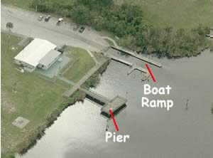 1300 NE Bianca Drive
Palm Bay, FL 32910
GPS 28° 01'48.35" N 80° 34'57.46" W
( Foot of pier )
Go to map of fishing piers in Brevard County
|
|
|
Alex Goode Park along Turkey Creek offers; fishing pier 80 feet in length with a platform at the end measuring 45 feet x 20 feet, hand launching of kayaks or canoes, pavilion, benches and restrooms.
There is a boat ramp on site also.

Castaway Point Park Fishing Piers
2990 Bay Boulevard
Palm Bay , FL 32905
GPS 28° 02'23.84" N 80° 34'51.51" W
( Entrance )
|
|
|
The Castaway Point Park and ofers; 2 fishing piers the first 130 feet in length, the second is 50 feet in length with a 40 foot "T" on the end, both are over the waters of the Indian River, pavilions, picnic areas, picnic tables, benches and restrooms.

Claude Edge Front Street Park Fishing Pier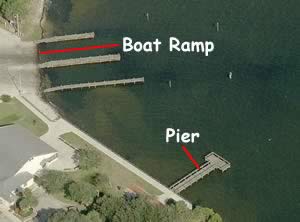 2210 Front Street
Melbourne, FL 32902
GPS 28° 04'44.70" N 80° 35'57.98" W
( Foot of pier )
Go to map of fishing piers in Brevard County
|
|
|
Claude Edge Front Street Park offers; a fishing pier 60 feet in length, pavilion, benches and restrooms.
There is a boat ramp on site also.

Cocoa Beach Pier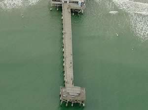 401 Meade Avenue
Cocoa Beach, Fl 32931
1-321-783-7549 ( Information )
GPS 28° 22'03.64" N 80° 36'09.83" W
Go to map of fishing piers in Brevard County
|
|
|
Saltwater fishing, spectators, rod rental available, first portion of the pier is free and then a small fee applies unless you have a receipt from one of the establishments.

Eddy Creek Fishing Pier ~ In the Canaveral National Seashore ~ Access 7
Admission fee applies to The Canaveral National Seashore
28° 40'29.90" N 80° 38'55.71" W
( Foot of pier )
The Eddy Creek fishing pier is located within the Canaveral National Seashore at access 7. The pier is 55' in length over the waters of Eddy Creek / Mosquito Lagoon and 9 parking spaces ( the beach access lot has an additional 29 spaces ). Bathrooms are located across the road, at base of stairs to the beach.
See video of the Eddy Creek fishing pier.
A primitive boat ramp is also at this location.

Eau Galle Causeway Fishing Catwalk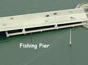 Eau Gallie Causeway ( SR-518 )
Melbourne, Fl 32935
1-321-255-4400
Hours: Boat ramp is open 24 hours
GPS 28° 08'01.82" N 80°36'48.17" W
( Catwalk )
Go to map of fishing piers in Brevard County
|
|
|
The fishing catwalk is on the easterly side of the bridge and the parking area is on the westbound lane side and near the foot of the bridge. The causeway bridge provides shade at different areas depending on the time of day.

Fisherman's Landing Park Fishing Pier 5795 US 1
Grant - Valkaria, FL 32949
1-321-255-4400 ( Facility Reservations )
Hours: 7am ~ Dark, Except for special uses
GPS 27° 55'18.59" N 80° 31'14.78" W
( Entrance )
GPS 27° 55'17.36" N 80° 31'09.97" W
( Foot of pier )
Go to map of fishing piers in
Brevard County
|
|
|
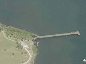
Fisherman's Landing park sits on 7.5 acres and offers; fishing pier extending 250 feet out over the water with a 30 foot "T" at the end, hand launching of kayaks or canoes from the northern parking area, pavilion, grills and restrooms. The Grant Historical House is also on site.

Intracoastal Waterway Park Fishing Pier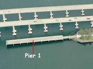 Eastern side of the W. Merritt Island Causeway
Entrance is off the westbound lanes of the causeway;
GPS 28° 21'23.51" N 80° 42'43.14" W
( Turn lane into park going westbound )
When exiting the park you are placed into the eastbound lanes of the causeway.
GPS 28° 21'22.15" N 80° 42'58.02" W
( Foot of pier 1 )
GPS 28° 21'24.77" N 80° 42'49.22" W
( Foot of pier 2 )
GPS 28° 21'24.77" N 80° 42'37.63" W
( Foot of pier 3 )
NOAA tide data not reliable
|
|
Go to map of fishing piers in Brevard County
• Pier 1 is 250 feet in length. Along the Indian River, small picnic shelters and restroom on
the southern side.
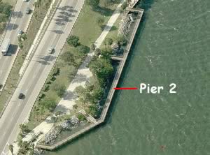
• Pier 2 runs parallel to the north shore, and is 450 feet in length.
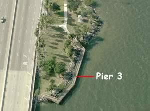
• Pier 3 also runs parallel to the north shore, and is 220 feet in length, this pier is a little
further east and requires a small walk down a sidewalk to access.

Malcolm E McLouth Fishing Pier at Jetty Park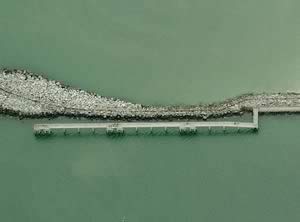 250 Jetty Park Drive
Cape Canaveral, FL 32920
GPS 28° 24'26.66" N 80° 35'30.73" W
( Entrance )
Go to map of fishing piers in Brevard County
|
|
|
The Malcolm E McLouth Fishing Pier at Jetty Park is open 24 hours and offers, a pier 1200 feet in length, fish cleaning tables, lighted for night fishing, paved surface, fully accessible to the physically challenged, service animals only. Snook, Spanish Mackeral and Drum are popular species that are caught at Jetty Park, bring a kid and have a great day of fishing.

McFarland Park Fishing Pier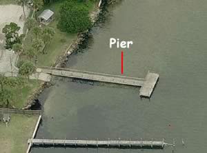 2060 Indian River Drive
Cocoa, FL 32922
1-321-633-1874
Hours: 7am - Dark
GPS 28° 23'26.45" N 80° 44'28.92" W
( Foot of pier )
Tide data for this location is not reliable.
|
|
See Video of the McFarland Fishing Pier.
Go to map of fishing piers in Brevard County
McFarland Park along the Indian River offers; Fishing pier a 100 feet in length with a 30 foot "T" at the end, small boat ramp, small single table picnic shelter and benches. No restrooms at this location.

Melbourne Beach Historic Fishing Pier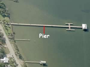 Ocean Avenue and Riverside Drive
Melbourne Beach, FL 32951
GPS 28° 04'06.26" N 80° 33'57.70" W
( Foot of pier )
Go to map of fishing piers in Brevard County
|
|
|
The Historic City Pier in Melbourne is 600 feet in length over the water and offers, Shaded area at the end, trash receptacles and restrooms which are located at Rykman Park ( restrooms are not open all the time ).

Osteen Park Fishing Pier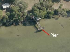 425 South Tropical Trail
Merritt Island, FL 32952
1-321-633-1874
Hours: 7am ~ Dark ~ Except for special uses
GPS 28° 20'59.08" N 80° 42'16.78" W
( Foot of pier )
Go to map of fishing piers in Brevard County
NOAA tide data not reliable
|
|
The Osteen Park fishing pier is 75 feet in length with a 25 foot "T" at the end and offers; A small pavilion with 2 grills, picnic tables with 6 grills, benches and restrooms.

Parrish Park Fishing Pier On the A. Max Brewer Causeway
Titusville, FL 32796
GPS 28° 37'25.53" N 80° 47'43.92" W
( Foot of pier )
Go to map of fishing piers in Brevard County
NOAA tide data not reliable
|
|
See video of the Parrish Park fishing pier.
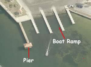
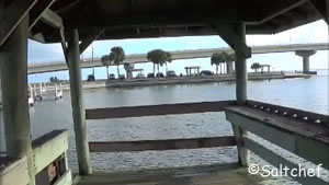
The Parrish Park fishing pier is 110 feet in length with a shaded area at the end. Amenities at Parrish park include; Small covered picnic areas, tables and restrooms.
There is a boat ramp on site also.

Pineapple Park Fishing Pier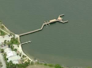 1521 Pineapple Avenue
Melbourne, Florida 32936
1-321-255-4608
GPS 28° 07'55.29" N 80° 37'31.28" W
( Foot of pier )
Go to map of fishing piers in Brevard County
|
|
|
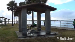
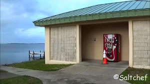
Pineapple Park is operated by the City of Melbourne and offers; a fishing pier about 400 feet in length, playground and restrooms.

Riverside Park Fishing Pier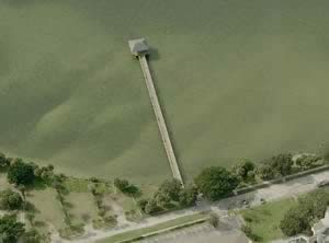 Riverside Place North
Indialantic, FL 32903
GPS 28° 05'23.55" N 80° 34'35.38" W
( Foot of pier )
NOAA tide data not reliable
|
|
Riverside Park fishing pier is 415 feet in length over the eastern shores of the Indian River and offers; Shaded area at the end of the pier and trash receptacles. No restrooms at this location.

Rotary Park Fishing Pier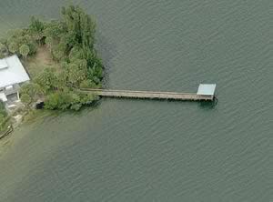 US 1 and Suntree Boulevard
Rockledge, FL 32955
1-321-255-4400
1-321-255-4400 ( Facility reservations )
Hours: 7am - Dark, except for special uses
GPS 28° 13'48.55" N 80° 40'14.29" W
( Foot of pier )
Go to map of fishing piers in Brevard County
NOAA tide data not reliable
|
|
Rotary Park sits on 10.3 acres along the Indian River Lagoon. Activities and amenities at Rotary Park include a fishing pier that is 140 feet in length with a shaded area at the end, shoreline fishing, pavilions, playground, boardwalks and restrooms.

Rotary Riverfront Park Fishing Pier 4141 South Washington Avenue
Titusville, FL 32783
GPS 28° 33'57.62" N 80° 47'52.85" W
( Foot of pier )
Go to map of fishing piers in
Brevard County
NOAA tide data not reliable
|
|
The Rotary Riverfront Park pier is 600' out over the water of the Indian River. The pier has multiple prongs coming off the main portion. Rotary Riverfront has a picnic pavilion. No restroom facilities here.

Sebastian Inlet State Recreation Area Fishing Pier / Jetty
9700 South A1A
Melbourne Beach FL 32951
1-321-984-4852
Hours: 24 hours a day
Fees: Please call the above # for fee schedule
GPS 27° 51'42.53" N 80° 26'49.18" W
( Foot of pier )
Go to map of fishing piers in Brevard County
|
|
|
This fishing pier is on the northern side of the Sebastian Inlet and extends about 500 feet over the water.
A boat ramp is on site also

Space View Park ~ Veterans Memorial Park ~ Fishing Piers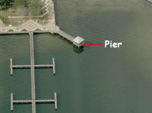 8 Broad Street
Titusville, FL 32782
GPS 28° 36'50.19" N 80° 48'13.42" W
( Foot of pier 1 )
GPS 28° 36'49.65" N 80° 48'13.36" W
( Foot of pier 2 )
See Video of the
Veterans Memorial Park Fishing Pier.
Go to map of fishing piers in Brevard County
NOAA tide data not reliable
|
|
Space View Park ~ Veterans Memorial Park
Fishing pier 1 is 75' in length with a shaded area at the end.
Fishing pier 2 is 440' in length and has 8 prongs which allow additional fishing opportunities from the main portion.

Titusville Veterans Memorial Fishing Piers
GPS 28° 37'11.01" N 80° 48'01.10" W
( Foot of pier 1 )
NOAA tide data not reliable
See our video of the Titusville Veterans Memorial Fishing Piers.
|
|
The Titusville Veterans Memorial fishing pier 1 is 480' in length.
Fishing pier 2 is about 300' in length, and shade is provided on some areas by the overhead bridge.
Please be sure to have your proper Florida fishing license with you when fishing here. This pier has a few special regulations regarding lighting devices at night, be sure to check the regulations prior to going.

Ulamay Wildlife Sanctuary Fishing Pier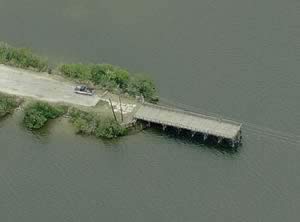 Sykes Creek Parkway and Old Audobon Road
Merritt Island, FL 32952
GPS 28° 22'08.57" N 80° 41'01.95" W
( Foot of pier )
NOAA tide data not reliable
|
|
Go to map of fishing piers in Brevard County
The fishing pier at Ulamay Wildlife Sanctuary is 100 feet in length. No restrooms at this location.

Valencia Dock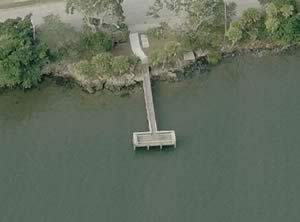 914 Rockledge Drive
Rockledge, FL 32955
1-321-633-1874
Hours: 7am - Dark except for special uses.
GPS 28° 20'12.06" N 80° 43'02.64" W
( Foot of pier )
Go to map of fishing piers in Brevard County
NOAA tide data not reliable
|
|

Useful Links
| Saltwater Fishing Piers in Brevard County Florida |
|
|
| Areas in Brevard County Florida include; Cape Canaveral, Cocoa, Cocoa Beach, Grant, Melbourne Beach, Palm shores, Merritt Island, Rockledge, Indian Harbor Beach, Titusville, Palm Bay, Malabar, Satellite Beach, Scottsmore, Pineda, Bonaventure, Georgiana and Port St. John |
| Bodies of brackish and saltwater in Brevard County Florida include; Atlantic Ocean, Banana Creek, Banana River, Black Point Creek, Boggy Pond, Broadaxe Creek, Buck Creek, Canaveral Barge Canal, Cow Pen Creek, Crane Creek, Cucumber Slough, Devils Elbow, Dummit Creek, Eau Gallie River, Eddy Creek, Flowing Well Creek, Gator Creek, Gator Hole, Hog Point Creek, Horse Creek, Houseboat Cut, Indian River Lagoon, Intracoastal Waterway, Marsh Bay Creek, Max Hoeck Creek, Moore Creek, Mosquito Lagoon, Mullet Creek, Pintail Creek, Puckett Creek, Roach Hole, Ross Creek, Sebastian Inlet, Seven Pines Creek, St Sebastian, Sykes Creek, Tea Creek and Turkey Creek. |
![]() Home
Home ![]() About
About ![]() Sitemap
Sitemap ![]() Credits
Credits
![]() Privacy
Privacy ![]() Advertise
Advertise ![]() Contact
Contact ![]()
