Brunswick County, North Carolina ~ Boat Ramps
- National &
State Parks - County &
City Parks - Beaches
Accesses - Boat Ramps
Brunswick - Fishing Piers
Brunswick - Map of
Boat Ramps - Boat Ramps
Adjoining Counties
Public Boat Ramps in Brunswick County, North Carolina
Seach our site below
Bricklanding Road Boat Ramp
2000 Bricklanding Road SW
Shallotte, NC 28470
GPS 33° 54'16.92" N 78° 23'37.75" W
( Waters edge at ramp )
2 launching lanes, floating courtesy docks, portable toilets.
Not on map or navigation yet.
Brunswick River Park Boat Ramp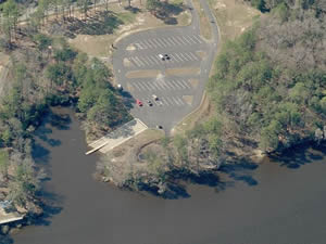 576 River Road SE
Leland, NC 28451
GPS 34° 13'15.07" N 77° 58'51.49" W
( Waters edge at ramp )
NOAA Wilmington, NC 8658120
|
|
|
The Brunswick River Park boat ramp is on the Cape Fear River and offers; 2 launching lanes, courtesy dock, about 50 boat trailer parking spots, playground and restrooms.
Dutchman Creek Park Boat Ramp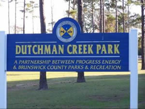 Fish Factory Road SE & Vanesa Drive SE
Oak Island, NC 28461
Entrance to the boat ramp area of Dutchman Creek Park is near this intersection.
or;
4750 Fish Factory Road SE
Southport, NC 28461
910-253-2670
GPS 33° 55'41.67" N 78° 03'34.15" W
( Waters edge at ramp )
NOAA Southport, NC 8659084
|
|
|
Dutchman Creek Park boat ramp offers; 3 launching lanes, courtesy docks, playground, picnicking, 80 paved boat trailer parking spaces, additional 100 spaces along the roadsides and in grass areas near the park ( please do not block hydrants or private accesses ), hand launching of kayaks at shoreline and restrooms. The pavilion is located at the south end near the playground. It is about 6 miles on the water to the Southport Channel.
Federal Point Boat Ramp ~ Shallow Draft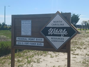 2514 South Fort Fisher Boulevard
Kure Beach, NC 28449
GPS 33° 57'31.12" N 77°56'30.26" W
( Waters edge at ramp )
|
|
|
Located along the Cape Fear River and operated by the North Carolina Wildlife Resources Commission the Federal Point boat ramp offers; 2 lane ramp, floating courtesy docks and 25 paved boat trailer parking spaces. No restrooms at this location.
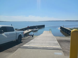
Holden Beach Boat Ramp
101 South Shore Drive
Supply, NC 28462
Address is real close but not exact, ramp is basically under the bridge.
GPS 33° 54'58.63" N 78° 16'03.14" W
|
|
|
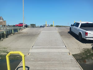
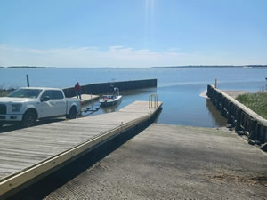
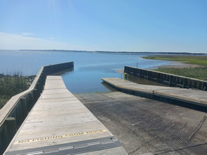
The Holden Beach boat ramp is along the ICW and offers; 2 launching lanes, floating courtesy docks and about 75+ boat trailer parking spaces at the ramp and scattered at the side streets. The Atlantic waters are about 2 miles to the north and through the Lockwood's Folley Inlet.
Ocean Isle Beach Boat Ramp
67 Causeway Drive
Ocean Isle Beach, NC 28469
The ramp is basically under the bridge
GPS 33° 53'41.88" N 78° 26'21.74" W
( Waters edge at ramp )
|
|
|
The Ocean Isle Beach boat ramp offers; 2 launching lanes, courtesy dock, ICW access and 58 boat trailer parking spots.
Rice Creek Boat Ramp - Fresh Water
797 Gordon Lewis Drive SE
Winnabow, NC 28479
Rice Creek boat ramp is considered to be fresh water and offers; single launching lane, courtesy dock that needs some repair and parking for about 10 small boat trailers. No restrooms at this location. The dock and ramp area are in need of some TLC by the State
Sunset Beach Boat Ramp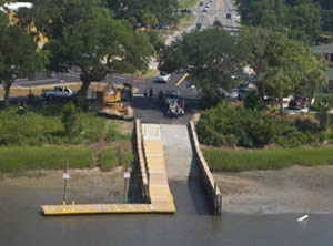 Sunset Boulevard North & Canal Avenue
Sunset Beach, NC 28468
GPS 33° 52'55.79" N 78° 30'39.69" W
( Waters edge at ramp )
|
|
|
Managed by the Town of Sunset Beach the boat ramp sits along the Intracoastal Waterway and offers; 1 launching lane, courtesy dock, 26 boat trailer parking spaces and portable toilet.
There is a fishing pier on site also.
Sunset Harbor Boat Ramp
356 Riverview Drive Southeast
Bolivia, NC 28422
GPS 33° 55'22.07" N 78° 12'46.65" W
( Waters edge at ramp )
NOAA Lockwoods Folly Inlet TEC2869
|
|
|
The Sunset Harbor boat ramp in Bolivia, North Carolina is along the Intercoastal Waterway and gives easy access to the Atlantic waters via the Lockwoods Folly Inlet, the ramp offers; 2 launching lanes, courtesy docks, 33 boat trailer parking spaces, handicapped access and a small fishing pier is on site also.
Varnumtown Boat Ramp
Closest intersection is;
South Ebbtide Lane & Fisherman Road
Varnamtown, NC 28462
GPS 33° 56'46.06" N 78° 13'24.14" W
( Waters edge at ramp )
55th Street Boat Ramp
Closest intersection is;
55th Street & East Yacht Drive
Oak Island, NC 28465
GPS 33° 55'14.22" N 78° 06'25.57" W
( Waters edge at ramp area )
GPS 33° 55'09.59" N 78° 06'26.69" W
( Additional Parking )
Located in a small alcove along the Intracoastal Waterway the 55th Street boat ramp offers; 2 launching lanes, courtesy dock, parking on both sides along the road near the ramp, an additional lot that has about 25 boat trailer parking spaces is located across E. Yacht Drive, it looks as if parking may be available along E. Yacht Drive also. No restrooms at this location.
Useful Links
| North Carolina Saltwater Fishing Regulations | Safe Handling of Self Caught Seafood |
| Seafood Recipes | Videos of Fishing Knots |
| Public Boat Ramps in Brunswick County, North Carolina |
| Areas in Brunswick County, North Carolina Include;Antioch, Ash, Batarora, Bell Swamp, Belville, Bishop, Biven, Bolivia, Bonaparte Landing, Boones Neck, Bowensville, Brunswick Station, Calabash, Camp Branch, Carolina Shores, Caswell Beach, Cedar Grove Cedar Hill, Civietown, Clairmont, Clarendon, Coolvale, Doe Creek, Eastbrook, Easy Hill, Holden Beach, Leland, Long Beach, Longwood, Maco, Navassa, Northwest, Ocean Isle Beach, Piney Grove, Sandy Creek, Shallotte, Southport, St James, Supply, Sunset Beach, Sunset Harbor, Thomasboro, Varnamtown, Winnabow and Yaupon Beach. |
| Bodies of Brackish and Saltwater in Brunswick County, North Carolina Include; Atlantic Ocean, Brunswick River, Calabash River, Cape Fear River, Denis Creek, Eastern Channel, Elizabeth River, Intercoastal Waterway, Little River, Lockwoods Folly Inlet, Old Mill Creek, Piney Point Creek, Saucepan Creek, Shallotte River and Spring Branch. |
![]() Home
Home
![]() About
About
![]() Sitemap
Sitemap
![]() Credits
Credits
![]() Privacy
Privacy
![]() Advertise
Advertise
![]() Contact
Contact
![]()
