Bryan County, Georgia ~ Boat Ramps
- National &
State Parks - County &
City Parks - Beaches
- Boat Ramps
Bryan County - Fishing Piers
Bryan County - Map of
Boat Ramps - Boat Ramps
Adjoining Counties
Public Boat Ramps in Bryan County, Georgia
Seach our site below
Belfast Keller Road Hand Launch
Closest intersection is;
Belfast Keller Road & Magnolia Marsh Road
Richmond Hill, GA 31324
Entrance is 2/10ths of a mile west on Belfast Keller Road from the above intersection.
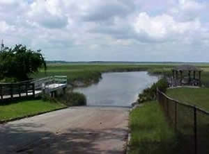
The Belfast Keller Road hand launch is along the Tivoli River. There are 16 parking spaces, 1 handicap and 2 for longer vehicles. The portage from the parking lot out the pier and to the right is about 190'. A portable toilet is usually located at the northern end of the parking lot. A fishing pier is also on site.
GPS 31° 50'24.29" N 81° 15'58.52" W
( Entrance )
NOAA Sunbury, Sunbury Channel, GA 8672875
|
|
|
Demere Creek Boat Ramp & Hand Launch
 Closest intersection is;
Bryan Neck Road & Demeries Creek Road
Richmond Hill, GA 31324
Area is 500 feet down Demeries Creek Road from the above intersection.
GPS 31° 47'09.48" N 81° 15'17.22" W
( Waters edge at ramp )
NOAA Sunbury, Sunbury Channel, GA 8672875
|
|
|
The Demere Creek boat ramp offers; wide single launching lane, courtesy docks, very decent amount of parking and restrooms.
Fort McAllister Ogeechee Boat Ramp
3894 Fort McAllister Road
Richmond Hill, GA 31324
The above address is for the State Park, this boat ramp is before the entrance and will be on the left.
The State Park also has a ramp along Red Bird Creek, it is reserved for the use of campers at the State Park. It is on the map with a red place marker.
GPS 31° 53'21.59" N 81° 12'13.99" W
( Waters edge at ramp )
NOAA Fort McAllister, Ogeechee River TEC3419
|
|
|
The public boat ramp at Fort McAllister offers; Single launching lane, courtesy dock, picnic areas, playground and restrooms. Watch for swift cross currents when launching or loading here.
A fishing pier is on site also.
Richmond Hill Wildlife Management Area Boat Ramp ~ Egypt Island
912-262-3173
Unfortunately, this ramp has been closed due to silting in & trash being dumped at and in the boat ramp.
GPS 31° 50'26.33" N 81° 21'15.46" W
Useful Links
| Public Boat Ramps in Bryan County, Georgia |
| Areas in Bryan County, Georgia include; Belfast, Black Creek, Fancy Hall, Pembroke, Port Royal, Richmond Hill, Keller, Lanier Myrtle Grove and Oak Level. |
| Bodies of brackish and saltwater in Bryan County, Georgia include; Atlantic Ocean, Bear River, Belfast River, Buckhead Creek, Buttermilk Sound, Cabbage Garden Creek, Canoochee River, Cubbage Creek, Demeres Creek, Fancy Hall Creek, Florida Passage, Jerico River, Jones Hammock Creek, Kilkenny Creek, Laurel View River, Lincoln Creek, Medway River, Newell Creek, Ogeechee River, Redbird Creek, Skipper Narrows, St Catherines Sound, Sweet Hill Creek and Tivoli River. |
![]() Home
Home
![]() About
About
![]() Sitemap
Sitemap
![]() Credits
Credits
![]() Privacy
Privacy
![]() Advertise
Advertise
![]() Contact
Contact
![]()
