Gulf County, Florida ~ Boat Ramps
- National &
State Parks - County &
City Parks - Beaches
Gulf - Boat Ramps
Gulf - Fishing Piers
Gulf - Map of
Boat Ramps - Boat Ramps
Adjoining Counties
Public Boat Ramps in Port St. Joe & Wewahitchka, Florida
Seach our site below
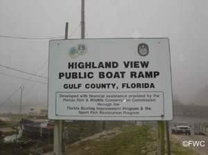
Highland View Boat Ramp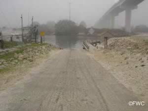 No real address associated with this ramp
the following are the closest cross streets;
Bonita Street & Parker Avenue
Port St Joe, FL 32456
Almost under the bridge
GPS 29° 49'56.72" N 85° 18'47.12" W
( waters edge at ramp )
Go to map of boat ramps in Gulf County
|
|
|
Located at the southern end of the Gulf County Canal almost under the George Tapper Bridge this ramp offers; single lane ramp with easy access to St Joseph Bay and the Gulf of Mexico saltwater fishing opportunities, non-floating courtesy docks, parking for 25-30 boat trailers and restrooms. Watch for strong and erratic crosscurrents which are reported at the entrance to St Joseph Bay Northeast of St Joseph Point. These currents are particularly strong during the ebb tide ( going out ). Caution is advised when entering the bay.
| Read the Water Color |
| Brown, brown....run aground |
| White, white....you just might |
| Green, green....nice and clean |
| Blue, blue......cruise on through |

Indian Pass Boat Ramp
¾ miles east of the intersection of:
South Osceola & State Highway 30B
Port St. Joe, FL 32456
On Highway 30B
GPS 29° 40'59.77" N 85° 13'20.50" W
( waters edge at ramp )
Go to map of boat ramps in Gulf County
|
|
|
The Indian Pass boat ramp offers; Single launching lane which is fairly wide, there are gang planks on either side of the ramp which can serve as a courtesy dock of sorts depending on tides, parking for about 10-15 boat trailers, not sure of the restroom situation here. The ramp gives easy access to Saint Vincent Sound and the Gulf of Mexico. Currents at this location can be extreme depending on tides and wind!

Port St. Joe City / Frank Pate Boat Ramp
Cecil Costin State Route & Baltzell Avenue
Port St Joe, FL 32456
GPS 29°48'39.78" N 85° 18'19.21" W
( waters edge at ramp )
Go to map of boat ramps in Gulf County
|
|
|
The Port St Joe City - Frank Pate boat ramp along St Joseph Bay offers; 4 Launching lanes, courtesy docks, parking scattered around probably for 50 + boat trailers, playground and restrooms.

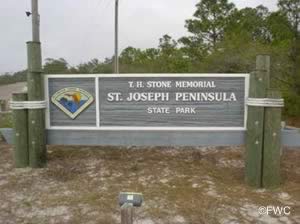
St Joseph Peninsula State Park Boat Ramp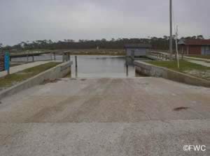 8899 Cape San Blas Road
Port St Joe, FL 32456
GPS 29° 45'50.98" N 85° 24'09.42" W
( waters edge at ramp )
GPS 29° 45'30.08" N 85° 23'47.94" W
( entrance to park )
Go to map of boat ramps in Gulf County
|
|
|
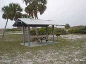
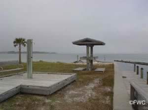
The St Joseph Peninsula State Park boat ramp offers; Double wide launching lane, courtesy docks, parking for 25 +/- boat trailers, a few small picnic shelters and restrooms. There is a fee to enter the park and also an additional launching fee.
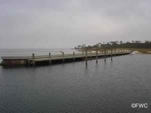

White City Park Boat Ramp
Closest intersection is;
Sealy Drive & Pridgeon Road
Wewahitchka, FL 32465
Boat ramp is on Pridgeon Drive
GPS 29° 52'50.88" N 85° 13'17.16" W
( Waters edge at ramp )
Go to map of boat ramps in Gulf County
The White City Park boat ramp offers; 2 launching lanes, courtesy docks, parking for 50 +/- boat trailers, picnic pavilion and restrooms which are located near the large pavilion more towards the back of the park.
Technically a freshwater ramp that can give access to the Gulf of Mexico through the Gulf County Canal. The purchase of a combination salt and freshwater fishing license will keep you on the proper side of the regulations, the lines defining the boundries of salt verses freshwater fishing are many times left up to the enforcement agency. Always be aware of any special regulations regarding specific species.
1.7 miles to the Gulf County Canal and then 5.5 miles on the canal to St Josephs Bay.
NOAA

Useful Links
| Public Boat Ramps in Gulf County Florida |
|
|
| Areas in Gulf County Florida Include; Dalkeith, Highland View, Honeyville, Overstreet, Port St. Joe, Wewahitchka and White City. |
| Areas of Salt and Brackish Water Gulf County Florida Include; Gulf of Mexico, Indian Lagoon and St Joseph Bay. |
![]() Home
Home ![]() About
About ![]() Sitemap
Sitemap ![]() Credits
Credits
![]() Privacy
Privacy ![]() Advertise
Advertise ![]() Contact
Contact ![]()
