Charlotte County, Florida ~ County and City Parks
- National &
State Parks - County &
City Parks - Beaches
Charlotte - Boat Ramps
Charlotte - Fishing Piers
Charlotte - Map of
Parks - Parks in
Adjoining Counties
Public Fishing at County & City Parks in Charlotte County, Florida
Seach our site below
Bay Heights Park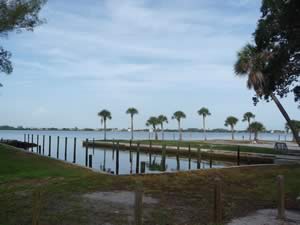 1000 South McCall Road
Englewood, FL 34223
GPS 26° 56'41.65" N 82° 21'06.11" W ( Park entrance )
NOAA Englewood, Lemon Bay 8725747
Fishing, Picnicking and Picnic Tables
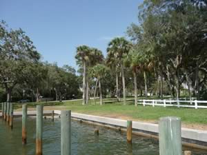
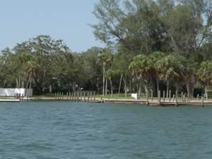

Bayshore Live Oak Park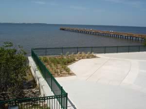 23157 Bayshore Road
Sibley Bay Drive and Bayshore Road
Charlotte Harbor, FL 33980
NOAA Punta Gorda 8725744

Chadwick Park ~ AKA ~ Englewood Beach Park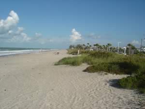 2100 North Beach Road
Englewood FL 34223
1-941-681-3742
GPS 26° 55'30.47" N 82° 21'39.17" W ( Park entrance )
NOAA Port Boca Grande, Charlotte Harbor 8725577
Fishing, swimming, pavilions rentals, picnicking, grills, restrooms / port-o-lets, birding, playground, basketball, and volleyball courts.
Beach wheelchairs are available 7 days a week on a help yourself basis starting at 7:30 a.m. and must be returned by 3:30 p.m. to be locked up for the evening.

Cedar Point Environmental Park
2300 Placida Road
Englewood FL 34224
GPS 26° 55'27.34" N 82° 19'56.88" W
( Park entrance )
NOAA Englewood, Lemon Bay 8725747
115 acres, Cedar Point on Lemon Bay is one of Charlotte County's unique parks with pine flatwoods, salt marsh, mangrove and hammock areas. Cedar Point is a great place to see wading birds that visit the mangrove fringe and adjacent seagrasses. Birding, Canoe / Kayak, Fishing, Picnicking and Playground.

Chester Roberts Park
5084 Melbourne Street
Port Charlotte, FL 33980
GPS 26° 57'23.16" N 82° 03'40.91" W
NOAA Punta Gorda 8725744
Chester Roberts Park sits on 1/3 of an acre along the Peace River and offers; Fishing, kayak / canoe launching and benches.

Elizabeth ~ Wilson Park
Park Beach Circle
Punta Gorda, FL 33950
GPS 26° 55'32.28" N 82° 04'02.78" W
NOAA Punta Gorda 8725744
Elizabeth ~ Wilson Park sits on 8/10 of an acre along Charlotte Harbor at Bass Inlet. Amenities offered include; Shoreline fishing, benches and beautiful vistas.

Gilcrist Park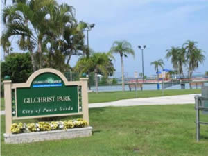 400 West Retta Esplanade
Punta Gorda, FL 33950
941-575-3372 ( City Hall )
GPS 26° 56'01.00" N 82° 03'19.88" W
NOAA Punta Gorda 8725744
Gilcrist Park sits on 11 acres along Charlotte Harbor. Amenities offered include; fishing pier, gazebo, restrooms, shelters, picnic tables, small beach and four parking lots.

Harbour Heights Park 27420 Voyageur Drive
Punta Gorda, FL 33983
GPS 26° 59'20.49" N 81° 59'45.31" W
( Entrance to park )
GPS 26° 59'24.45" N 81° 59'43.95" W
( Waters edge at ramp )
Fishing, boat ramps, picnicking, grills, restrooms / port-o-lets, canoe / kayak and playground.
Go to map of saltwater boat ramps in Charlotte County
NOAA Punta Gorda 8725744

Laishley Park
100 Nesbit Street
Punta Gorda, FL 33950
941-575-3372 ( City Hall )
GPS 26° 56'17.63" N 82° 02'57.15" W ( Park entrance )
GPS 26° 56'19.75" N 82° 03'06.17" W ( Waters edge at boat ramp )
GPS 26° 56'25.92" N 82° 03'05.81" W ( Foot of fishing pier )
NOAA Punta Gorda 8725744
Shelter with picnic tables, restrooms, fishing pier and boat ramp.

Lister Park
4301 Lister Street
Port Charlotte, FL 33980
GPS 26° 57'49.38" N 82° 04'52.46" W
NOAA Punta Gorda 8725744
Fishing
No real parking here.

Oyster Creek Regional Park
Two entrances. one off Placida Road ( Western side ) the other off San Casa Drive 9 ( Eastern side ).

Pittman Park
802 West Retta Esplanade
Punta Gorda, FL 33950
GPS 26° 55'51.22" N 82° 03'31.81" W
NOAA Punta Gorda 8725744

Placida Park
Boca Grande Causeway and Gasparilla Road
Placida, FL 33946
GPS 26° 50'05.36" N 82° 16'09.82" W
( Entrance to park when going south on Placida)
GPS 26° 50'00.18" N 82° 16'08.54" W
( Boca Grande Causeway entrance is easiest if trailering a boat )
GPS 26° 49'57.63" N 82° 16'10.45" W ( Waters edge at ramp )
NOAA Placida, Gasparilla Sound 8725667
Boat Ramps, Canoe/Kayak, Restrooms/Port-O-Lets

Ponce De Leon Park
3400 Ponce De Leon Parkway
Punta Gorda, FL 33950
941-575-3372 ( City Hall )
GPS 26° 55'01.47" N 82° 05'25.29" W ( Entrance to park )
GPS 26° 54'33.52" N 82° 05'41.53" W ( Waters edge at ramp )
GPS 26° 54'33.58" N 82° 05'39.16" W ( Fishing pier 1 )
GPS 26° 54'33.60" N 82° 05'42.54" W ( Fishing pier 2 )
NOAA Punta Gorda 8725744
Boat ramp, boat trailer parking, (2) two fishing piers ( #2 is about 75 feet in length along the waters edge and # 1 is about 100 feet long along the waters edge), playground, man-made beach, shelter, restrooms and picnic tables. Operated by the City of Punta Gorda.

Spring Lake Park
3520 Lake View Boulevard
Port Charlotte, FL 33948
GPS 26° 58'27.84" N 82° 07'24.46" W
( Entrance off Lake View )
GPS 26° 58'26.10" N 82° 07'18.33" W
( Waters edge at ramp )
Go to map of saltwater boat ramps in Charlotte County
NOAA Punta Gorda 8725744
Bridge at Edgewater Drive has a clearance of approx. 10 feet. Restrooms, Fishing, Boat ramp, Fishing dock.

Sunrise Park
20499 Edgewater Drive
Port Charlotte, FL 33952
GPS 26° 58'23.78" N 82° 06'43.20" W ( Entrance to park )
NOAA Punta Gorda 8725744
Sunrise Park sits on 40 acres of open space with active and passive amenities. It is contiguous to the Sunrise Waterway and adjacent to 114 acres of a state buffer that is part of the Charlotte Harbor State Reserve activities include; Canoe / kayak launching, fishing, picnicking / picnic tables, bird watching and restrooms / port-o-lets.

Useful Links
| Public Fishing at County & City Parks in Charlotte County, Florida |
|
|
| Areas in Charlotte County Florida Include; Boca Grande, Cape Haze, Charlotte Harbor, Charlotte Park, Cleveland, Deep Creek, Englewood, Grove City, Harbour Heights, Manasota Key, Murdock, Placida, Port Charlotte, Punta Gorda, Rotonda and Solana. |
| Areas of Salt and Brackish Water in Charlotte County Florida Include; Alligator Bay, Alligator Creek North Fork, Alligator Creek South Fork, Catfish Creek, Charlotte Harbor, Coral Creek, Deerfly Bay, Gasparilla Sound, Gulf of Mexico, Hunter Creek, Jim Long Lake, Lemon Bay, Little Alligator Creek, Muddy Cove, Myakka Cutoff, Myakka River, Peace River, Placida Harbor, Sam Knight Creek, Shell Creek, Tippecanoe Bay, Turtle Bay and Whidden Creek. |
![]() Home
Home ![]() About
About ![]() Sitemap
Sitemap ![]() Credits
Credits
![]() Privacy
Privacy ![]() Advertise
Advertise ![]() Contact
Contact ![]()
