Currituck County, North Carolina ~ Boat Ramps
- National &
State Parks - County &
City Parks - Beaches
Currituck - Boat Ramps
Currituck - Fishing Piers
Currituck - Map of
Boat Ramps
Currituck - Boat Ramps
Adjoining Counties
Public Boat Ramps in Currituck County, North Carolina
Seach our site below
Brumley Road Boat Ramp 192 Brumley Road
Knotts Island, NC 27950
GPS 36° 30'28.55" N 75° 54'36.42" W
( Waters edge at ramp )
NOAA Manns Harbor, NC 8652247
|
|
|
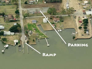
Located on Knotts Island Bay, the Brumley Road ramp offers; single launching lane, courtesy dock and 25 boat trailer parking spaces which are just up the road in the lot on the north side. Hand launch your kayaks and canoes from this location. Please be aware that about 2.5 miles to the north is the Virginia state line, and the associated fishing regulations.
Carova Beach Park Boat Ramp
At the intersection of;
Ocean Pearl Road & Gulf Hawk Boulevard
Corolla, NC 27927
GPS 36° 30'35.29" N 75° 51'54.31" W
( Waters edge at ramp )
NOAA Manns Harbor, NC 8652247
|
|
|
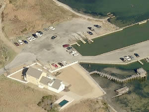
The Corova Beach Park offers; Single lane ramp, courtesy docks, small pavilions and restrooms. The ramp sits at the end of a canal, about 8/10ths of a mile to get to Knotts Island Bay.
Coinjock Boat Ramp Closest intersection is;
Waterlily Road & Old Coinjock Canal Road
Poplar Branch, NC 27923
1.2 miles north on Waterlily Road from the above intersection.
Ramp will be on the left.
GPS 36° 21'32.96" N 75° 56'41.81" W
( Waters edge at ramp )
|
|
No tide stations close by |
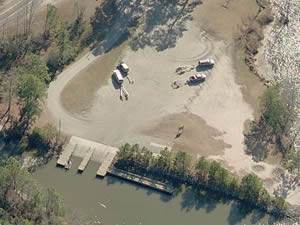
The Coinjock boat ramp offers, 2 launching lanes, courtesy docks and 22 boat trailer parking spaces. The facility is at the southern end of Coinjock Bay.
Currituck Heritage Park Boat Ramp ~ Whalehead Club
Club Road
Corolla, NC 27927
252-453-9040
Open: Dusk to Dawn
GPS 36° 22'25.37" N 75° 50'00.33" W
( Waters edge at ramp )
|
|
|
Currituck Heritage Park boat ramp along Currituck Sound offers; A single lane ramp, courtesy docks.
Indiantown Creek Boat Ramp
Closest intersection is;
South Gregory Road & South Indiantown Road
Camden, NC 27921
9/10ths of a mile south on Indiantown Road from above intersection.
GPS 36° 20'58.69" N 76° 04'22.93" W
( Waters edge of ramp )
Located along Indiantown Creek.
Poplar Branch Boat Ramp 101 Poplar Branch Road
Poplar Branch, NC 27965
GPS 36° 17'13.61" N 75° 53'01.29" W
( Waters edge at ramp )
NOAA
The Poplar Brach ramp offers; 2 launching lanes, courtesy docks and 15 boat trailer parking spaces.
Poyners Road Boat Ramp
Closest intersection is;
Caratoke Highway & Poyners Road
Moyock, NC 27958
Ramp is 1.3 miles north on Poyners from the above intersection.
GPS 36° 28'06.33" N 76° 04'36.30" W
( Waters edge at ramp )
NOAA
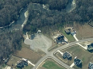
Operated by NC Wildlife Resources Commission the Poyners Road ramp offers; Single launching lane, courtesy docks. No restrooms at this location
Shingle Landing Boat Ramp 129 Creekside Drive
Moyock, NC 27958
GPS 36° 31'46.66" N 76° 10'12.05" W
( Waters edge at ramp )
NOAA
Located along the Northwest River the Shingle Landing ramp offers; Single launching lane, courtesy docks and about 35 boat trailer parking spaces.
Sound Park Boat Ramp
8955 Caratoke Highway
Point Harbor, NC 27964
GPS 36° 05'38.37" N 75° 47'50.38" W
( Waters edge at ramp )
NOAA
Located along the southwestrn shores of Currituck Sound the Sound Park boat ramp offers; 2 launching lanes, courtesy docks, 27 paved boat trailer parking spaces, picnic pavilions, grills and restrooms.
Useful Links
| North Carolina Saltwater Fishing Regulations | Safe Handling of Self Caught Seafood |
| Videos of Fishing Knots | Seafood Recipes |
| Fish of the Atlantic |
| Public Boat Ramps in Currituck County, North Carolina |
| Areas in Currituck County North Carolina Include; Aydlett, Barco, Carova Beach, Coinjock, Corolla, Currituck, Grandy, Gregory, Harbinger, Knotts Island, Jarvisburg, Mamie, Maple, Moyock, Point Harbor, Poplar Beach, Poplar Branch, Powells Point, Sanderling, Shawboro, Sligo, Spot and Waterlily. |
| Bodies of Salt and Brackish Water in Currituck County North Carolina Include; Albemarle Sound, Back Bay, Ballast Bay, Baums Creek, Beach Creek, Beasley Bay, Bellows Bay, Brant Island Pond, Buckskin Creek, Burris Bay, Capsies Creek, Cedar Island Bay, Coinjack Bay, Currituck Sound, Deep Neck, Duck Creek, Dowdy Bay, Fosters Channel, Goat Island Bay, Goose Pond, Great Beach Pond, Intercoastal Waterway, Jenkins Cove, Knotts Island Bay, Pettys Pond, Knotts Island Channel, Lutz Creek, Myrtle Bay, North Landing River, Little Goat Island Bay, Lone Oak Channel, Neals Creek, Narrow Ridges, North River, Parker Creek, Piney Cove, Piney Island Bay, Racoon Bay, Roland Creek, Sanders Bay, Sanders Creek, Sheep Creek, Ships Bay, Shoe Hole Bay, Stumpy Cove, Taylor Bay, Tull Bay, Tull Creek, Ware Creek, Webster Creek, Wells Bay, Wells Creek, Whale Head Bay and Yankee Pond. |
![]() Home
Home
![]() About
About
![]() Sitemap
Sitemap
![]() Credits
Credits
![]() Privacy
Privacy
![]() Advertise
Advertise
![]() Contact
Contact
![]()
