Sarasota County, Florida ~ Fishing Piers
- National &
State Parks - County &
City Parks - Beaches
Sarasota - Boat Ramps
Sarasota - Fishing Piers
Sarasota - Map of
Fishing Piers - Fishing Piers
Adjoining Counties
Find Public Fishing Piers in Sarasota County, Florida
Seach our site below
Hurricane Ian caused major damage in Sarasota County, Florida. Saltchef is still assessing the situation.
Causeway Park Fishing Pier / Saprito Pier 420 John Ringling Boulevard
Sarasota, FL 34236
GPS 27° 20'03.42" N 82° 33'16.43" W
( Foot of pier )
GPS 27° 20'08.94" N 82° 33'05.37" W
( Entrance is off John Ringling south bound )
NOAA Sarasota 8726083
|
|
The Saprito / Causeway Park fishing pier is 560 feet in length with an 80 foot "T" at the end and is over the waters of the Sarasota Bay. The pier is open 24 hours a day. Be sure to have your valid Florida fishing license in hand. Restrooms are available.
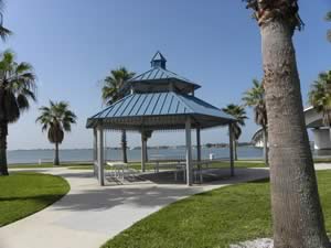
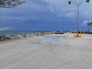
Humphris Park Jetty Fishing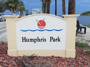 Closest intersection is;
Tarpon Center Drive & Inlet Circle
Venice, FL 34284
Park entrance is about 900 feet north on Tarpon Center from above intersection.
GPS 27° 06'44.13" N 82° 27'57.80" W
( park entrance )
NOAA Venice, Roberts Bay 8725889
|
|
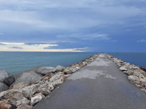
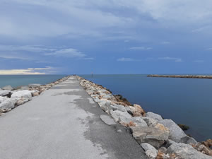
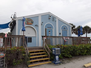
Operated by the City of Venice Humphris Park sits on 2 acres on the south side of the Venice Inlet and offers; Fishing on the jetty which is about 650 feet in length, picnic tables, benches, showers and restrooms.
Ken Thompson Park Fishing Pier
1700 Ken Thompson Parkway
Lido Key, FL 34236
GPS 27° 20'04.45" N 82° 34'24.12" W ( Small fishing pier )
GPS 27° 20'04.88" N 82° 34'32.77" W ( Entrance to park )
GPS 27° 20'01.17" N 82° 34'29.35" W ( Waters edge at ramp )
NOAA Sarasota 8726083
|
|
A 92 acre park owned and operated by City of Sarasota. Amenities include; fishing pier, boat ramp, restrooms, playground, picnicking, covered picnic areas, kayaking, birding and walking trails through mangrove and restored tidal marsh areas.
New Pass Fishing Piers
1700 Ken Thompson Parkway
Lido Key, FL 34236
GPS 27° 20'12.04" N 82° 34'32.29" W
( One of the small piers )
NOAA Sarasota 8726083
|
|
Other side from Ken Thompson Park.
Nokomis Park Fishing Dock
234 Nippino Trail East
Nokomis, FL 34275
GPS 27° 06'55.29" N 82° 26'41.96" W
( Fishing dock )
NOAA Venice, Roberts Bay, FL 8725889
|
|
Fishing on Rails to Trails bridge also. Hand launch on site also. Over the waters of where Curry Creek meets Roberts Bay.
North Jetty Park Fishing Jetty
¾ mile south from the intersection of;
Albee Road West & South Casey Key Road
Venice, FL 34275
GPS 27° 06'57.04" N 82° 28'01.72" W
( Entrance to park )
NOAA Venice, Roberts Bay 8725889
|
|
Fishing jetty about 600 feet in length, surf fishing with respect to swimmers, bait shop, beach access parking, concession, picnic shelter, picnic tables, playground, restrooms, showers and volleyball courts.
Osprey Fishing Pier
Closest intersection is;
Main Street & Pine Avenue
Osprey, FL 34229
Pier is 600 west on Main St from the above intersection.
GPS 27° 11'51.53" N 82° 29'36.26" W
( Foot of pier )
NOAA Blackburn Point, FL 8725943
|
|
The Osprey fishing pier is 240 feet in length over the waters of Little Sarasota Bay. Limited parking at this location.
Phillippi Estate Fishing Piers
5500 South Tamiami Trail
Sarasota, FL 34231
GPS 27° 16'15.66" N 82° 32'03.43" W ( Foot of pier 1 )
GPS 27° 16'20.89" N 82° 31'53.87" W ( Foot of pier 2 )
GPS 27° 16'11.88" N 82° 31'51.33" W ( Entrance to estate )
NOAA Sarasota 8726083
|
|
The Phillippi Estate fishing piers are on the southern shore of the Phillippi River. Pier 1 extends 45 feet over the water. Pier 2 extends 35 feet over the water with a 30 foot "T" at the end. Restrooms and shaded gazebos are on site also.
Venice Fishing Pier at Brohard Park
Damaged heavily by Hurricane Ian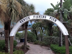 1600 Harbor Drive South
Venice, FL 34285
GPS 27° 04'22.86" N 82° 26' 57.18" W
( Entrance to parking lot )
GPS 27° 04'22.89" N 82° 27' 02.84" W
( Foot of pier )
NOAA Redfish Pass, Captiva Island North 8725441
|
|
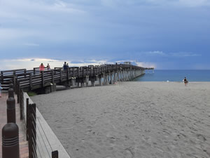
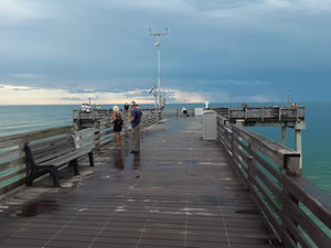
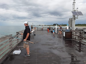
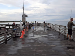
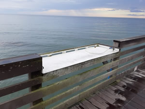
The Venice fishing pier is owned by the City of Venice and is 700 feet in length over the waters of the Gulf of Mexico. The pier area offers; 24 hour operation, free fishing and no license is required to fish ON the pier, bait cutting / fish cleaning table, picnic pavilions (6) and restrooms.
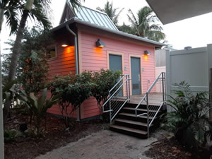
Whitaker Gateway Park Fishing Pier
1455 North Tamiami Trail
Sarasota, FL 34230
GPS 27° 21'00.90" N 82° 32'49.47" W
( Entrance to park )
GPS 27° 21'00.47" N 82° 33'02.51" W
( Foot of pier )
NOAA Sarasota 8726083
|
|
Whitaker Gateway Park offers; Fishing pier which is 80 feet in length over the waters of Sarasota Bay, playground, pavilions, picnicking, walking & fitness trail, shoreline fishing from the bulkhead and restrooms.
| Public Fishing Piers in Sarasota County Florida |
|
|
| Areas in Sarasota County Florida Include; Bee Ridge, Desoto Lakes, Englewood, Fruitville, Gulf Gate Estates, Kensington Park, Lake Sarasota, Laurel, Longboat Key, Nokomis, North Port, North Sarasota, Osprey, Plantation, Ridge Wood Heights, Sarasota, Sarasota Springs, Siesta Key, South Gate Ridge, South Sarasota, South Venice, Southgate, The Meadows, Vamo Venice, Venice Gardens and Warm Mineral Springs. |
| Areas Brackish and Saltwater in Sarasota County Florida Include; Alligator Creek, Big Sarasota Pass, Big Slough, Blackburn Bay, Curry Creek, Deer Prairie Slough, Dona Bay, Dryman Bay, Forked Creek, Gulf of Mexico, Hudson Bayou, Intracoastal Waterway, Lemon Bay, Little Sarasota Bay, Lyons Bay, Myakka River, New Pass, Phillippi River, Roberts Bay, Salt Creek, Sarasota Bay and Whitaker Bayou. |
![]() Home
Home ![]() About
About ![]() Sitemap
Sitemap ![]() Credits
Credits
![]() Privacy
Privacy ![]() Advertise
Advertise ![]() Contact
Contact ![]()
