Pasco County, Florida ~ County and City Parks
- National &
State Parks - County &
City Parks - Beaches
Pasco - Boat Ramps
Pasco - Fishing Piers
Pasco - Map of
Parks - Parks in
Adjoining Counties
Local County and City Parks with Salt or Brackish Water Fishing in Pasco County, Florida
Seach our site below
Anclote River Park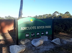 1119 Baillies Bluff Road
Holiday, Florida 34691
727-938-2598
Open Sunrise to Sunset
Boat ramp open 24 hours
( For active launching or retrieval )
GPS 28° 10'30.78" N 82° 47'06.81" W
( Entrance )
Anclote River tide chart 8726924
|
|
|
Anclote River Park offers; 300' Beach, boat ramp, picnic pavilion, playground and restrooms.
Brasher Park
4951 Koons Road
Port Richey, FL 34673
GPS 28° 17'07.63" N 82° 43'54.82" W
Gulf Harbors, FL - Station ID: 8726995
|
|
|
Brasher Park offers; Hand launching area, restrooms, picnic tables, small pavilions and ample parking. Located on the north side of Boggy Bay. Kayak into areas at the Werner-Boyce Salt Springs State Park. The northern areas of Werner-Boyce are about 6 miles away as the crow flies or you can begin to access the southern areas with a paddle of about 1 mile. Operated by the City of Port Richey.
Cotee River Park
Grand Boulevard
New Port Richey, FL 34656
GPS 28° 15'16.10" N 82° 43'20.36" W
( Southern end of park )
Pithlachascotee River NOAA tide chart 8727012
|
|
|
Cotee River Park is a linear park along Grand Boulevard in Port Richey. benches and shaded picnic structures, popular with bikers and walkers. Docks and decks are private property.
Eagle Point Park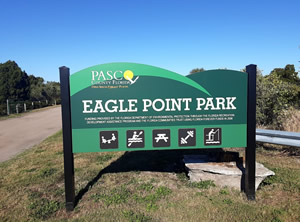 Closest intersection is;
Trouble Creek Road & Rustic Drive
New Port Richey, FL 34656
From the above intersection go 1/3rd of a mile west on Trouble Creek, entrance to park is at the corner.
GPS 28° 13'26.44" N 82° 44'53.55" W
( Entrance )
NOAA Gulf Harbors, FL - Station ID: 8726995
|
|
|
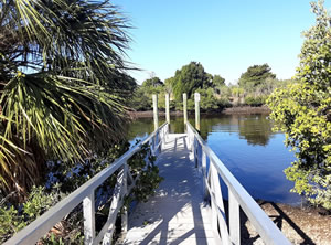
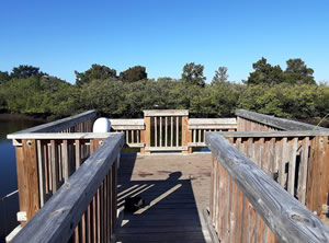
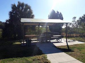
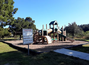
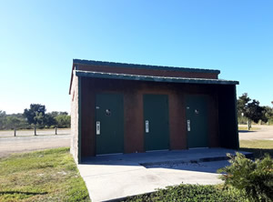
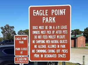
Eagle Point Park in New Port Richey sits on 15 acres within a 600 acre coastal preserve and offers; Floating canoe and kayak launch dock, 3 fishing piers, a couple of picnic pavilions, playground and restrooms.
Frances Avenue Park
5580 Frances Avenue
New Port Richey, FL 34656
GPS 28° 14'32.76" N 82° 42'45.65" W
( Entrance )
Middle Pithlachascotee River NOAA tide chart 8727001
|
|
|
Operated by the City of New Port Richey and sitting along the Pithlachascotee River, Frances Avenue Park offers; Hand launching of canoes, kayaks, picnic pavilion, playground and restrooms. Frances Avenue Park is considered the beginning of the Florida Canoe Trail.
Grand Boulevard Park
5708 Riverview Drive
New Port Richey, FL 34652
GPS 28° 14'28.37" N 82° 43'11.82" W
( Entrance )
NOAA MIDDLE PITHLACHASCOTEE RIVER, FL - Station ID: 8727001
Grand Boulevard Park offers; Shoreline fishing of the Pithlachascotee River, picnic pavilion, floating dock, playground & restrooms.
James E. Grey Preserve
6938 Plathe Road
New Port Richey, FL 34653
GPS 28° 14'19.85" N 82° 41'56.86" W
( Park entrance )
NOAA MIDDLE PITHLACHASCOTEE RIVER, FL - Station ID: 8727001
|
|
|
Operated by the City of New Port Richey this park is difficult to find and it may appear that you are entering private property, through the gate, just continue on and you will come upon the parking area. Restrooms, hand launching of kayaks, fishing pier on Pithlachascotee River, pavilions with areas for cooking and wildlife viewing are offered here.
Jasmine Park
Closest intersection is;
Jasmine Drive & Mandy Lane
New Port Richey, FL 34652
GPS 28° 15'41.94" N 82° 43'20.24" W
Pithlachascotee River NOAA tide chart 8727012
|
|
|
Operated by the City of New Port Richey. Fishing off the concrete bulkhead, small covered picnic table, grill, benches and trash receptacles. A neighborhood park with no on-site parking.
Key Vista Nature Park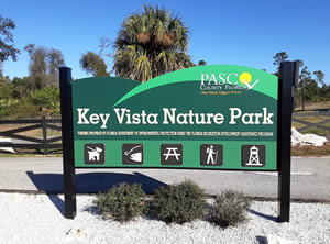 2700 Baillies Bluff Road
Holiday, FL 34691
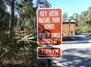
Dawn - Dusk
Small parking fee applicable
GPS 28° 11'58.26" N 82° 46'44.16" W
( Entrance )
NOAA Baileys Bluff Gulfside, FL 8726978 Station is non-functioning
See Map of Key Vista Nature Park.
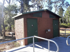
Key Vista Nature Park sits on 101 acres along Rocky Creek and the Gulf of Mexico and offers; Observation tower near the Gulf, benches, shore line fishing of Rocky Creek or the Gulf of Mexico, BBQ grills, picnic area, drinking fountain and restrooms. Numerous trails to hike along and one of the trails hooks into Anclote Gulf Park to the south.
Nicks Park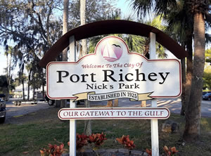 7929 Bayview Street
Port Richey, FL 34673
GPS 28° 16'21.55" N 82° 43'30.86" W
( Entrance )
NOAA PITHLACHASCOTEE RIVER, FL - Station ID: 8727012
|
|
|
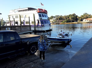
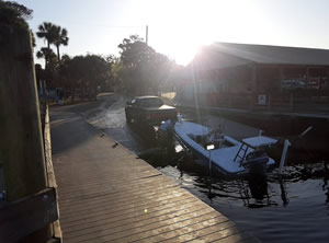
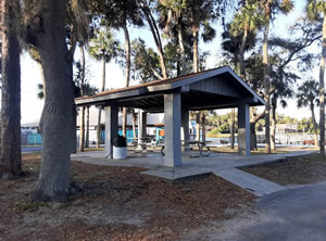
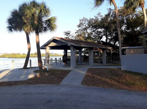
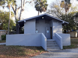
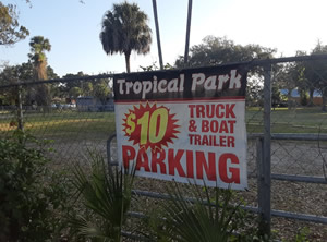
Nicks Park offers; Boat ramp, courtesy dock, 2 picnic pavilions, restrooms Boat trailer parking is limited within this park. The city says additional parking is available at Waterfront Park. Also across the street from the park is a private lot that says parking is available for a nominal fee, The fee is payable at the Bait Depot bait shop 727-494-1580.
Oelsner Park
5218 Miller Bayou Drive
Port Richey, FL 34673
GPS 28° 16'41.55" N 82° 43'41.86" W
Pithlachascotee River NOAA tide chart 8727012
Oelsner Park is operated by The City of New Port Richey. Located along the northern shores of Millers Bayou the park offers; Shoreline fishing at a bulkhead area or small natural area, picnic tables, gazebo, restrooms and paved parking for about 14 cars.
Port Richey Waterfront Park
8119 Old Post Road
Port Richey, FL 34673
GPS 28° 16'30.93" N 82° 43'25.83" W
( Entrance )
NOAA PITHLACHASCOTEE RIVER, FL - Station ID: 8727012
|
|
|
The Port Richey Waterfront Park along the western area of Millers Bayou offers; Fishing pier, kayak launching, picnic tables, playground and restrooms.
Robert Rees Memorial Park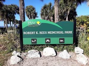 4835 Green Key Road
New Port Richey, FL 34652
GPS 28° 15'17.85" N 82° 45'02.17" W
( Entrance area )
NOAA Gulf Harbors, FL 8726995
|
|
|
Robert Rees Memorial Park offers; Hand launching of kayaks, fishing, 2 decent sized picnic pavilions, small playground, beach, swimming, sunbathing, boardwalk to observation deck and restrooms.
R.J. Strickland Memorial Park ~ AKA ~ Hudson Beach
6345 Clark Street
Hudson, FL 34667
GPS 28° 21'45.00" N 82° 42'33.74" W
( Entrance area )
NOAA HUDSON, HUDSON CREEK, FL - Station ID: 8727061
|
|
|
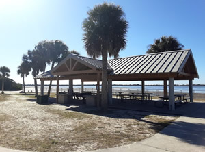
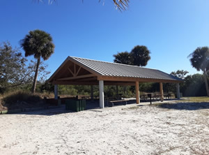
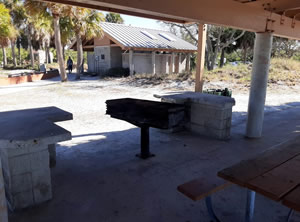
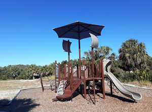
Robert J. Strickland Memorial Park offers a boat ramp, fishing access, picnic pavilions, beach area and restrooms.
Sims Park
Grand Boulevard & Bank Street
New Port Richey, FL 34652
GPS 28° 15'08.17" N 82° 43'20.46" W
( Entrance area )
NOAA MIDDLE PITHLACHASCOTEE RIVER, FL - Station ID: 8727001
|
|
|
Useful Links
| County & City Parks in Pasco County Florida |
|
|
| Areas in Pasco County Florida include; Aripeka, Bayonet Point, Beacon Square, Connerton, Crystal Springs, Dade City, Dade City North, Elfers, Heritage Pines, Holiday, Hudson, Jasmine Estates, Key Vista, Lacoochee, Land O' Lakes, Meadow Oaks, Moon Lake New Port Richey, New Port Richey East, Odessa, Pasadena Hills, Port Richey, Quail Ridge, River Ridge, San Antonio, Shady Hills, St. Leo, Trinity, Trilby, Wesley Chapel, Zephyrhills, Zephyrhills North, Zephyrhills South and Zephyrhills West. |
| Areas of Salt and Brackish Water Pasco County Florida include; Anclote River, Ben Pilot Creek, Big Bayou, Cross Bayou, Cow Creek, Double Hammock Creek, Fillmans Creek, Gulf of Mexico, Hammock Creek, Hope Bayou, Hudson Creek, Lighter Bayou, Long Grassy Creek, Millers Bayou, Oyster Creek, Pithlachascotee River, Pound Neck Creek, Rocky Creek, Salt Springs Run, Sand Bay & Sponge Crawl Creek. |
![]() Home
Home ![]() About
About ![]() Sitemap
Sitemap ![]() Credits
Credits
![]() Privacy
Privacy ![]() Advertise
Advertise ![]() Contact
Contact ![]()
