Cedar Key & Yankeetown Florida ~ Fishing Piers
- National &
State Parks - County &
City Parks - Beaches
- Boat Ramps
Levy County - Fishing Piers
Levy County - Map of
Fishing Piers
Levy County - Fishing Piers
Adjoining Counties
Public Fishing Piers in Levy County, Florida. Cedar Key
Seach our site below
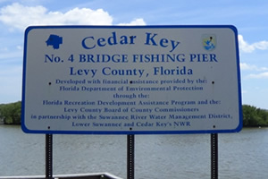
No. 4 Bridge Fishing Pier Closest intersection is;
SW 154 Ave & Route 24
Cedar Key, FL 32625
( Pier is 900 feet down SW 154 Ave from above intersection, adjacent to the boat ramp )
GPS 29° 09'51.85" N 83° 01'37.52" W
( Foot of pier )
NOAA Cedar Key, FL 8727520
|
|
The No. 4 bridge fishing pier in Cedar Key is 200' in length over the waters of Number 4 Channel. There is a semi permanent portolet on site. The area also has a boat ramp.
Go to our Video of No 4 Fishing Pier
City Fishing Pier Cedar Key Dock Street & C Street
Cedar Key, Florida 32625
GPS 29° 08'03.96" N 83° 01'52.09" W
( Foot of pier )
NOAA Cedar Key, FL 8727520
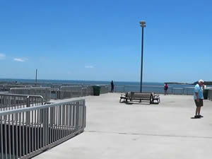
The fishing pier in the downtown area of Cedar Key is about 250' feet in length and has multiple prongs for added opportunities. The pier has a fish cleaning table and restrooms. Restaurants are very close by and the views are spectacular.
Go to our Video of Downtown Cedar Key Fishing Pier
Shell Mound Park Fishing Pier 17650 SW 78 Place
Cedar Key, FL 32625
The above address is for the campground.
Once there, continue an additional ½ mile onto dirt road,
the pier is at the end.
GPS 29° 12'24.13" N 83° 04'08.21" W
( Foot of pier )
NOAA Cedar Key, FL 8727520
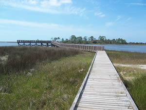
Located within the Lower Suwannee National Wildlife Refuge. The Shell Mound Park pier is about 180 in length over high tide water and has a 65' section at the end that travels parallel with the shoreline.
Useful Links
| Public Fishing Piers in Levy County Florida |
|
|
| Areas in Levy County Florida include; Andrews, Bronson, Cedar Key, Chiefland, East Bronson, East Williston, Ellzey, Fowlers Bluff, Gulf Hammock, Inglis, Lebanon Junction, Manatee Road, Otter Creek, Raleigh, Rosewood, Turkeytown, Usher, Williston, Williston Highlands and Yankeetown. |
| Areas of Salt and Brackish Water Levy County Florida include; Gulf of Mexico, Suwannee River and Withlacoochee River. |
![]() Home
Home ![]() About
About ![]() Sitemap
Sitemap ![]() Credits
Credits
![]() Privacy
Privacy ![]() Advertise
Advertise ![]() Contact
Contact ![]()
