Public
Boat Ramps
in
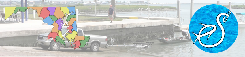
Worcester County, Maryland
Seach our site below
Assateague Island State Park Boat Ramp
Across the street and closer to the bridge from;
7206 National Seashore Lane
Berlin, MD 21811
GPS 38° 14'52.28" N 75° 09'04.85" W
( waters edge at ramp )
The Assateague Island State Park boat ramp offers; 2 launching lanes, courtesy docks, parking for 67 boat trailers & restrooms.
Bayside Drive Hand Launch
Closest intersection is;
Bayside Drive & Bayberry Drive
Berlin, MD 21811
From the above intersection go 8/10ths of of a mile on
Bayside Drive to the parking and launch area.
410-641-1441
Small fee to enter the National Seashore applies.
GPS 38° 12'33.97" N 75° 10'05.65" W
( launch area )
The Bayside Drive hand launch along Sinepuxent Bay offers; sand launch area, about 30 car parking spaces & restrooms. The area is located within the Assateague Island National Seashore.
Cedar Hall Boat Launching Ramp
At the intersection of;
Cedar Hall Wharf Road & Shore Line Lane
Pocomoke City, MD 21851
Open 24 hours
410-632-3766
GPS 38° 00'31.27" N 75° 37'14.29" W
( waters edge at ramp )
The Cedar Hall boat ramp is along The Pocomoke River and offers; 2 launching lanes, courtesy docks, paved parking for 10 boat trailers & portable restrooms.
George Island Landing Boat Launching Ramp
Closest major intersection is;
South Church Street ( route 12 ) & George Island Landing Road
Stockton, MD 21864
From the above intersection go approx. 3 miles east on George Island Road to the ramp area.
Open 24 hours
GPS 38° 02'28.27" N 75° 21'40.43" W
( waters edge at ramp )
The George Island Landing boat ramp, owned and managed by Worcester County is along Chincoteague Bay and offers; 1 wide launching lane, courtesy docks, parking for 50 boat trailers & portable restrooms.
Gum Point Landing Boat Ramp
Closest intersection is;
Racetrack Road & Gum Point Road
Berlin, MD 21811
Go east on Gum Point Road for 5/10ths of a mile ramp is on the right.
Open - Dawn to Dusk
GPS 38° 21'22.46" N 75° 09'38.88" W
( waters edge at ramp )
The Gum Point Landing boat ramp offers; single launching lane, courtesy docks, parking for 20 boat trailers ( grass area ) & portable restrooms.
Isle of Wight Nature Park Hand Launch
Closest intersection is;
Ocean City Expressway & St. Martins Neck Road
Bishopville, MD 21813
From the above intersection go east 1/10th of of a mile on
St. Martins Neck Road ( 90° bend ) to the parking and launch area.
GPS 38° 23'19.39" N 75° 06'31.30" W
( launch area )
The Isle of Wight Nature Park hand launch area along Isle of Wight Bay is a short distance off the Ocean City Expressway offers; parking for about 5 cars, sand launch area, short portage of about 80'. No other amenities at this location.
Mason Landing Boat Launching Ramp
Closest intersection is;
Langmaid Road & Marshall Creek Road
Newark, MD 21841
From the above intersection go approx. 1.75 miles east / south on Marshall Creek Road to the ramp area.
Open 24 hours
GPS 38° 14'14.73" N 75° 15'25.52" W
( waters edge at ramp )
The Taylors Landing boat ramp is along Massey Creek and offers; 1 launching lane, courtesy docks, parking for about 15 boat trailers & portable restrooms.
Pocomoke City Boat Launching Ramp
At the intersection of;
Riverside Drive & Laurel Street
Pocomoke City, MD 21851
410-957-1333
GPS 38° 04'23.54" N 75° 34'20.22" W
( waters edge at ramp )
The Pocomoke City boat ramp operated by the Town of Pocomoke City is along The Pocomoke River and offers; single wide launching lane, courtesy docks, paved parking for 20 boat trailers & portable restrooms.
Pocomoke River State Park Boat Launching Ramp ~ Shad Landing
3461 Worcester Highway
Snow Hill, MD 21893
GPS 38° 08'25.50" N 75° 26'25.65" W
( waters edge at ramp )
The Pocomoke River State Park also known as Shad Landing boat ramp is along the Pocomoke River and offers; 2 wide launching lanes, courtesy docks, paved parking for 23 boat trailers & restrooms.
Public Landing Boat Launching Ramp
Closest intersection is;
Public Landing Wharf Road & Outten Road
Snow Hill, MD 21863
From the above intersection go 250' north on Public Landing Wharf Road, entrance is on the left.
Open; 5am - 12pm
GPS 38° 09'03.99" N 75° 17'09.88" W
( waters edge at ramp )
The Public Landing boat ramp offers; single wide launching lane, courtesy docks, paved parking for about 15 boat trailers.
Shell Mill Landing Boat Launching Ramp
Closest intersection is;
Shell Mill Road & St Martins Neck Road
Bishopville, MD 21813
From the above intersection go 3/4 miles south on Shell Mill Road, to the ramp area.
Open; 24 hours
410-632-3766
GPS 38° 25'27.02" N 75° 11'15.96" W
( waters edge at ramp )
The Shell Mill Landing boat ramp along the Bishopville Prong off of the St Martin River offers; single launching lane, courtesy dock, parking for 30 boat trailers & portable restrooms.
South Point Road Boat Launching Ramp
Closest intersection is;
South Point Road & Waterside Drive
Berlin, MD 21811
From the above intersection go 400' east on South Point Road, to the ramp area.
Open; 24 hours
410-632-3766
GPS 38° 12'59.92" N 75° 11'27.06" W
( waters edge at ramp )
South Point Road boat ramp along the Sinepuxent Bay offers; single launching lane, courtesy dock, parking for 15 boat trailers & portable restrooms.
Taylors Landing Boat Launching Ramp
Closest major intersection is;
Bayview Road & Taylor Landing Road
Girdletree, MD 21829
From the above intersection go approx. 1 mile south / east on Taylor Landing Road to the ramp area.
410-632-3766
Open 24 hours
GPS 38° 04'35.24" N 75° 21'52.35" W
( waters edge at ramp )
The Taylors Landing boat ramp, owned and managed by Worester County is along Chincoteague Bay and offers; 1 launching lane, courtesy docks, parking for 25 boat trailers & portable restrooms.
Truitts Landing Hand Launch
Closest intersection is;
Truitts Landing Road & Cherrix Road
Girdletree, MD 21829
From the above intersection go 2.3 miles south / east on Truitts Landing Road. The ramp area is at the end of the road.
GPS 38° 05'57.61" N 75° 20'16.97" W
( launch area )
The Truitts Landing hand launch, is along Chincoteague Bay and offers; sand launch, minimal parking, no other amenities at this location.
West Ocean City Boat Ramp
At the intersection of;
Golf Course Road & Sunset Avenue
Ocean City, MD 21842
GPS 38° 19'39.19" N 75° 06'25.22" W
( waters edge at ramp )
The West Ocean City boat ramp along Sinepuxent Bay offers; 6 launching lanes, courtesy docks, parking for 130 boat trailers & restrooms. This ramp gives super easy access to the Ocean City Inlet.
Winters Quarters Landing Boat Launching Ramp
Closest major intersection is;
Winter Quarters Drive & US-13 / Ocean Highway
Pocomoke City, MD 21851
From the above intersection go approx. 1/2 mile north on Winters Quarter Drive to the ramp area.
GPS 38° 05'08.96" N 75° 33'33.54" W
( waters edge at ramp )
The Winters Quarters Landing boat ramp is managed by Pocomoke City and offers; 1 launching lane, courtesy docks, parking for 3 - 5 boat trailers.
64th Street Boat Launching Ramp
At the intersection of;
64th Street & Seabay Drive
Ocean City, MD 21842
GPS 38° 23'13.21" N 75° 04'06.39" W
( waters edge at ramp )
The 64th Street boat ramp along Isle of Wight Bay offers; 2 launching lanes, courtesy dock, parking for 32 boat trailers. The ramp is free to use. A fee is charged for the boat trailer parking.
Useful Links
| Maryland Fishing Information | Safe Handling of Self Caught Seafood |
| Map of Boat Ramps Hand Launches in Worcester County, Maryland | |
| Videos of Fishing Knots | Seafood Recipes |
| Areas in Worcester County Maryland Includes; Berlin, Bishopville, Boxiron, Cedartown, Friendship, Germantown, Girdletree, Goodwill, Ironshire, Klej Grange, Nassawango Hills, Newark, Ocean City, Ocean Pines, Pocomoke City, Public Landing, Showell, Sinepuxtent, Snow Hill, Southpoint, Stockton, Taylorville, West Ocean City, Whaleyville & Whiton. |
| Saltwater & Brackish Bodies of Water in Worcester County Maryland Includes; Assawoman Bay, Atlantic Ocean, Ayer Creek, Back Creek, Bassett Creek, Bat Creek, Beaverdam Creek, Bishopville Prong, Buck Island Creek, Burch Branch, Chincoteague Bay, Cotter Creek, Cropper Creek, Gibbs Pond, Grays Creek, Greys Creek, Harry Creek, Herring Creek, Isle of Wight Bay, Johnson Bay, Manklin Creek, Marshall Creek, Martin Bay, Newport Creek, Pawpaw Creek, Pocomoke River, Porter Creek, Purnell Pond, Robins Creek, Rowley Cove, Saint Martin River, Scarboro Creek, Sinpuxent Bay, Stag Creek, Swan Gut, Tanhouse Creek, Trappe Creek, Turville Creek, Waterworks Creek & Zippy Creek. |
![]() Home
Home ![]() About
About ![]() Sitemap
Sitemap ![]() Credits
Credits
![]() Privacy
Privacy ![]() Advertise
Advertise ![]() Contact
Contact ![]()