Glynn County, Georgia ~ Boat Ramps
- National &
State Parks - County &
City Parks - Beaches
Glynn - Boat Ramps
Glynn - Fishing Piers
Glynn - Map of
Boat Ramps - Boat Ramps
Adjoining Counties
Public Boat Ramps in Glynn County, Georgia
Seach our site below
Altamaha Regional Park Boat Ramp - Freshwater
1605 Altamaha Park Road
Brunswick, GA 31525
912-289-9068
GPS 31° 25' 37.79" N 81° 36' 22.22" W
( Waters edge at ramp 1 )
GPS 31° 25' 36.36" N 81° 36' 22.11" W
( Waters edge at ramp 2 )
Fresh water area, brackish water starts about 2 +/- miles down river. 2 separate ramps, floating courtesy docks, pavilion with smoker/grill and sink picnic tables, playground area, horseshoe pit with equipment, 2 boat ramps (no fee), swimming area with swings, lighted fishing pier, lighted scaling/cleaning dock, nature / bird watching trail, riverfront pavilion with seating, swimming area.
Not on map or navigation yet.
Blythe Island Beachside Drive - Turtle River Park Boat Ramp
 Closest intersection is;
Midway Circle & Park Street
Brunswick GA 31523
From the above intersection go onto Park Street and the ramp is less than 1/10th of a mile down.
GPS 31° 11' 24.38" N 81° 32' 46.28" W
( Waters edge at ramp )
|
|
|
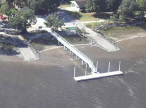
The Blythe Island Beachside Drive boat ramp offers; 2 separate launching lanes, courtesy dock, parking around various areas of park for 20 boat trailers, picnic tables and nicely shaded and fenced playground. No restrooms at this location.
Blythe Island Regional Park Boat Ramp & Boat Lift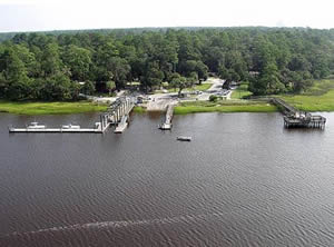 6616 Blythe Island Hwy
Brunswick, GA 31523
GPS 31° 09' 07.80" N 81° 32' 49.56" W
( Waters edge at ramp )
|
|
|
Blythe Island Regional Park boat ramp and boat lift up to 10,000 lbs along the South Brunswick River offers; 2 launching lanes, boat lift ( extra fee ) to save your trailer from the saltwater, courtesy dock, parking for probably 40 boat trailers around various areas of park, pavilions and restrooms. Overnight docking is available for campers.
The Clarence Hilburn fishing pier on site also.
Jekyll Creek Boat Ramp Closest intersection is;
South River View Drive & Harbor Road
Jekyll Island, GA 31527
Go South on South River View Drive for 1/2 mile, turn right near tidelands nature center and go around pond and ramp is about another 1/2 mile.
GPS 31° 02'30.55" N 81° 25'16.95" W
( Entrance area )
GPS 31° 02'19.35" N 81° 25'07.27" W
( Waters edge at ramp )
See a Video of The Jekyll Creek Boat Ramp.
|
|
|
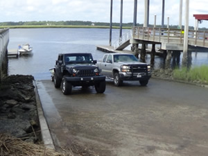
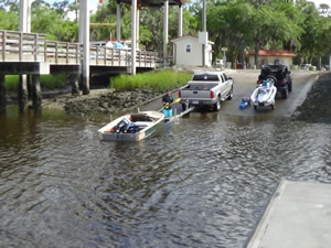
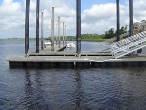
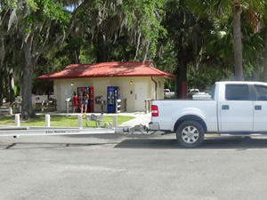
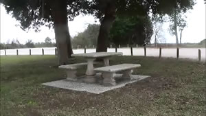
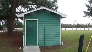
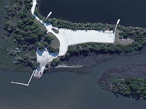
The Jekyll Creek boat ramp is located behind the Tidelands Nature Center on Jekyll Island, Georgia. The facility offers nice wide ramp, courtesy dock, washdown station, picnic table, parking for 75+ boat trailers and restrooms. Hand launch your canoe or kayak at this location.
The courtesy dock is also a fishing pier. Please be courteous with fishermen.
MacKay River Boat Ramp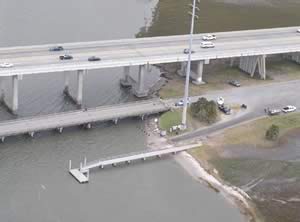 Torras Causeway & Marina Drive
St. Simons, GA 31522
Turn into Marina Drive and then turn right onto next road and ramp is 1/3 rd of a mile down.
GPS 31° 10' 14.00" N 81° 25' 24.55" W
( Waters edge at ramp )
|
|
|
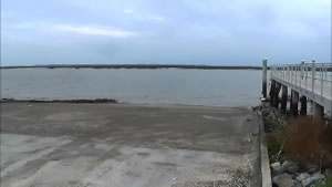
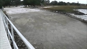
The Mackay River boat ramp offers; single launching lane, courtesy dock and parking for about 30 boat trailers most of this parking can be under the shade of the bridge. Watch the swift cross currents at this location. No restrooms at this location.
There is a fishing pier here also.
Sidney Lanier Park Boat Ramp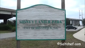 Closest intersection is;
Glynn Avenue & Conservation Way
Brunswick, GA 31520
This intersection is at the northern base of the bridge, turn in and make a left and the ramp is under the bridge.
GPS 31° 07'26.50" N 81° 28'50.54" W
( Waters edge at ramp )
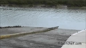
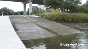
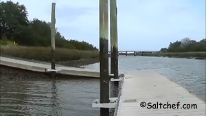
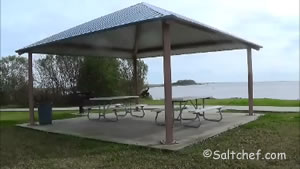
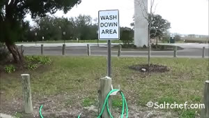
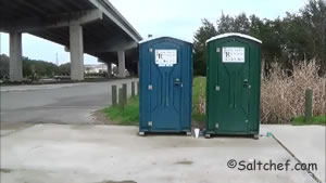
The Sidney Lanier Park boat ramp along the South Brunswick River offers; 2 launching lanes ( a little steep ), floating courtesy dock, wash down station, picnic tables, picnic pavilions, 50 boat trailer parking spaces and port-o-lets.
There is a fishing pier on site also.
See a Video of The Sidney Lanier Park boat ramp.
South Brunswick River Boat Ramp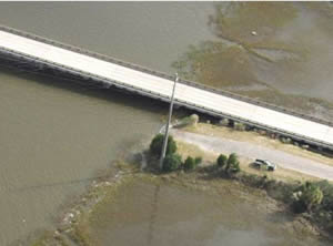 Closest intersection is;
Georgia Highway 303 & Anchor Drive
Brunswick, GA 31523
From the above intersection travel 1/4 mile north on GA 303 and access road will be on the left.
GPS 31° 09' 09.49" N 81° 34' 07.86" W
( Waters edge at ramp )
|
|
|
The South Brunswick River boat ramp offers; single lane ramp, no courtesy dock and parking for 10 boat trailers along side of access road. Access road can be rough careful when coming off highway.
No restrooms at this location.
St Simons Island Marina Boat Lift up to 26'
1000 Arthur J. Moore Drive
St Simons, GA 31522
912-638-7520
6:30 - 5:30 Weekdays
6:00 - 6:00 Weekends
GPS 31° 10'13.31" N 81° 24'32.01" W
( Lift area )
The St Simons Island Marina offers; a boat lift capable of putting vessels up to 26' in length into the water, parking in a wooded area for about 60+ trailers, restrooms, fish cleaning table and bait is normally available. The Gascoigne Bluff fishing pier is just down the road also.
Upper Turtle River Boat Ramp
Closest intersection is;
Georgia 99 & Georgetown Road
Brunswick, GA 31523
Entrance will be on left 3/10ths of a mile north on 99 from above intersection.
GPS 31° 12'57.52" N 81° 40'08.81" W
( Waters edge at ramp )
|
|
|
The Upper Turtle River Ramp offers no amenities and is technically freshwater, but you can easily navigate towards salt and brackish waters from here. Watch height of railroad bridge 3 miles down stream.
Village Creek ~ Harrington Boat Ramp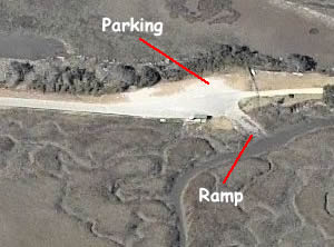 Closest intersection is;
Clapper Rail Lane & South Harrington Road
St. Simons, GA 31522
From the above intersection travel east on South Harrington road for 3/10ths of a mile to the ramp.
GPS 31° 12' 19.37" N 81° 21' 36.47" W
( Waters edge at ramp )
|
|
|
The Village Creek ~ Harrington boat ramp is along the Black Bank River and offers; single lane ramp, no courtesy dock and parking for about 15-18 boat trailers, fish cleaning table and a single table and bench under the small area at the cleaning table.
No restrooms at this location. Please be sure to not block the private driveway at the end.
Useful Links
| Public Boat Ramps in Glynn County Georgia |
| Areas in Glynn County, Georgia include; Brunswick, Country Club Estates, Dock Junction, Everett, Jekyll Island, Sea Island, Sterling, St. Simons and Thalmann. |
| Bodies of brackish and saltwater in Glynn County, Georgia include; Acamemy Creek, Altahama River, Atlantic Ocean, Back River, Belle Point Creek, Black Bank River, Brailsford Creek, Brunswick River, Buck Swamp, Buffalo River, Bungalow Creek, Burnett Creek, Cedar Point Creek, Chubbs Creek, Clubbs Creek, Cowpen Creek, Crooked Creek, Cypress Mill Creek, Dillard Creek, Dunbar Creek, Dupree Creek, Eagle Nest Creek, East River, Fancy Bluff Creek, Frederica River, Gibson Creek, Grant Creek, Hampton River, Hillery Slough, Hog Crawl Creek, Jekyll River, Jekyll Sound, Jointer Creek, Jones Creek, Jove Creek, Latham River, Little Buffalo Creek, Little Stailla River, Laurel Grove Creek, Little River, Long Creek, Mackay River, Morrison Slough, Mosquito Creek, New Hope Creek, Oatland Creek, Oglethorpe Bay, Parsons Creek, Pine Creek, Plantation Creek, Postell Creek, Ratcliffe Creek, Sam Creek, South Altamaha River, South Brunswick River, St Simons Sound, Tayla Creek, Terry Creek, Troup Creek, Tuirtle River, Village Creek, Wallys Leg, White Oak Creek, Wilson Creek and Yellow Bluff Creek. |
![]() Home
Home
![]() About
About
![]() Sitemap
Sitemap
![]() Credits
Credits
![]() Privacy
Privacy
![]() Advertise
Advertise
![]() Contact
Contact
![]()
