Hampton, Poquoson, Virginia ~ Boat Ramps
- National &
State Parks - City Parks
- Boat Ramps
Hampton - Fishing Piers
Hampton - Map of
Boat Ramps - Boat Ramps
Adjoining Counties
Public Boat Ramps in Hampton, Virginia
Seach our site below
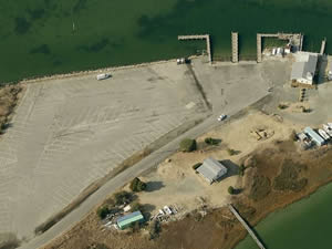
Fox Hill ~ Dandy Boat Ramp Closest intersection is;
Dandy Point Road & Dandy Haven Road
Hampton, VA 23664
From the above intersection go down Dandy Point Road for 1/3 mile to the ramp.
GPS 37° 05'46.05" N 76° 17'40.85" W
( Waters edge at ramp )
|
|
|
The Fox Hill ~ Dandy Boat Ramp along the Back River offers; 3 launching lanes, courtesy docks, about 90 trailer parking spaces and portable toilets.
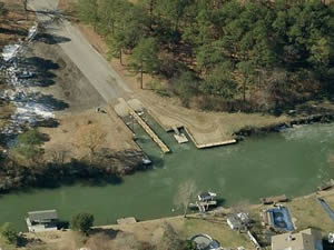
Gosnold's Hope Park Boat Ramp Closest intersection is;
Shelby Avenue & Marshall Street
Hampton, VA 23669
From the above intersection go down Shelby Avenue for 250' ramp area on the right.
GPS 37° 04'30.15" N 76° 19'44.93" W
( Waters edge at ramp )
|
|
|
The Gosnold's Hope Park Boat Ramp along the Southwest Branch of the Back River offers; 2 launching lanes, courtesy docks, about 30 trailer parking spaces and restrooms at main park area.
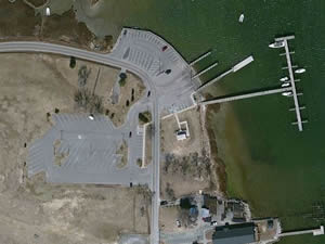
Messick Point Boat Ramp Closest intersection is;
Messick Road & Ridge Road
Poquoson, Virginia 23662
From the above intersection go south on Messick Road for 1.2 miles ramp area on the left.
GPS 37° 06'38.74" N 76° 19'09.11" W
( Waters edge at ramp )
|
|
|
The Messick Point Boat Ramp along the Back River offers; 4 launching lanes, courtesy docks, 48 paved trailer parking spaces and restrooms.
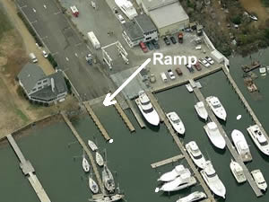
Sunset Creek Boat Ramp Closest intersection is;
Marina Road & Ivy Home Road
Hampton, Virginia 23669
From the above intersection go down Marina Road for 400' ramp area on the left.
GPS 37° 00'59.08" N 76° 20'46.28" W
( Waters edge at ramp )
|
|
|
The Sunset Creek Boat Ramp at the mouth of the Hampton River offers; 2 launching lanes, courtesy docks, 16 trailer parking spaces and portable toilets.
Useful Links
| Virginia Saltwater Fishing Regulations | Safe Handling of Self Caught Seafood |
| Videos of Fishing Knots | |
| Seafood Recipes | Fish of the Atlantic |
| Public Boat Ramps in Hampton, Virginia |
| Bodies of Brackish & Saltwater in Hampton, Virginia Include; Back River, Bennett Creek, Chesapeake Bay, Easton Cove, Hampton River, Harris River, James River, Lambs Creek, Lyons Creek, Mill Creek, Northwest Branch Back River, Poquoson River, Roberts Creek, Southwest Branch Back River and Whitehouse Cove. |
![]() Home
Home
![]() About
About
![]() Sitemap
Sitemap
![]() Credits
Credits
![]() Privacy
Privacy
![]() Advertise
Advertise
![]() Contact
Contact
![]()
