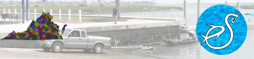
Boat Ramps
in
Chesapeake County, Norfolk & Portsmouth, Virginia
Seach our site below
Elizabeth River Park Boat Ramp 1400 Elizabeth River Way
Chesapeake, Virginia 23322
757-494-1202
GPS 36° 48'32.48" N 76° 17'08.08" W
( Ramp area )
Operated by the City of Chesapeake. The facility offers, about 30 paved trailer spots, 2 launching lanes, courtesy docks, picnic shelters, grills, playground & restrooms.
A fishing pier is on site also.
|
|
|
Great Bridge Lock Park Boat Ramp 100 Locks Road
Chesapeake, Virginia 23322
757-382-6411
GPS 36° 43'31.72" N 76° 14'48.66" W
( Ramp area )
|
|
|
Operated by the City of Chesapeake. Along the S. Branch Elizabeth River the facility offers, 26 paved trailer spots, 2 launching lanes, courtesy docks, floating launch for kayaks, picnic shelters, grills, playground and restrooms.
Haven Creek Boat Ramp Closest intersection is;
Llewellyn Avenue & Delaware Avenue
Norfolk, Virginia 23504
Basically on the NW corner of this intersection
GPS 36° 53'03.14" N 76° 17'02.08" W
( Ramp area )
|
|
|
Operated by the City of Norfolk, the Haven Creek boat ramp offers, 16 paved trailer spots, single launching lane and courtesy dock.
Portsmouth City Park Boat Ramp Closest intersection is;
Cpl J M Williams Avenue & Clifford Street
Portsmouth, Virginia 23701
Ramp is 7/10ths of a mile down Cpl J M Williams Avenue from above intersection.
GPS 36° 50'04.24" N 76° 22'17.49" W
( Ramp area )
|
|
|
Along the W. Branch Elizabeth River the facility offers, 60 paved trailer spots, 4 launching lanes, courtesy docks, playground and restrooms.
Willoughby Spit Boat Ramp At the intersection of;
Bayville Street & 13 View Street
Norfolk, Virginia 23503
GPS 36° 57'50.94" N 76° 17'16.84" W
( Ramp area )
|
|
|
Sitting on 5 acres along the northern section of Willoghby Bay the facility offers, 80 paved trailer spots, 2 launching lanes, courtesy docks and portable restrooms.
Useful Links
| Virginia Saltwater Fishing Regulations | Safe Handling of Self Caught Seafood |
| Videos of Fishing Knots | |
| Seafood Recipes | Fish of the Atlantic |
| Public Boat Ramps in Chesapeake City, Norfolk and Portsmouth, Virginia |
|
|
| Areas around Chesapeake City, Virginia Include; Benefit Bower's Hill, Buell, Camelot, Crestwood, Eva Gardens, Fentress, Gertie, Gilmerton, Grassfield, Great Bridge, Greenbrier, Hickory, Hodges Ferry, Indian River, Mount Pleasant, Northwest, Oak Grove, Oaklette, Portlock, South Norfolk, Sterns Creek and Wallaceton. |
| Bodies of Brackish & Saltwater in Chesapeake City, Virginia Include; Baines Creek, Craney Island Creek, Deep Creek, Drum Point Creek, Eastern Branch Elizabeth River, Elizabeth River, Hoflers Creek, Hull Creek, Indian River, James River, Jones Creek, Julian Creek, Knitting Mill Creek, Lafayette River, Lilly Creek, North Landing River, Paradise Creek, Pescara Creek, Pocaty River, Scott Creek, Scuffleton Creek, Spotico Creek, Steamboat Creek, Tartts Creek, Western Branch Elizabeth River and Willoughby Bay. |
![]() Home
Home
![]() About
About
![]() Sitemap
Sitemap
![]() Credits
Credits
![]() Privacy
Privacy
![]() Advertise
Advertise
![]() Contact
Contact
![]()