Charleston County, South Carolina ~ Fishing Piers
- National &
State Parks - County &
City Parks - Beaches
Charleston - Boat Ramps
Charleston - Fishing Piers
Charleston- Breach Inlet Bridge
- Brittlebank Park Fishing Pier
- Buck Hall Fishing Pier
- Cherry Landing Fishing Pier
- Cooper River County Park
Crabbing & Fishing Pier - Dawho Landing Fishing Pier
- Fort Moultrie Fishing Pier
- Four Poles Park Fishing Pier
- Folly Beach
Ocean Fishing Pier - Garris Landing
Moores Fishing Pier - James Island Park Fishing Pier
- Map of
Piers - Fishing Piers
Adjoining Counties
Public Fishing Piers in Charleston County, South Carolina
Seach our site below
Breach Inlet Bridge
Park at; Thomson Park on Southside
Jasper Boulevard & Middle Street
Sullivan's Island, SC 29482
GPS 32° 46'34.39" N 79° 48'44.12" W
( Center of bridge )
State Road 703, catwalks on both sides of travel lanes, WATCH TRAFFIC ! No facilities. Strong currents.
Brittlebank Park Fishing Pier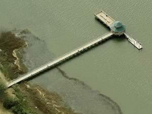 Lockwood Drive & Fishburn Street
Charleston, SC 29403
GPS 32° 47'19.73" N 79° 57'44.96" W
( Foot of pier )
NOAA South Ashley Bridge, Ashley..., SC 8665495
|
|
|
The Brittlebank Park fishing pier along the Ashley River is 320 feet in length with a 70 "L" at the end, with a shade structure. There is a playground nearby and a portable toilet is available.
Buck Hall Fishing Pier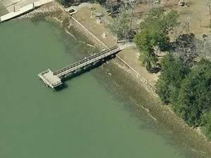 Closest intersection is;
US 17 & Buck Hall Landing Road
McClellanville, SC 29458
Pier is 6/10ths of a mile down Buck Hall Landing Road from the above intersection.
GPS 33° 02'19.49" N 79° 33'38.23" W
( Foot of pier )
NOAA Buck Hall, Awendaw Creek, SC 8663858
|
|
|
The Buck Hall fishing pier is 85 feet in length over the Intracoastal Waterway and has a 25 foot "T" at the end.
A boat ramp is on site also.
Cherry Landing Fishing Pier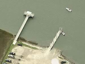 Cherry Point Road & Boat Landing Alley
Wadmalaw Island, SC 29487
Fishing pier is 1/10th of a mile down Boat Landing Alley from above intersection.
GPS 32° 35'52.11" N 80° 10'56.94" W
( Foot of pier )
NOAA Rockville, Bohicket Creek 8667089
|
|
|
The Cherry Landing fishing pier is 170 feet in length over the waters of Bohicket Creek, there is also a shade structure at the end on the "T". No restrooms at this location.
A boat ramp is on site also.
Cooper River County Park Crabbing & Fishing Pier
1010 Tidewater Road
North Charleston, SC 29405
843-406-6966
GPS 32° 49'57.85" N 79° 56'14.28" W
( Foot of northern portion where crabbing and fishing is allowed in designated area)
Fishing and crabbing allowed in designated area on concrete north pier only.
Fishing and crabbing are prohibited on the south side of the north pier between the two walkways leading to the floating docks and from the floating docks.
Fishing requires a valid saltwater fishing license.
Dawho Landing Fishing Pier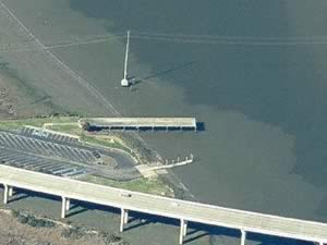 Dawho Road
Be careful as there are 2 Dawho( o ) roads near each other and they confuse entered addresses something terrible.
Best to use actual GPS coordinates below if possible.
GPS 32° 38'07.37" N 80° 20'29.26" W
( Foot of pier )
NOAA South Edisto River At Dawho River, SC 8666616
|
|
|
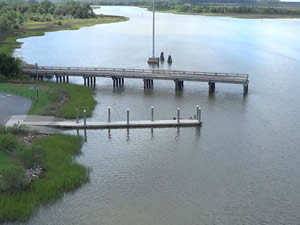

The Dawho Landing fishing pier is 240 feet in length over the ICW. No restrooms at this location.
There is a boat ramp on site also.
Fort Moultrie National Monument / Sullivans Island
1214 Middle Street
Sullivan's Island, SC 29482
Pier is located behind visitor center
GPS 32° 45'44.23" N 79° 51'24.77" W
( foot of pier )
Fishing from pier on the Intracoastal side. No fishing on gangway or past the gangway. Pier is about 150' out over the water with a 130' "T" at the end. Please be respectful of others on the pier.
Folly Beach Ocean Fishing Pier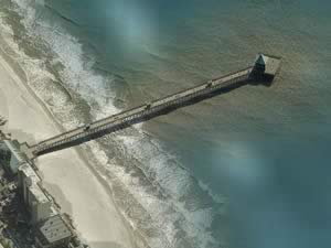 101 East Arctic Avenue
Folly Beach, SC 29439
GPS 32° 39'16.67" N 79° 56'22.17" W
|
|
|
Originally built in the 1930's the Folly Beach Ocean fishing pier is 1045 feet in length over the Atlantic waters. The pier offers; a 1400 sf. shade structure at end, rod rentals, gift and tackle shop and restrooms. Fish, sightsee, bird watch or just relax here.
Hours;
January & February - 8 a.m. – sunset
| March
7 am – sunset |
April
6 a.m. – 10 p.m. |
May – September
6 am – 11 p.m. |
October
6 a.m. – 10 p.m. |
November
7 a.m. – sunset |
December
8 a.m. – sunset
Four Poles Park Fishing Pier
Entrance to park is at the intersection of;
Hillyard Street & Four Poles Park Drive
North Charleston, SC 29405
GPS 32° 52'06.31" N 79° 58'57.53" W
( Foot of pier )
Four Poles pier along Noisette Creek is 170' in length with a 40' "T" at the end.
Garris Landing ~ Moores Fishing Pier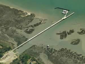 Closest intersection is;
Bulls Island Road & Mossey Grove Lane
Mount Pleasant, SC 29429
Pier is 2/10ths of a mile down Bulls Island Road from the above intersection.
GPS 32° 56'23.86" N 79° 39'26.44" W
( Foot of pier )
|
|
|
Garris Landing fishing pier is 1100 feet in length and is managed by Cape Romain NWR.
There is also a boat ramp on site.
James Island County Park Fishing Pier
871 Riverland Drive
Charleston, SC 29412
Closest intersection within park is;
James Island Parkway & Fisherman's Way
At the above intersection go down Fisherman's wWy for 3/10ths of a mile, nearest parking area for pier will be on the left.
Small entrance fee to the park
GPS 32° 43'47.05" N 79° 59'38.53" W
( Foot of pier )
|
|
|
The James Island County Park fishing pier over a tidal creek off of the Stono River is managed by Charleston County and is 265 feet in total length, of that 75 feet is normally over the water, there is a 65' "L" at the end, with a small shade structure. James Island is a large park with a campingsites, playground, rentable picnic pavilions, hiking trails and restrooms.
John Limehouse Fishing Pier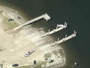 499 Main Road
Johns Island, SC 29455
GPS 32° 46'48.96" N 80° 06'20.82" W
( Entrance to pier area )
GPS 32° 47'05.36" N 80° 06'24.16" W
( Foot of pier )
|
|
|
The John Limehouse fishing pier managed by Charleston County is 110 feet in length over the waters of the Stono River. No restrooms at this location.
There is a
boat ramp on site also.
Mount Pleasant Memorial Waterfront Park Fishing Pier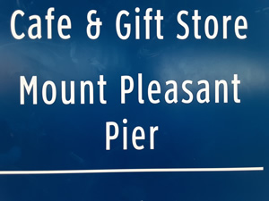 71 Harry Hallman Boulevard
Mount Pleasant, SC 29464
843-762-9946
Small fee for fishing.
GPS 32° 48'06.55" N 79° 54'16.65" W
( Foot of pier )
NOAA 8665530 Charleston, Cooper River Entrance, SC
|
|
|
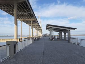
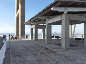
The Mount Pleasant Memorial Waterfront Park fishing pier is 1250 feet in length over Charleston Harbor. Located in the shadow of the Arthur J. Ravenel Jr. Bridge's ( Rt 17 ) east side. No pets on the pier, restrooms are in the concession area. A small fee is charged for fishing.
I have visited alot of piers and this is one of the cleanest I have seen!
Northbridge Park Fishing Pier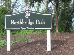 On the south side of Sam Rittenberg Boulevard
where it crosses the Asley River
GPS 32° 50'02.29" N 79° 59'10.75" W
( When going north on Sam Rittenberg )
GPS 32° 50'02.32" N 79° 59'12.03" W
( When going south on Sam Rittenberg )
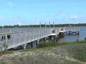
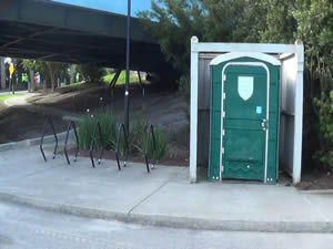
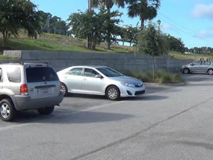
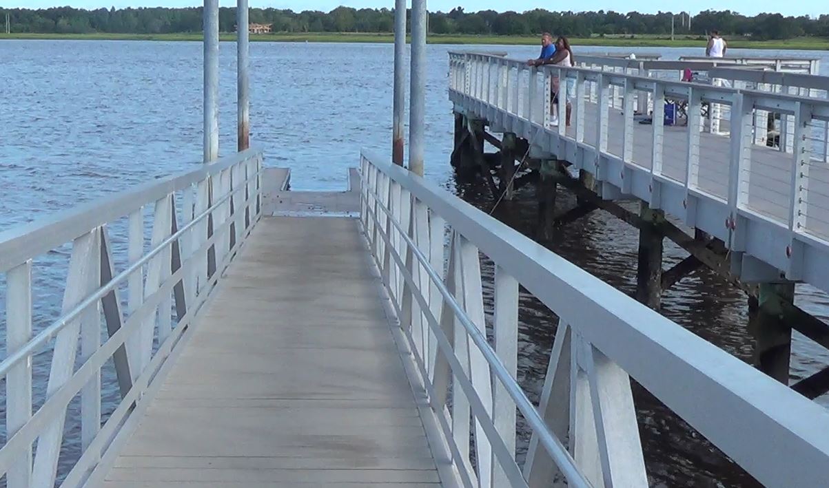
Northbridge Park offers; Fishing pier, floating hand launch deck, picnic tables and port-o-let.
Pitt Street Park | Pickett Park Fishing Pier
998 Pitt Street
Mt Pleasant, SC 29464
Once you get to the end of Pitt Street the foot of the pier is a 1500' walk.
GPS 32° 46'10.50" N 79° 51'43.38" W
( Foot of pier )
The Pitt Street pier is 450 feet in length.
Remley's Point Fishing Pier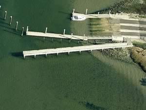 5th Avenue & On the Harbor Drive
Mount Pleasant, SC 29464
Fishing pier is just down 5th Ave. from the above intersection.
GPS 32° 48'48.35" N 79° 54'27.31" W
( Foot of pier )
NOAA Wando River Entrance, Hobcaw Point, SC 8665192
|
|
|
Remley's Point fishing pier on the Wando River is managed by Charleston County and is 190 feet in length. There is also a boat ramp is on site.
R.M. Hendricks Fishing Dock
Closest intersection is;
Virginia Avenue & Lincoln Avenue
North Charleston, SC 29405
Entrance is almost across the street from the above intersection.
GPS 32° 53'29.52" N 79° 58'16.05" W
( Foot of dock )
|
|
|
The R.M. Hendricks fishing dock is managed by the Cooper River Parks Commission along the Cooper River. The park offers; Playground, picnic pavilion and restrooms. A boat ramp is on site also.
Shem Creek Fishing Pier
Closest intersection is;
Shrimp Boat Lane & Coleman Boulevard
Mt Pleasant, SC 29464
Turn onto Shrimp Boat Lane, parking area is immediately on the right.
GPS 32° 47'37.69" N 79° 52'58.68" W
( Entrance onto boardwalk near restrooms )
Getting out to the end of the pier is about a 1900' walk. Restrooms are near the parking area.
Sol Legare Island Fishing Pier
Closest intersection is;
Sol Legare Road & Old Oscar Walker Road
Charleston, SC 29412
Fishing pier is 1 mile down Sol Legare Road from the above intersection.
GPS 32° 40'05.69" N 79° 59'49.75" W
( Foot of pier )
|
|
|
The Sol Lagare fishing pier is 120' in length with a shaded area at the end. Please be aware of boats at the ramp when fishing here. No restrooms at this location.
Steamboat Fishing Pier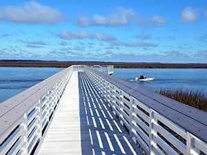 Closest intersection is;
Steamboat Landing Road & Jenkins Hill Road
Edisto Island, SC 29438
Pier is 9/10ths of a mile down Steamboat Landing Road from the above intersection.
GPS 32° 36'08.33" N 80° 17'35.03" W
( Foot of pier )
NOAA Steamboat Creek Landing, SC 8667075
|
|
|
Steamboat fishing pier on Edisto Island is managed by Charleston County and is 180 feet in length over the waters of Steamboat Creek.
No restrooms at this location.
There is also a boat ramp on site.
Sunrise Park Fishing Pier ~ Melton Peter Demetre Park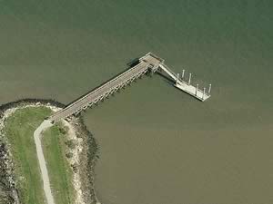 665 Wampler Drive
Charleston, SC 29412
GPS 32° 45'17.14" N 79° 55'00.42" W
( Foot of pier )
NOAA 8665726 FORT JOHNSON, CHARLESTON HARBOR, SC
|
|
|
The Sunrise Park - Melton Peter Demetre fishing pier is 145 feet in length over the southern waters of Charleston Harborand offers; Benches, picnic pavilion & picnic tables and estrooms are there, but have something to be desired.
W.O. Thomas Country Farm Fishing Pier
Bridge View Drive & Corporate Road
North Charleston, SC 29405
GPS 32° 50'10.16" N 80° 01'16.02" W
( Foot of pier )
NOAA I-526 Bridge, Ashley River, SC 8665099
|
|
|
Managed by Charleston County, the Country Farm W.O. Thomas fishing pier is 100 feet in length.
No restrooms at this location.
There is a boat ramp is on site also.
Useful Links
| Public Fishing Piers in Charleston County, South Carolina |
| Areas in Charleston County, South Carolina include; Awendaw, Charleston, Folly Beach, Hollywood, Isle of Palms, Kiawah Island, Lincolnville, McClellanville, Meggett, Mount Pleasant, North Charleston, Ravenel, Rockville, Seabrook Island and Sullivans Island. |
| Bodies of brackish and saltwater in Charleston County, South Carolina include; Adams Creek, Alligator Creek, Anderson Creek, Ashley River, Atlantic Ocean, Bass Creek, Big Bay Creek, Black Island Creek, Bohicket Creek, Breach Inlet, Bulls Bay, Bull Harbor, Bull River, Bullyard Sound, Cape Romain Harbor, Capers Creek, Capers Inlet, Casino Creek, Charleston Harbor, Church Creek, Cinder Creek, Clark Creek, Clark Sound, Clawson Creek, Clouter Creek, Conch Creek, Congaree Boat Creek, Copahee Sound, Copper River, Dawho River, Deep Creek, Dewees Inlet, Devils Den Creek, Dupre Creek, Five Fathoms Creek, Folly River, Goose Creek, Graham Creek, Grays Sound, Green Creek, Grove Creek, Hamlin Creek, Hamlin Sound, Harbor River, Haulover Creek, Hobcaw Creek, Horsebend Creek, Horse Head Creek, Intercoastal Waterway, James Island Creek, Jeremy Creek, Key Creek, Kiawah River, King Flats Creek, Leadenwah Creek, Lighthouse Inlet, Little Pappas Creek, Long Creek, Mark Bay, Mathews Creek, Mill Den Creek, Muddy Bay, Nellie Creek, New Cut, Noisette Creek, North Edisto River, Oak Island Creek, Oyster Bay, Parrot Point Creek, Pappas Creek, Price Creek, Privateer Creek, Racoon Creek, Ram Horn Creek, Rat Island Creek, Robbins Creek, Romain River, Santee Path Creek, Santee River, Schooner Creek, Sett Creek, Seven Reaches Creek, Sewee Bay, Shem Creek, Shrine Creek, Sol Legare Creek, Steamboat Creek, Stono, Swinton Creek, Tibwin Creek, Toogoodoo Creek, Toomer Creek, Wadmalaw River, Wando River, Wappoo Creek and Yellow House Creek. |
![]() Home
Home
![]() About
About
![]() Sitemap
Sitemap
![]() Credits
Credits
![]() Privacy
Privacy
![]() Advertise
Advertise
![]() Contact
Contact
![]()
