Carteret County, North Carolina ~ Fishing Piers
- National &
State Parks - County &
City Parks - Beaches
Carteret - Boat Ramps
Carteret - Fishing Piers
Carteret - Map of
Fishing Piers - &Fishing Piers
Adjoining Counties
Public Fishing Piers in Carteret County, North Carolina
Seach our site below
Beaufort Fishing Pier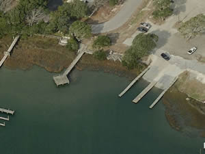 2370 Lennoxville Road
Beaufort, NC 28516
GPS 34° 42'35.30" N 76° 37'56.95" W
( Foot of pier )
NOAA Beaufort, Taylor Creek, NC 8656518
|
|
|
The Beaufort fishing pier along Taylor Creek is about 100' in length. The area has restrooms near boat ramp parking lot and benches along the shoreline and on the pier.
A boat ramp on site also.
Bogue Inlet Ocean Fishing Pier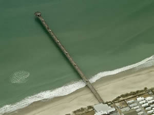 100 Bogue Inlet Drive
Emerald Isle, NC 28594
252-354-2919
Open 24 hours through the fall fishing season. Please call them for the exact dates.
GPS 34° 39'38.40" N 77° 02'02.39" W
( Foot of pier )
NOAA Bogue Inlet TEC2837
|
|
|
The Bogue Inlet Pier is 1000 feet in in length and offers; Lights, benches, shaded seating areas, trash cans and restrooms.
Cedar Point Fishing Pier
144 Cedar Point Boulevard
Cedar Point, NC 28584
GPS 34° 40'39.18" N 77° 06'30.52" W
( Foot of pier )
NOAA Bogue Inlet TEC2837
|
|
|
Amenities include; Fishing pier about 50 feet in length over waters of the White Oak River near Bogue Inlet, 7 vehicle parking spaces and restrooms.
There is a boat ramp on site also.
Cedar Street ~ Emerlad Isles ~ Fishing Pier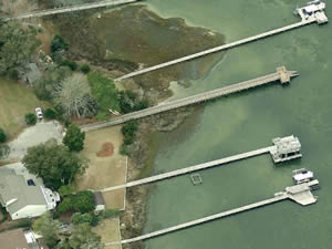 Closest intersection is;
Sound Drive & Cedar Street
Emerald Isle, NC 28594
Pier is 200 feet north on Cedar Street
from the above intersection.
GPS 34° 40'17.34" N 77° 01'57.30" W
( Foot of pier )
NOAA Bogue Inlet TEC2837
|
|
|
The fishing pier at the northern end of Cedar Street in Emerald Isles is 180 feet in length, with a 20 foot "T" at the end, there is a picnic table on the land area and a trash can. Parking for 6-8 cars.
Conchs Point Dock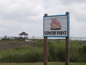 Bay Street & North 7th Street
Morehead City, NC 28557
GPS 34° 43'28.89" N 76° 42'036.78" W
( Foot of pier )
NOAA
The Conchs Point dock is 160' in length over the water, please yield to incoming or out going watercraft.
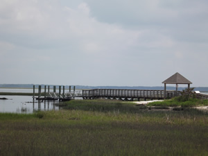
Emerald Isle Fishing Pier
6800 Emerald Drive
Emerald Isle, NC 28594
GPS 34° 40'24.03" N 77° 00'26.33" W
( Pier area )
NOAA Bogue Inlet TEC2837
|
|
|
Emerald Island fishing pier is located at the intracoastal end of the channel serving the boat ramp. The walkway entrance is on the left side of the ramps once you get on the wooden walkway it is about a 1100' walk to the pier area. The area area offers; restrooms, benches, the parking area for cars is behind the launching ramp area.
Emerald Isles Woods Park Fishing Pier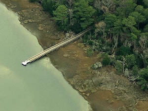 9404 Coast Guard Road
Emerald Isle, NC 28594
GPS 34° 39'48.72" N 77° 04'02.38" W
( Foot of pier )
NOAA Bogue Inlet TEC2837
|
|
|
The Emerald Woods Park fishing pier is 70' in length over the water and offers; Pavilion, grills, restrooms, fishing, hiking, walking and wildlife viewing.
Jaycee Park ~ Morehead City ~ Fishing Piers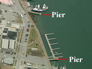 South 9th Street & Shepard Street
Morehead City, NC 28557
GPS 34° 43'09.00" N 76° 42'51.31" W
( Pier at the south end of 9th Street )
GPS 34° 43'10.58" N 76° 42'46.22" W
( Pier at the south end of 8th Street )
NOAA Morehead City Harbor, NC 8656502
|
|
|
The Jaycee Park has 2 small piers near the boat docks. The pier at the end of 9th street is 60 feet in length, the pier at the end of 8th street is about 100 feet in length.
Harkers Island Road Fishing Pier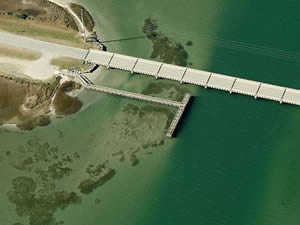 The address below is for the Straits Landing boat ramp
1648 Harkers Island Road
Straits, NC 28516
The pier is located 1200 feet south on Harkers Island Road beyond the above address on the small island that is between the mainland and Harkers Island.
GPS 34° 43'10.92" N 76° 34'33.35" W
( Foot of pier )
NOAA Harkers Island Bridge, NC 8656503
|
|
|
Morehead City Recreational Center Fishing Pier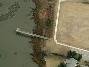 1600 Fisher Street
Morehead City / Carteret, NC 28557
GPS 34° 43'33.32" N 76° 43'29.51" W
( Foot of pier )
NOAA Morehead City, NC 8656496
|
|
|
The Morehead City Recreational Center fishing pier is about 135' in length with 65' of this over the waters of Calico Creek.
Newport River Boat Ramp Fishing Pier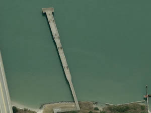 Arendell Street
Morehead City, NC 28557
GPS 34° 43'18.82" N 76° 41'12.94" W
( Foot of pier )
NOAA Morehead City, NC 8656496
|
|
|
The Newport River boat ramp fishing pier is 565' in length over the waters of the Newport River. The pier offers; fish cleaning tables, benches, lighting & restrooms.
A boat ramp is on site also
North 11th Street Fishing Pier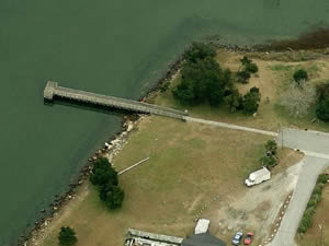 Closest intersection is:
Avery Street & North 11th Street
Morehead City, NC 28557
Pier is 400 feet north on N 11th Street from the above intersection.
GPS 34° 43'34.38" N 76° 42'58.96" W
( Foot of pier )
NOAA Morehead City, NC 8656496
|
|
|
The North 11 Street fishing pier in Morehead City is about 130 feet in length with 65 feet over the waters of the Newport River / Calico Creek.
Oceanana Fishing Pier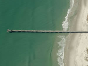 East Fort Macon Road & Oceanana Drive
Atlantic Beach, NC 28512
252-726-0863
Open 24 hours closes November thru April.
Call for exact dates.
GPS 34° 41'50.94" N 76° 43'37.20" W
( Foot of pier )
NOAA Triple ESS Marina, Bogue Sd., NC 8656583
|
|
|
The Oceanana Fishing Pier is 1000 feet in length over the Atlantic waters and offers; Fishing, benches, lights and restrooms.
South 10th Street Fishing Pier ~ Morehead City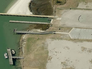 South 10th Street & Shepard Street
Morehead City, NC 28557
GPS 34° 43'08.18" N 76° 42'56.66" W
NOAA Morehead City Harbor, NC 8656502
|
|
|
A small pier only about 40' in length over water, has a 10x16 foot platform at the end.
Located next to the boat ramp.
Useful Links
| Public Fishing Piers in Carteret County North Carolina |
| Areas in Carteret County, North Carolina Include; Atlantic, Atlantic Beach, Beaufort, Bettie, Bogue, Broad Creek, Cape Carteret, Cedar Island, Cedar Point,Davis, Emerald Isle, Gales Creek, Gloucester,Harkers Island, Harlowe, Indian Beach, Lola, Marshalllberg, Merrimon, Mill Creek, Morehead City, Newport, North River, Ocean, Otway, Peletier, Pine Knoll Shores, Salter Path, Sea Gate, Sea Level, Stacy, Stella, Straights, Smyrna, Wildwood, Williston and Wiregrass. |
| Bodies of Brackish and Saltwater in Carteret County, North Carolina Include; Adams Creek, Atlantic Ocean, Back Creek, Back Sound, Big Creek, Bogue Inlet, Bogue Sound, Broad Creek, Brown Creek, Caleb Branch, Cales Creek, Calico Creek, Cedar Bay, Cedar Creek, Core Sound, Crab Point Bay, Dubling Creek, Eastman Creek, East Prong Broad Creek, Gales Creek, Golden Creek, Goose Creek, Great Creek, Hadnot Creek, Harlowe Creek, Howland Creek, Intercoastal Waterway, Issac Creek, Janaquin Creek, Jarrett Bay, Lewis Creek, Long Bay, Middens Creek, Nelson Bay, Newport River, North Bay, North River, North Leopard Creek, Old Canal, Oyster Creek, Pamlico Sound, Parsons Creek, Pettiford Creek, Pettiford Creek Bay, Rattan Bay, Salters Creek, Sleepy Creek, Smyrna Creek, South Leopard Creek, South River, Southwest River, Starkey Creek, The Straights, Thorofare Bay, Tumer Creek, Turnagain Bay, Wade Creek, Ward Creek, West Bay, West Prong Broad Creek, White Oak River, Whitehurst Creek and Williston Creek. |
![]() Home
Home ![]() About
About ![]() Sitemap
Sitemap ![]() Credits
Credits ![]() Privacy
Privacy ![]() Advertise
Advertise ![]() Contact
Contact ![]()
