Carteret County, North Carolina ~ Boat Ramps
- National &
State Parks - County &
City Parks - Beaches
Carteret - Boat Ramps
Carteret - Fishing Piers
Carteret - Map of
Boat Ramps - Boat Ramps
Adjoining Counties
Boat Ramps in Beaufort, Morehead City, Cedar Island, Cartaret County, North Carolina
Seach our site below
Beaufort West Boat Ramp and Hand Launch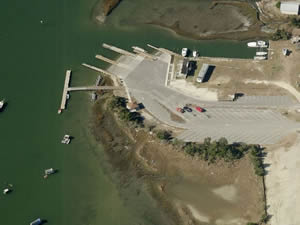 298 West Beaufort Road
Beaufort, NC 28516
GPS 34° 43'31.39" N 76° 39'47.66" W
( Waters edge at ramp )
Go to map of boat ramps in Carteret County
NOAA Gallant Channel, NC 8656451
|
|
|
The Beaufort West boat ramp offers; 2 wide launching lanes, 48 boat trailer spaces, courtesy docks, small shelter near water, hand launching area and restrooms. Access to the open Atlantic waters is easy from this location, through the Beaufort Inlet.
Beaufort Boat Ramp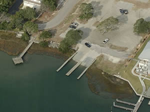 2370 Lennoxville Road
Beaufort, NC 28516
GPS 34° 42'34.52" N 76° 37'55.22" W
( Waters edge at ramp )
Go to map of boat ramps in Carteret County
NOAA Beaufort, Taylor Creek, NC 8656518
|
|
|
The Beaufort boat ramp located along Taylor Creek offers; 2 launching lanes, 31 spaces boat trailer parking spaces, courtesy docks and restrooms.
Fishing pier on site also
Cedar Island National Wildlife Refuge Boat Ramp ~ Base of Thorofare Bridge
Closest intersection is;
Cedar Island Road & Old Cedar Island Road
Atlantic, NC 28511
From the above intersection go north on Route 12 / Cedar Island Road for 3/4 mile to entrance area on the left.
GPS 34° 55'32.95" N 76° 21'53.53" W
The Cedar Island National Wildlife Refuge Boat Ramp is located at the southern base of the Thorofare bridge.
Cedar Island Boat Ramp
115 Driftwood Drive
Cedar Island, NC 28520
GPS 35° 01'07.69" N 76° 18'45.33" W
Adjacent to the Cedar Island ~ Ocracoke Ferry Terminal. The area offers; 2 launching lanes, courtesy docks & 15 designated paved parking spaces for boat trailers.
Cedar Point Boat Ramp ~ Small Craft ~ Croatan National Forest
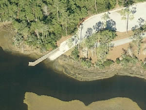 Closest intersection is;
VFW Road & Croatan Forest Road
Croatan National Forest
Cedar Point, NC 28584
Go straight down Croatan Forest Road for 8/10ths of a mile to ramp at end.
GPS 34° 41'28.68" N 77° 05'14.40" W
( Waters edge at ramp )
Go to map of boat ramps in Carteret County
NOAA Bogue Inlet TEC2837
|
|
|
The Cedar Point boat ramp located within the Croatan National Forest offers; Single lane ramp for small craft, courtesy dock, 6 paved designated boat trailer parking spaces & restrooms.
Cedar Point Boat Ramp and Hand Launch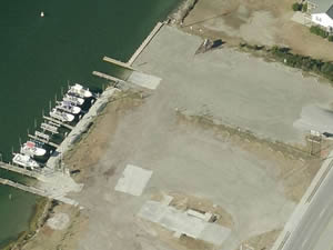 144 Cedar Point Boulevard
Cedar Point, NC 28584
GPS 34° 40'40.19" N 77° 06'32.29" W
( Waters edge at ramp )
Go to map of boat ramps in Carteret County
NOAA Bogue Inlet TEC2837
|
|
|
Amenities at Cedar Point boat ramp include; 37 boat trailer parking spots, 7 vehicles, restrooms and hand launching of kayaks. There is a fishing pier on site also.
Emerald Isle Boat Ramp and Hand Launch
6800 Emerald Drive
Emerald Isle, NC 28594
GPS 34° 40'16.78" N 77° 00'22.00" W
( Waters edge at ramp )
Go to map of boat ramps in Carteret County
NOAA Bogue Inlet TEC2837
|
|
|
Emerald Island boat ramp & hand launch offers; 4 launching lanes, courtesy docks, 112 trailer spots, restrooms and hand launching.
Lola Road Boat Ramp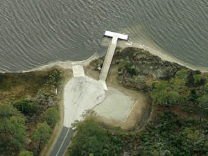 Closest intersection is;
Cedar Island Road & Lola Road
Cedar Island, NC 28520
Ramp is about 2.5 miles down Lola Road from the above intersection.
GPS 34° 57'03.58" N 76° 16'51.86" W
( Waters edge at ramp )
Go to map of boat ramps in Carteret County
NOAA Shell Point, Harkers Island TEC2801
|
|
|
The Lola Road boat ramp offers; Single launching lane, courtesy dock, 20 boat trailer parking spots including an additional lot just up the road.
Moonlight Drive Boat Ramp
Closest intersection is;
Atlantic Beach Causeway & Moonlight Drive
Atlantic Beach, North Carolina 28512
250' down Moonlight Drive from above intersection.
GPS 34° 42'31.79" N 76° 44'17.87" W
( Waters edge at ramp )
NOAA Atlantic Beach Bridge, NC 8656499
|
|
|
The Moonlight Drive boat ramp offers; single launching lane & 3 boat trailer parking spots.
Morehead City Boat Ramp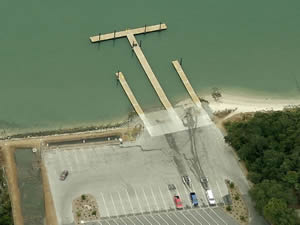 3407 Arendell Street
Morehead City, NC 28557
GPS 34° 43'20.25" N 76° 45'03.67" W
( Waters edge at ramp )
Go to map of boat ramps in Carteret County
NOAA Atlantic Beach Bridge, NC 8656499
|
|
|
The Morehead City boat ramp offers; 2 wide launching lanes, courtesy docks, 33 boat trailer parking spots
Newport River Boat Ramp
Arendell Street
Morehead City, NC 28557
GPS 34° 43'21.26" N 76° 41'12.86" W
( Waters edge at ramps )
|
|
|
The Newport River boat ramp in Morehead City offers; 6 launching lanes, courtesy docks, 54 boat trailer parking spaces and restrooms.
There is a fishing pier on site also.
Oyster Creek Boat Ramp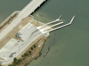 1300 US Hwy 70
Davis, NC 28524
GPS 34° 49'07.90" N 76° 27'03.04" W
( Waters edge at ramp )
Go to map of boat ramps in Carteret County
NOAA Shell Point, Harkers Island TEC2801
|
|
|
The Oyster Creek boat ramp offers; 2 launching lanes, courtesy docks & 15 boat trailer parking spots.
Salters Creek Boat Ramp
200 Wildlife Ramp Road
Sea Level, NC 28577
GPS 34° 53'31.64" N 76° 24'00.43" W
( Waters edge at ramp )
Go to map of boat ramps in Carteret County
NOAA Sea Level, NC StationId: 8655875
|
|
|
Salters Creek boat ramp offers; 15 boat trailer spaces and courtesy dock. Located at the mouth of Salters Creek at Nelson Bay.
Straits Landing Boat Ramp
1648 Harkers Island Road
Straits, NC 28516
GPS 34° 43'18.82" N 76° 34'30.88" W
( Waters edge at ramp )
Go to map of boat ramps in Carteret County
NOAA Harkers Island Bridge, NC 8656503
|
|
|
The Straits Landing boat ramp offers; 2 launching lanes, courtesy docks & 39 boat trailer parking spaces.
South 10th Street Boat Ramp & Hand Launch
South 10th Street & Shepard Street
Morehead City, NC 28557
GPS 34° 43'08.59" N 76° 42'57.68" W
( Waters edge at ramp )
NOAA Morehead City Harbor, NC 8656502
The South 10th Street boat ramp offers; Single launching lane, courtesy docks & parking for about 15-18 boat trailers. Fishing pier next door
West Bogue Sound Boat Ramp | Neighborhood Ramp
West Bogue Sound Drive & West Canal Street
Atlantic Beach, North Carolina 28512
GPS 34° 42'09.95" N 76° 44'12.56" W
( Waters edge at ramp )
Atlantic Beach Bridge, NC - Station ID: 8656499
No Parking at this location, a neighborhood ramp in essence.
Useful Links
| North Carolina Saltwater Fishing Regulations | Safe Handling of Self Caught Seafood |
| Seafood Recipes | Videos of Fishing Knots |
| Public Boat Ramps in Carteret County, North Carolina |
| Areas in Carteret County, North Carolina Include; Atlantic, Atlantic Beach, Beaufort, Bettie, Bogue, Broad Creek, Cape Carteret, Cedar Island, Cedar Point,Davis, Emerald Isle, Gales Creek, Gloucester,Harkers Island, Harlowe, Indian Beach, Lola, Marshalllberg, Merrimon, Mill Creek, Morehead City, Newport, North River, Ocean, Otway, Peletier, Pine Knoll Shores, Salter Path, Sea Gate, Sea Level, Stacy, Stella, Straights, Smyrna, Wildwood, Williston and Wiregrass. |
| Bodies of Brackish and Saltwater in Carteret County, North Carolina Include; Adams Creek, Atlantic Ocean, Back Creek, Back Sound, Big Creek, Bogue Inlet, Bogue Sound, Broad Creek, Brown Creek, Caleb Branch, Cales Creek, Calico Creek, Cedar Bay, Cedar Creek, Core Sound, Crab Point Bay, Dubling Creek, Eastman Creek, East Prong Broad Creek, Gales Creek, Golden Creek, Goose Creek, Great Creek, Hadnot Creek, Harlowe Creek, Howland Creek, Intracoastal Waterway, Issac Creek, Janaquin Creek, Jarrett Bay, Lewis Creek, Long Bay, Middens Creek, Nelson Bay, Newport River, North Bay, North River, North Leopard Creek, Old Canal, Oyster Creek, Pamlico Sound, Parsons Creek, Pettiford Creek, Pettiford Creek Bay, Rattan Bay, Salters Creek, Sleepy Creek, Smyrna Creek, South Leopard Creek, South River, Southwest River, Starkey Creek, The Straights, Thorofare Bay, Tumer Creek, Turnagain Bay, Wade Creek, Ward Creek, West Bay, West Prong Broad Creek, White Oak River, Whitehurst Creek and Williston Creek. |
![]() Home
Home
![]() About
About
![]() Sitemap
Sitemap
![]() Credits
Credits
![]() Privacy
Privacy
![]() Advertise
Advertise
![]() Contact
Contact
![]()
