Beaches in St Augustine, Ponte Vedra & Vilano, St. Johns County, Florida
- National &
State Parks - County &
City Parks - Beaches
St Johns - Boat Ramps
St Johns - Fishing Piers
St Johns - Map of
Beaches - Beaches in
Adjoining
Counties
Fishing on the Beaches of St. Johns County, Florida
Seach our site below
Map & Listing of Beach Accesses in St Augustine south to Flagler County Line
Map & Listing of Beach Accesses in Ponte Vedra & Vilano
Butler Park East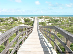
5860 A1A South
St Augustine, FL 32080
GPS 29° 47'12.16" N 81° 15'34.07" W
Go to map of beaches in St Johns County.
Butler Park East offers; Beach access, swimming, surf fishing with respect to swimmers, picnic pavilions, outdoor rinsing showers, restrooms,surfing and leased pets are welocomed. You can also build a sand castle, beach comb or fly a kite.
Go to Video of Butler Park East.
|
|
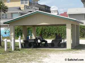
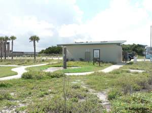
Crescent Beach Park and Drive-on Access
6930 A1A South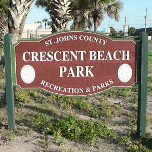 St Augustine, FL 32080
GPS 29° 46'07.82" N 81° 15'10.78" W
Go to map of beaches in St Johns County.
Beach access drive on ramp is right next door, check for permits required and whether it is advisable for you to drive your vehicle on the beach.
Restrooms, rinsing showers, surf fishing, kite flying, surfing, boogie boarding, swimming and picnic shelters. Leashed well behaved pets are welcome when no gifts are left behind.
Go to Video of Crescent Beach Park.
![]() Crescent Beach Park Drive-on Beach Access
Crescent Beach Park Drive-on Beach Access
GPS 29° 46'07.70" N 81° 15'12.02" W
Be sure to follow speed limit signs and travel lanes.
Get your St Johns County beach driving. or pay the daily fee ( March 1 - Sept 30 ) at the beach ramp booth
Pedestrians can also access the beach here.
Fort Matanzas Beach Access and Drive-on Access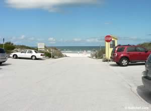
![]() Fort Matanzas Drive-on Beach Access
Fort Matanzas Drive-on Beach Access
GPS 29° 43'00.95" N 81° 13'57.74" W
Go to map of beaches in St Johns County.
|
|
Be sure to follow speed limit signs and travel lane.
You can only drive north from this point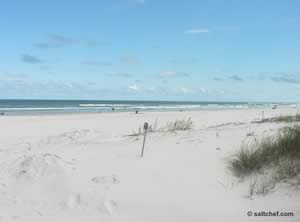 Be sure to get your St Johns County beach driving season passes!
or pay the daily fee ( March 1 - Sept 30 ) at the beach ramp booth
Pedestrians can also access the beach here with no fee.
Fees do apply for beach driving.
Guana Tolomato North Beach Access
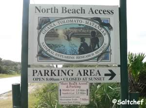
GPS 30° 07'02.25" N 81° 20'45.45" W
( Entrance )
Go to map of beaches in St Johns County.
Approx. 3.2 miles south on A1A from the intersection of Mickler Road and A1A in Ponte Vedra Beach.
Approx 14 miles north of Vilano Town Center.
|
|
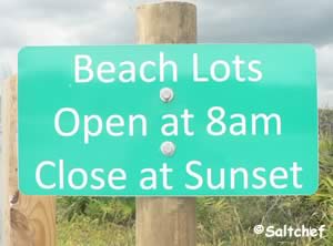
Parking for about 70 cars, Beach is not easily accessible for handicapped persons as there is a wooden walk-over with stairs. Observation area on the wooden walk-over, distance to the observation area on walk-over is about a 300 foot walk from parking lot, the beach is about a 425 foot walk from the parking lot. Surf fishing, beach combing, swimming ( NO Lifeguards ), sunbathing, surfing and scenic views are just some of the activities one can enjoy at this location. Use caution when crossing A1A.
Guana Tolomato Middle Beach Access
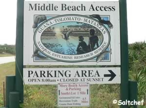
GPS 30° 05'06.82" N 81° 20'16.61" W
( Entrance )
Go to map of beaches in St Johns County.
Approx. 5.4 miles south on A1A from the intersection of Mickler Road and A1A in Ponte Vedra Beach.
Approx 11.8 miles north of Vilano Town Center.
|
|

Parking for about 70 cars, 9 spaces for longer recreational type vehicles ( No camping ). Beach access is across A1A via a wooden walk-over, distance to beach is about 500 foot walk, please be careful when crossing A1A.
Guana Tolomato South Beach Access
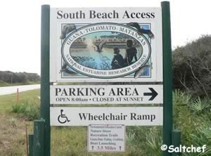
GPS 30° 04'23.21" N 81° 20'06.09" W
( Entrance )
Go to map of beaches in St Johns County.
Approx. 6.2 miles south on A1A from the intersection of Mickler Road and A1A in Ponte Vedra Beach.
Approx 11 miles north of Vilano Town Center.
|
|

Parking for about 100 cars, about a 360 foot walk to the beach from the parking lot via a wooden walk-over, ramps have also been installed to make walking up the dunes a little easier than the stairs.
Mickler's Landing Beachfront Park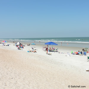
Closest intersection is;
Ponte Vedra Boulevard & Micklers Road
Ponte Vedra, FL 32082
800 feet up Ponte Vedra Boulevard from the above intersection on the right.
GPS 30° 09'43.08" N 81° 21'28.03" W
( Entrance )
Go to map of beaches in St Johns County.
|
|
Mickler's Landing Beachfront Park offers; Beach Access, parking lot for about 125+/-, restrooms, rinsing showers, handicapped accesible dune walkover, grills, surfing, surf fishing with respect to swimmers, horseback riding, lifeguards staffed seasonally ( please check ).
Go to Video of Mickler's Landing Park.
Horseback riding from this park north:
Restricts riding from the northern boundary of the Guana Tolomato Matanzas National Research Reserve to the Duval County line between April 15th and September 15th between the hours of 9:00 am and 5:00 p.m on Saturday, Sunday, and Federal Holidays.
Horseback riding from this park south:
No restrictions on time of year.
Nease Beach Front Park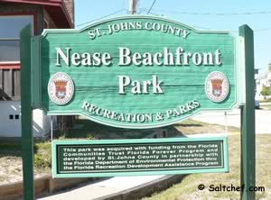 450 feet north on A1A from the intersection of;
A1A and Gardener Street
Vilano Beach, FL 32084
Parking lot on west side of road and beach walk-over on east side. Watch traffic!
GPS 29° 55'36.51" N 81° 17'44.77" W
( Entrance )
Go to map of beaches in St Johns County.
The Nease Beachfront Park offers; Beach access, parking in lot for 18 +/- cars. No restrooms or rinsing showers at this location. Please be very careful crossing A1A when accessing the beach. The park also offers a wildlife viewing area along the marsh.
|
|
North Beach Park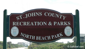
3721 Coastal Highway
Vilano Beach, FL 32084
Approx. 1.6 miles north on A1A from
Vilano Town Center
GPS 29° 56'28.07" N 81° 18'03.42" W
( Entrance to park )
Go to map of beaches in St Johns County.
|
|
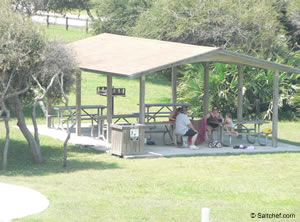
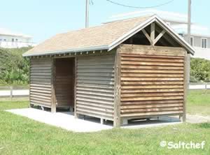
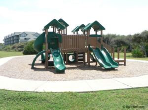
North Beach Park offers; Beach access, restrooms, picnic shelter, playground, swimming, sunbathing, shelling, wildlife viewing, surf fishing, parking for 65 +/-. Please be aware that there are stairs at walkover to get to beach.
Go to Video of North Beach Park.
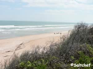
Ocean Hammock Park Beach Access
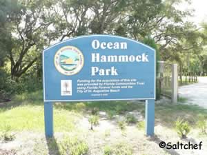 Entrance is across the street from the intersection of;
A1A Beach Boulevard & Whispering Oaks Circle
St. Augustine, FL 32080
GPS 29° 49'56.13" N 81° 16'09.98" W
( Entrance to parking area )
|
|
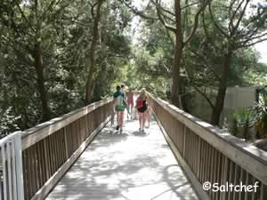
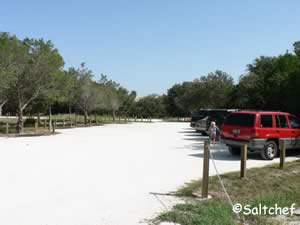
It is about a 1400 foot walk from the parking lot to the beach over a nice wooden walkway. There is one handicapped parking spot at the road.
Pope Road Beach Access
Pope Road & A1A
St Augustine, FL 32080
GPS 29° 51'33.72" N 81° 16'01.26" W
NOAA
Beach access to the southern end of Anastasia State Park. Parking for about 24 cars, port-o-lets, rinsing showers and an elevated viewing structure with shade.
St Augustine Beach | Multiple Access Points
Link for Beach Access Map & Listings is Below |
Map & Listing of Beach Accesses in St Augustine south to Flagler County Line
East end of Pope Road ~ GPS 29° 51'33.73" N 81° 16'01.46" W
To the north is Anastasia State Park Beach, you can access the State Park beach for free when you walk-in from the south. Access into the interior of the State Park is limited to paying customers. No pets are allowed on Anastasia State Park Beach. To the south are St Johns County beaches which allow leashed well behaved pets. Surf fishing, shelling, walking, running, kite flying, swimming and surfing are just a few of the activities you can enjoy from this location. The St Johns County Ocean Fishing Pier is a short walk down the beach.
St Johns County Pier Beach Access ~ GPS 29° 51'25.88" N 81° 16'01.58" W
Restrooms, showers, pavilion ( check for availability ), volleyball courts, ocean fishing pier ( small fee ), surfing, swimming, seasonal lifeguards, kite flying, sunbathing and many other relaxing activities.
Parking for about 100 cars.
End of 16th Street ~ GPS 29° 51'19.07" N 81° 16'01.44" W
End of 3rd Street ~ GPS 29° 50'47.90" N 81° 16'02.26 W
![]() "A" Street Drive-on Beach Access ~ GPS 29° 50'40.67" N 81° 16'02.44" W
"A" Street Drive-on Beach Access ~ GPS 29° 50'40.67" N 81° 16'02.44" W
First drive-on access all traffic heads south from here.
Be sure to get your St Johns County beach driving season passes!
or pay the daily fee ( March 1 - Sept 30 ) at the beach ramp booth
Pedestrians can also access the beach here.
![]() Ocean Trace Drive-on Beach Access ~ GPS 29° 49'18.97" N 81° 16'13.69" W
Ocean Trace Drive-on Beach Access ~ GPS 29° 49'18.97" N 81° 16'13.69" W
Be sure to follow speed limit signs and travel lane.
Be sure to get your St Johns County beach driving season passes!
or pay the daily fee ( March 1 - Sept 30 ) at the beach ramp booth
Pedestrians can also access the beach here
![]() Dondanville Road Drive-on Beach Access ~ GPS 29° 48'56.22" N 81° 16' 06.67" W
Dondanville Road Drive-on Beach Access ~ GPS 29° 48'56.22" N 81° 16' 06.67" W
Be sure to follow speed limit signs and travel lane.
Be sure to get your St Johns County beach driving season passes!
or pay the daily fee ( March 1 - Sept 30 ) at the beach ramp booth
Pedestrians can also access the beach here.
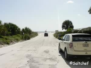
![]() Matanzas Avenue Drive-on Beach Access ~ GPS 29° 47'41.66" N 81° 15'43.92" W
Matanzas Avenue Drive-on Beach Access ~ GPS 29° 47'41.66" N 81° 15'43.92" W
Be sure to follow speed limit signs and travel lane.
Be sure to get your St Johns County beach driving season passes!
or pay the daily fee ( March 1 - Sept 30 ) at the beach ramp booth
Pedestrians can also access the beach here.
![]() Mary Street Drive-on Beach Access ~ GPS 29°
47'20.41" N 81° 15'36.69" W
Mary Street Drive-on Beach Access ~ GPS 29°
47'20.41" N 81° 15'36.69" W
Be sure to follow speed limit signs and travel lane.
Be sure to get your St Johns County beach driving season passes!
or pay the daily fee ( March 1 - Sept 30 ) at the beach ramp booth
Pedestrians can also access the beach here.
|
|
South Ponte Vedra Beach Recreation Area
2.5 miles south of Guana Tolomato
or
About 5.2 miles north of Vilano Town Center.
Limited parking, restrooms, picnic shelter, grills, stairs going to the beach.
GPS 29° 59'25.12" N 81° 18'54.57" W
( Parking area )
Go to map of beaches in St Johns County.
|
|
Spyglass Beach Access
8202 A1A South
St. Augustine, FL 32080
GPS
29°43'55.24" N 81° 14'23.45" W
The Spyglass Access offers; Swimming, surfing, surf fishing with respect to swimmers, parking for 20 cars and a wooden walk-over to the beach. No restrooms at this location.
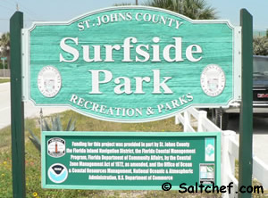
Surfside Park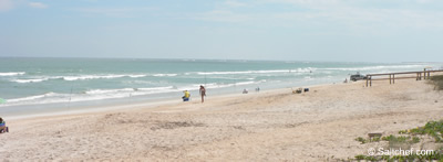
3070 Coastal Highway A1A
St Augustine, FL 32084
GPS
29°55'25.52" N 81° 17'40.26" W
Go to map of beaches in St. Johns County.
|
|
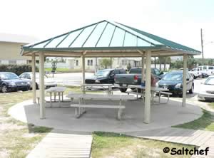
No Fees, walk-over to the beach, small pavilion, restrooms, rinsing showers, beautiful coquina sand beach.
Horseback riding often starts from this access heading north towards Mickler Park with no restrictions on time of year ( check tidal conditions though ).
North of Mickler Beach Front Park in Ponte Vedra other restrictions do apply.
Go to Video of Surfside Park.
Usina Beach
4100 Coastal Highway
St Augustine, FL 32082
GPS 29° 57'08.13" N 81° 18'16.30" W
( Entrance to parking )
Go to map of beaches in St Johns County.
|
|
Vilano Beach Pavilion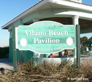
2725 Anahma Drive
St Augustine, FL 32084
GPS 29° 55'00.68" N 81° 17'27.18" W
Go to map of beaches in St Johns County.
Restrooms, dune walkover, showers, picnic shelter
( check for availability 1-904-209-0333 )
Go to Video of Vilano Beach Pavilion.
|
|
![]() Vilano Beach Drive-on Beach Access 1
Vilano Beach Drive-on Beach Access 1
GPS 29°
55'00.78" N 81° 17'26.19" W
( East end of Vilano Road )
![]() Vilano Beach Drive-on Beach Access 2
Vilano Beach Drive-on Beach Access 2
GPS 29°
54'43.81" N 81° 17'32.40" W
( Genoa Road )
Be sure to follow speed limit signs and stay in the travel lane.
Be sure to get your St Johns County beach driving season passes!
or pay the daily fee ( March 1 - Sept 30 ) at the beach ramp booth
Pedestrians can also access the beach here.
Useful Links
| Beaches in St. Johns County Florida |
| Areas in St. Johns County Florida include; St Augustine, Ponte Vedra, Vilano, St Augustine Beach, Nocatee, World Golf Village, Butler Beach, Palm Valley, Crescent Beach and Fruit Cove. |
| Bodies of brackish and saltwater in St. Johns County Florida include; Atlantic Ocean, Cabbage Creek, Capo Creek, Casa Cola Creek, Cunningham Creek, Cut Creek, Deep Creek, Durbin Creek, East Creek, Guana River, Hospital Creek, Intracoastal Waterway, Julington Creek, Matanzas Inlet, Matanzas River, Marshall Creek, Moultrie Creek, Pancho Creek, Pellicer Creek, Red House Branch, Robinson Creek, Salt Run, San Sebastian River, Six Mile Creek, Smith Creek, Sombrero Creek, St Augustine Inlet, St Johns River, Stokes Creek, Tolomato River, Ximanies Creek. |
![]() Home
Home ![]() About
About ![]() Sitemap
Sitemap ![]() Credits
Credits ![]() Privacy
Privacy ![]() Advertise
Advertise ![]() Contact
Contact ![]()
