Franklin County, Florida ~ Beaches
- National &
State Parks - County &
City Parks - Beaches
Franklin - Boat Ramps
Franklin- Abercrombie Boat Ramp
AKA Pine Log - Battery Park Boat Ramp
- Carrabelle City Boat Ramp
- Carrabelle Marine Street
Public Boat Ramp - Cow Creek Boat Ramp
Hand Launch - Doyle Creek Boat Ramp
- East River Landing Boat Ramp
- Gardner Landing Boat Ramp
- Indian Creek Park Boat Ramp
Old Ferry Dock - Ochlockonee Bay Bridge
Boat Ramp - Ochlockonee State Park
Boat Ramp
Actually Wakulla County
- Rock Landing
Crooked River Boat Ramp - St. George Island Bridge
West Side Boat Ramp
New Area - St. George Island Bridge
West Side Boat Ramp
Old Area - St. George Island State Park
Boat Ramp 1 - St. George Island State Park
Boat Ramp 2 - St. Teresa Wayside Boat Ramp
- Seafood Landing Park
- Sun & Sands Boat Ramp
- Tates Hell State Forest
Cash Creek Boat Ramp - Timber Island Boat Ramp
- Whiskey George Creek Boat Ramp
- Abercrombie Boat Ramp
- Fishing Piers
Franklin - Map of
Beaches - Beaches in
Adjoining Counties
Fishing at Beaches in Franklin County, Florida
Seach our site below
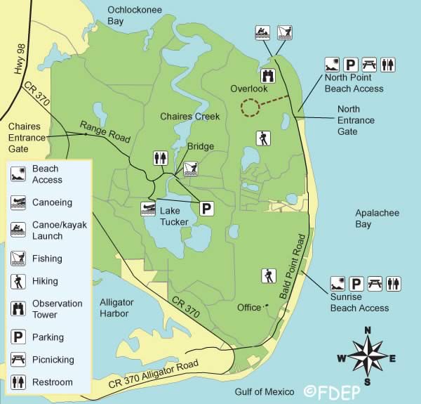
Bald Point State Park Beach ~ North Entrance Gate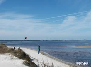 Closest intersection is;
Alligator Drive & Bald Point Road
Panacea, FL 32346
Approx. 3 miles east on Bald Point Road from the above intersection.
GPS 29° 56'15.34" N 84° 20'14.52"
( Entrance gate )
NOAA Bald Point Ochlockonee Bay, FL 8728237
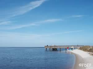
Located on Alligator Point and encompassing 4065 acres, where Ochlockonee Bay meets the Apalachee Bay, Bald Point State Park offers a variety of land and water activities. Coastal marshes, pine flatwoods, and oak thickets offer a diverse make-up of biological communities that make Bald Point a popular destination for birding and wildlife viewing. In the fall, bald eagles and other migrating species, such as, monarch butterflies, are commonly seen heading south for the winter. Bald Point offers access to two Apalachee Bay beaches for swimming, sunbathing, fishing, canoeing, kayaking and windsurfing. Facilities include a fishing dock and picnic pavilions. Species of fish in the brackish tidal water are mackeral, trout and flounder.
Carrabelle Beach
1.5 miles west of Carrabelle on US 98
GPS 29° 49'45.48" N 84° 41'32.87" W
NOAA Cat Point, Apalachicola Bay, FL 8728619
Nice uncrowded beach along St George Sound very close to Carrabelle, 14 small picnic shelters with grills, restrooms and parking for about 40 vehicles. Surf fishing is a popular activity near this beach.
St. George Island Beach Accesses
Clicking on the above link will take you to a chart showing beach access locations on
St. George Island.
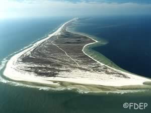
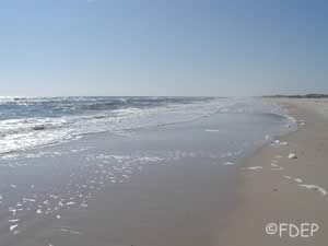
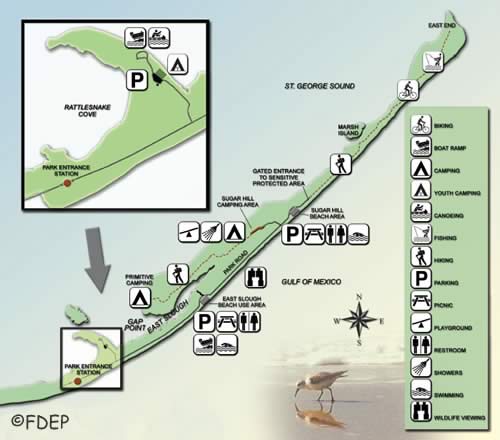
St. George Island State Park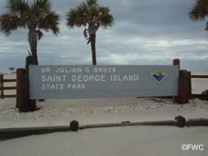 4.5 miles east on CR 300
GPS 29° 41'05.34" N 84° 47'42.36" W
( Entrance gate )
NOAA St. George Island,east End, FL 8728548
Once you go through the gate the first large parking area is about 2.5 miles into the park, the second large lot is another 2 miles past the first. The 2 main parking areas have pavilions and restrooms. The eastern most point of St George Island would be about a 3.7 mile walk one way on the beach from the 2nd parking lot.
Sunrise Beach ~ Before Gates to Bald Point State Park
Closest intersection is;
Alligator Drive & Bald Point Road
Panacea, FL 32346
Approx. 1¼ miles east on Bald Point Road from the above intersection.
GPS 29° 54'52.32" N 84° 20'12.10" W
( Entrance )
NOAA Bald Point Ochlockonee Bay, FL 8728237
Useful Links
| Beaches in Franklin County Florida |
|
|
| Areas in Franklin County Florida Include; Alligator Point, Apalachicola, Bald Point, Carrabelle, Eastpoint, Lanark Village and St. Teresa. |
| Areas of Salt and Brackish Water Franklin County Florida Include; Acorn Lake Creek, Alligator Harbor, Apalachicola Bay, Bear Creek, Big Bay, Big Bayou, Blounts Bay, Carabelle River, Cash Creek, Chipley Creek, Crooked River, Dickerman Cut, East Bay, East River, False River, Grassy Creek, Gulf of Mexico, Jackson River, Little River, Little St Marks River, New River, New River bayou, Ochlockonee Bay, Ochlockonee River, Postum Bayou, Sams Creek Cutoff, Scipio Creek, St George Sound, St Vincent Sound, West Bayou and Whiskey George Creek. |
![]() Home
Home ![]() About
About ![]() Sitemap
Sitemap ![]() Credits
Credits
![]() Privacy
Privacy ![]() Advertise
Advertise ![]() Contact
Contact ![]()
