
Public
Boat Ramps
in
Duval County ~ Jacksonville, Florida
Seach our site below
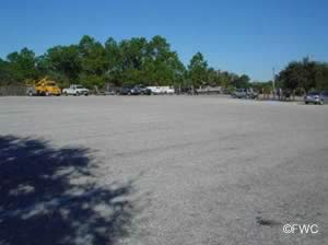
Alamacani Boat Ramp ~ Sand ~ Small Boats ~ Hand Launch
11080 Heckscher Drive
Jacksonville, FL 32226
GPS 30° 25'12.72" N 81° 25'12.34" W
( Waters edge at ramp )
|
|
|
Go to map of boat ramps in Duval County
The Alimicani area provides access to the Fort George River and offers, unimproved soft sand ramp which suitable for launching kayaks - jet skis - jon boats, Not ADA accessible, 7am - 10pm, no fees, no docks or fixed structures at the launching area.

Watch for strong currents here and shifting shoals.
Go to:
Video of the Alamacani Boat Ramp & Hand Launch.
Arlington Lions Club Park Boat Ramp 4322 Richard D. Gatlin Road
Jacksonville, FL 32277
GPS 30° 22'41.67" N 81° 37'15.62" W
( Waters edge at ramp )
Go to map of saltwater boat ramps in Duval County
Sitting on 30 acres the Arlington Lions Club boat ramp offers access to the St. Johns River. Amenities include; 2 boat ramps, 2 boat docks, 60 boat trailer parking spots, hand launch, parking for 40 cars, 3 picnic shelters, grills, picnic tables, benches, a children's playground and toilets which are located up a small road which will be on your left prior to getting to the boat ramp. Fishing pier is on site also.
A wooden walkway along the shoreline links Arlington Lions Club with Blue Cypress Park.
Go to: Video of the Arlington Lions Club Boat Ramp.


Arlington Road Boat Ramp 5130 Arlington Road
Jacksonville, FL 32211
GPS 30° 20'01.95" N 81° 36'43.44" W
( Waters edge at ramp )
|
|
|
Go to map of saltwater boat ramps in Duval County
The Arlington Road boat ramp offers; 2 launching lanes, courtesy docks, 13 boat trailer parking spots, security lighting, Port-O-Let and trash barrel. Arlington Road ramp provides easy access to the St Johns River downtown area of Jacksonville.


Beach Boulevard Ramp ~ AKA ~ Pottsburg Creek Boat Ramp ~ SMALL BOATS 8505 Beach Boulevard
Jacksonville, FL 32216
GPS 30° 17'13.66" N 81° 34'11.02" W
( Waters edge at ramp )
|
|
|
Go to map of saltwater boat ramps in Duval County
Beach Boulevard boat ramp sits on .5 acres along Big Pottsburg Creek and amenities include; Boat ramp, 13 boat traler parking spots, 3 car parking spots, trash receptacles and Port-O-Lets.
Due to the limited clearance at the Beach Boulevard bridge this ramp is only for small boats.
Go to: Video of the Beach Boulevard Boat Ramp & Hand Launch.


Bert Maxwell Boat Ramp 500 Maxwell Road
Jacksonville, FL 32218
GPS 30° 24'12.63" N 81° 39'49.34" W
( Waters edge at ramp )
|
|
|
Go to map of boat ramps in Duval County
The Bert Maxwell boat ramp on the banks of the Trout River in Jacksonville offers; 2 boat ramps, 3 boat docks, restrooms, 45 boat trailer parking spaces, 17 car parking spaces, pavilion, grills, picnic tables and benches.
There is also a very nice fishing pier on site.
Go to: Video of the Bert Maxwell Boat Ramp.


Big Talbot Island ~ Sawpit Creek Boat Ramp
 Big Talbot Island
Jacksonville, FL 32226
GPS 30°30'37.90"N 81°27'38.58"W
( Waters edge at ramp )
|
|
|
Go to map of boat ramps in Duval County
The Sawpit Creek boat ramp located on Big Talbot Island offers; single wide launching lane, courtesy docks, paved parking for 30 & restrooms. There is a small fee to launch here.
Go to: Video of the Sawpit Creek Boat Ramp.


Browns Creek Hand Launch 2.1 miles east on Heckscher Drive from 295 East
GPS 30°25'00.26"N 81°31'47.29"W
( Hand launch )
|
|
|
Be aware of high tides and parking at this location! No other amenities here.
County Dock Road Boat Ramp ~ Hand Launch
 Closest intersection is;
County Dock Road & Mandarin Road
Jacksonville, FL 32223
At the end of County Dock Road, limited parking.
GPS 30°10'04.03"N 81°38'51.64"W
( Hand launch )
The ramp here is not suitable for power boats. Hand launching of kayaks and canoes is OK though.
Fishing pier at this location also.
Curtis Lee Johnson Marina Park Boat Ramp
 Formerly known as;
The Lighthouse Marine Public Boat Ramp
5434 San Juan Avenue
Jacksonville, FL 32210
GPS 30° 16'54.32" N 81° 44'24.91" W
( Waters edge at ramp )
|
|
|
Go to map of boat ramps in Duval County
The Curtis Lee Johnson boat ramp is located along the Cedar River a short distance from the Ortega River and offers; single lane ramp, courtesy docks, parking for 16 boat trailers, small waterside picnic pavilion, trash receptacles and restrooms.
Go to: Video of the Curtis Lee Johnson Boat Ramp.


Dinsmore Boat Ramp
6800 Dunn Avenue Terrace
Jacksonville, FL 32219
GPS 30° 26'12.15 N 81° 45'40.80" W
( Waters edge at ramp )
The Dinsmore boat ramp sits along the upper portion of the Trout River and offers; 2 launching lanes, courtesy dock and parking for about 16 boat trailers. No restrooms at this location.
|
|
|
Dutton Island Hand Launch 793 Dutton Island Road West
Jacksonville, FL 32233
At the southern end of the park on Pablo Creek.
GPS 30°20'25.08"N 81°25'33.06"W
( Entrance area )
GPS 30° 20'10.75 N 81° 26'01.86" W
( Hand launch )
Paddle around Pablo Creek, Kestner Creek, De Blieu Creek, Garden Creek and Cemetery Creek.
Fishing pier on site also.
|
|
|
Fulton Road Landing Boat Ramp
5099 Fulton Road
Jacksonville, FL 32225
GPS 30° 23'21.12" N 81° 30'27.99" W
( Waters edge at ramp )
|
|
|
Go to map of boat ramps in Duval County
Harborview Public Boat Ramp 4100 Harbor View Drive
Jacksonville, FL 32208
GPS 30° 23'47.04" N 81° 42'38.48" W
( Waters edge at ramp )
|
|
|
Go to map of boat ramps in Duval County


Haulover Creek Hand Launch Closest intersection is:
Hecksher Drive & Fort George Road
Jacksinville, FL 32226
From the above intersection go north on Hecksher Drive for 4/10ths of mile to the entrance on left, watch for potholes when entering.
GPS 30°24'29.41"N 81°25'33.31"W
NOAA Mayport Bar Pilots Dock, FL 8720218
|
|
|
Hood Landing Public Boat Ramp 12925 Hood Landing Road
Jacksonville, FL 32223
GPS 30°08'03.99" N 81° 35'47.10" W
( Waters edge at ramp )
|
|
|
Go to map of boat ramps in Duval County
No amenities at this location. Watch where you park to avoid ticketing or towing.


Intracoastal Boat Ramp - Beach Boulevard Boat Ramp - Mark McCue
2510 2nd Avenue N Jacksonville, FL 32207
Hours; open 24 hours 7 days a week
GPS 30°17'24.28" N 81°25'11.72" W
( Waters edge at ramp )
|
|
|
Go to map of boat ramps in Duval County
The Mark McCue / Intracoastal Boat Ramp sitting on almost 2 acres along Pablo Creek offers; 2 wide launching lanes, courtesy dock, 37 trailer spots, 7 car spots, a couple shaded tables near water and portable restrooms.
This facility fills up quickly on weekends, get there early to secure your spot.
Go to: Video of the Intracoastal Boat Ramp.


Jim King Park Boat Ramp at Sisters Creek 8203 Heckscher Drive
Jacksonville, FL 32223
GPS 30° 23'43.70" N 81° 27'33.29" W
( Waters edge at ramp )
|
|
|
Go to map of boat ramps in Duval County
Jim King Park offers; 2 large boat ramps into Sisters Creek ( very close to St Johns River ), 94 boat trailer parking spaces, 360 vehicles parking, wash down faucets for boats, loading and unloading docks, security lighting, picnic tables, grills, restrooms at pier and boat ramp areas, trash barrels, fishing pier, playground near pier, kayak / canoe launching and home to Greater Jacksonville Kingfish Tournament.
Go to: Video of the Jim King Boat Ramp.


Joe Carlucci Park Boat Ramp 8414 Heritage River Road
Jacksonville, FL 32226
GPS 30° 23'30.74" N 81° 27'47.99" W
( Waters edge at ramp )
GPS 30° 23'58.70" N 81° 28'34.63" W
( Entrance to park off Hecksher Drive )
|
|
|
Go to map of boat ramps in Duval County
Joe Carlucci boat ramp and park sits on 5 acres and amenities include; Boat ramp, 24 boat trailer parking spaces, 5 picnic pavilions, picnic tables, grills, benches, drinking fountain, 50 car parking spots, trash receptacles and restrooms.
Go to: Video of the Joe Carlucci Boat Ramp.


John T. Lowe ~ Goodby's Boat Ramp
 9021 San Jose Boulevard
Jacksonville, FL 32257
GPS 30° 12'56.04" N 81° 36'59.25" W
( Waters edge at ramp )
|
|
|
Go to map of boat ramps in Duval County
John Lowe / Goodby's Creek boat ramp in Jacksonville sits on 4 acres and offers; 4 Boat ramps, courtesy docks, 43 boat trailer parking spaces, picnic pavilions and restrooms.
Go to: Video of the John T. Lowe Boat Ramp.


Lonnie Wurn Boat Ramp 4131 Ferber Road
Jacksonville, FL 32277
GPS 30° 22'32.80" N 81° 35'06.25" W
( Waters edge at ramp )
|
|
|
Go to map of boat ramps in Duval County
Lonnie Wurn boat ramp sits on 3.3 acres along Mill Cove and amenities include; Boat ramp, 9 boat trailer parking spaces, picnic pavilion, picnic tables, benches, playground and trash receptacles.


Mandarin Park Boat Ramp 14780 Mandarin Road
Jacksonville, FL 32223
GPS 30° 08'01.18" N 81° 38'03.04" W
( Waters edge at ramp )
GPS 30° 08'19.59" N 81° 38'10.47" W
( Entrance to park off Mandarin Road )
|
|
|
Go to map of boat ramps in Duval County
Comprising almost 37 acres Mandarin Park offers; boat ramp, 45 boat trailer parking spaces, loading and unloading docks, hand launch canoe / kayak, restrooms, 3 pavilions ( reservable ), picnic tables, grills, trash receptacles, 17 benches, playground, shoreline fishing, fishing pier, 35 car parking spaces and restrooms.
Go to: Video of the Mandarin Park Boat Ramp.


Mayport ~ Michael Scanlan Public Boat Ramp 4870 Ocean Street
Mayport, FL 32233
GPS 30° 23'50.20" N 81° 25'41.44" W
( Waters edge at ramp )
Village of Mayport, just east of the Ferry Slip.
|
|
|
Go to map of boat ramps in Duval County
Great ocean access from this ramp approx. 3 miles to open water. Access to the Mayport jetties, Ramp is at capacity during Kingfish tournaments.
75 trailer parking spots ~ Do not let this fool you though, these spots fill up quickly due to this ramps location. Some overflow parking is available.
Picnic area, restrooms, 4 floating docks, 6 ramps, This is an A unlimited rated ramp, ADA accessible, open 24 hours a day 365 days a year, swift currents and wakes from large ocean going vessels can make this ramp challenging at times.
Go to: Video of the Michael Scanlon Boat Ramp.


Oak Harbor Boat Ramp 2428 Seaway Street
Mayport, FL 32233
GPS 30° 21'21.45" N 81° 25'41.75" W
( Waters edge at ramp )
|
|
|
Go to map of boat ramps in Duval County
Go to: Video of the Oak Harbor Boat Ramp.


Palms Fish Camp Public Boat Ramp 6359 Heckscher Drive
Jacksonville, FL 32226
GPS 30° 24'16.95" N 81° 30'25.28" W
( Waters edge at ramp )
|
|
|
Go to map of boat ramps in Duval County
The Palms Fish Camp boat ramp along Clapboard Creek offers; Wide single lane ramp, courtesy dock, parking for 50+/- boat trailers, easy St Johns River access via Clapboard Creek and Port-O-Let.
Go to: Video of the Palms Fish Camp Boat Ramp.


Ribault Club Hand Launch ~ Fort George Island Cultural State Park
Behind the Ribault Clubhouse along the western shores of the Fort George River.
GPS 30°25'41.26"N 81°25'23.69"W
NOAA Fort George Island, FL 8720186
Simpson Creek Hand Launch
Northwest side of the bridge, park at your own risk.
GPS 30°27'48.81"N 81°25'56.48"W
NOAA Simpson Creek, FL 8720168
Sisters Creek Hand Launch
At the back of the Jim King Boat ramp facility.
Fairly long portage.
GPS 30°23'54.37"N 81°27'35.63"W
NOAA Sisters Creek, FL 8720196
St John's River Marina Boat Ramp 901 Museum Circle / 901 Gulf Life Drive
Jacksonville, FL 32207
GPS 30°19'9.86"N 81°39'41.45"W
( Waters edge at ramp )
|
|
|
Go to map of boat ramps in Duval County
The St Johns River marina boat ramp in the downtown of jacksonville offers; 2 launching lanes, courtesy docks, restrooms, 15 trailer parking spaces, a pedestrian dock, museums close by ( science and history), a planetarium very close by ( Alexander Brest Planetarium ). Please be aware of shoaling around the ramp and a steep drop-off at the end of ramp, currents can also be swift here.
Redfish ( fall and winter seem best time of year as the Redfish persue the mullet and shrimp), Flounder ( gets better as we go into the fall months ), Tarpon, Crapie, Largemouth bass, Bluegill, go after Ladyfish, Jacks
Go to: Video of the St Johns Marina Boat Ramp.


Timucuan Preserve Cedar Point Boat Ramp
 This ramp is at the end of Cedar Point Road on the left. About 1.3 miles from the intersection of:
Cedar Point Road & Sawpit Road
Jacksonville, FL 32226
GPS 30° 26'39.48" N 81° 27' 42.06" W
( Waters edge at ramp )
|
|
|
NOAA Fort George Island, FL 8720186
The Timicuan Preserve Cedar Point boat ramp offers; a single launching lane, courtesy dock, parking for about 20 boat trailers, picnic table and restrooms.
Locals say there is a large boulder straight out from the ramp, use caution.
Go to: Video of the Timucuan Preserve Cedar Point Boat Ramp.


T.K. Stokes Public Boat Ramp 2120 Riverview Avenue
Jacksonville, FL 32208
GPS 30° 23'47.93" N 81° 41'06.59" W
( Waters edge at ramp )
NOAA Ribault River, Lake Forest 8720216
|
|
|
Go to map of boat ramps in Duval County
The T.K. Stokes boat ramp sits on 3 acres along the Ribault River and offers; 1 single wide launching lane, courtesy dock, 7 boat trailer parking spaces, benches, small picnic pavilion and portable restrooms.
Go to: Video of the T.K. Stokes Boat Ramp.


Wayne B Stevens Boat Ramp 4555 Ortega Farms Boulevard
Jacksonville, FL 32210
GPS 30° 15'34.60" N 81° 43'38.59" W
( Waters edge at ramp )
|
|
|
Go to map of boat ramps in Duval County
On the Ortega River, a decent amount of parking, restrooms, recently renovated and dredged, fishing, hand launch of canoe or kayaks, 5 ramps, 1 grill, 2 picnic tables, 3 boat docks, 49 boat trailer parking spots, 27 car parking spots, 4.2 acres, 2 benches, species include; white catfish, redear sunfish.
Go to: Video of the Wayne B. Stevens Boat Ramp.


Listings Below are in Clay County
Governor's Creek Boat Ramp ~ Clay County 1300 Orange Avenue
Green Cove Springs, FL 32043
GPS 30° 00' 25.14" N 81° 41' 28.38" W
( Waters edge at ramp )
NOAA Red Bay Point, St Johns River, FL 8720503
Go to: Video of the Governor's Creek Boat Ramp.


Knight Boat Ramp ~ Clay County
 1485 River Lane
Green Cove Springs, FL 32043
GPS 30° 02' 21.72" N 81° 42' 27.93" W
( Waters edge at ramp )
NOAA Red Bay Point, St Johns River, FL 8720503
The Knight boat ramp in Green Cove Springs offers; 2 launching lanes, courtesy docks, small picnic pavilion and restrooms. This ramp gives very easy access to the St Johns River.
Fishing pier on site also.
Go to: Video of the Knight Boat Ramp.


Lakeshore Boat Ramp ~ Clay County
Closest intersection is;
Lakeshore Drive and CR 220
Fleming Island, FL 32006
Ramp is 1.4 miles down Lakeshore Drive from the above intersection.
GPS 30°07'23.06"N 81°43'38.70"W
( Waters edge at ramp )
NOAA Doctors Lake, Peoria Point, FL 8720406
Go to: Video of the Lakeshore Boat Ramp.
Old Shands Bridge Small Boat Ramp ~ Clay County 4051 Old Shands Bridge Boat Launch
Green Cove Springs, FL 32043
GPS 29°58'49.07"N 81°38'05.91"W
( Waters edge at ramp )
NOAA Red Bay Point, St Johns River, FL 8720503
There is also a fishing pier on site click here to go to that listing.
Go to: Video of the Old Shands Bridge Boat Ramp.


Useful Links
 |
| Salt & Brackish Water Public Boat Ramps in Duval County, Florida |
| Areas in Duval County, Florida Include; Atlantic Beach, Arlington, Baldwin, Englewood, Jacksonville, Jacksonville Beach, Mayport, Mandarin, Neptune Beach, Pecan Park and Mayport Naval Station. |
| Bodies of Salt & Brackish Water in Duval County, Florida Include; Arlington River, Atlantic Ocean, Big Pottsburg Creek, Back River, Big Fishweir Creek, Boathouse Creek, Broward River, Browns Creek, Burton Creek, Butcher Pen Creek, Caney Branch, Cedar Creek, Cedar Point Creek, Chicopit Bay, Christopher Creek, Clapboard Creek, Craig Creek, Dames Point Fulton Cutoff, Deep Creek, Deese Creek, Drummond Creek, Dunn Creek, Durbin Creek, Edwards Creek, Fishing Creek, Fitzpatrick Creek, Fort George River, Garden Creek, Goddby's Creek, Gunnison Cut, Hannah Mills Creek, Horseshoe Creek, Intracoastal Waterway, Julington Creek, Little Clapboard Creek, Little Pottsburg Creek, Mill Cove, Mill Creek, Miller Creek, Mink Creek, Moncrief Creek, Mud River, Nassau River, Nassau Sound, Nichols Creek, Ninemile River, Old Bull Bay, Ortega River, Pablo Creek, Plummers Cove, Pottsburg Creek, Pumpkin Hill Creek, Ribault River, Rushing Branch, Samples Creek, San Carlos Creek, Sawpit Creek, Seaton Creek, Shad Creek, Sherman Creek, Simpson Creek, Sisters Creek, St. Johns River, Strawberry Creek, Terrapin Creek, Thomas Creek, Trout River and Williamson Creek. |
![]() Home
Home
![]() About
About
![]() Sitemap
Sitemap
![]() Credits
Credits
![]() Privacy
Privacy
![]() Advertise
Advertise
![]() Contact
Contact
![]()