Miami - Dade County, Florida ~ Beaches
- National &
State Parks - County &
City Parks - Beaches
Miami-Dade - Boat Ramps
Miami-Dade - Fishing Piers
Miami-Dade - Map of
Beaches - Beaches in
Adjoining
Counties
Find Public Beaches and Accesses in Miami ~ Dade County, Florida
Seach our site below
Allison Park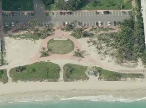 6500 Collins Avenue
Miami, FL 33141
Open; Sunrise to Sunset
GPS 25° 50'50.39" N 80° 07'12.28" W
( Entrance )
|
|
|
Go to map of beaches in Miami ~ Dade County
Allison Beach Park in Miami offers; Beach access, sunbathing, beachcombing, playground, 75 metered parking spaces in lot and restrooms
Bal Harbour Beach
Located between;
102nd Street on the northern end ( access point )
Hotels between these points limit beach access.
96th Street on the southern end ( access point )
|
|
|
Go to map of beaches in Miami ~ Dade County
Limited metered parking under the Haulover Bridge serves the 102nd street access.
GPS 25° 53'47.45" N 80° 07'27.27" W
( Turn lane when heading north bound to get under bridge )
North Bound on Collins Avenue
Stay in right hand lane after Harbour Way West light and head straight for parking under the bridge.
South Bound on Collins Avenue
Do a legal u-turn at the Harbour Way West light after you cross the Haulover Bridge and catch the north bound entrance that will now be in the right lane.
Parking lot at 96th street and Abbot Ave.
GPS 25° 53'11.27" N 80° 07'27.91" W
( Entrance into 96th and Abbot Ave. lot )
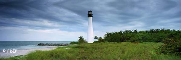
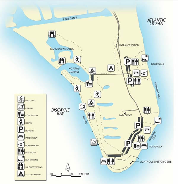
Bill Baggs Cape Florida State Park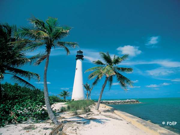 1200 South Crandon Boulevard
Key Biscayne, FL 33149
GPS 25° 40'45.85" N 80° 09'27.91" W
( Entrance )
|
|
|
Go to map of beaches in Miami ~ Dade County
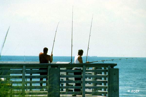
Fishing, kayaking, canoeing, swimming, snorkeling, sunbathing, hiking, beachcombing, wildlife, lighthouse, showers, restrooms, youth camping, bicycling and picnicking.
Crandon Park Beach 6747 Crandon Boulevard
Key Biscayne, FL 33149
GPS 25° 42'48.72" N 80° 09'14.91" W
( Entrance into the northern parking lot at beach )
|
|
|
Go to map of beaches in Miami ~ Dade County
Go to Crandon Park boat ramp information.
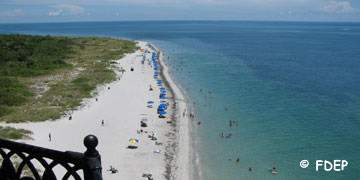
The beach is two miles long and is ranked as one of the top ten beaches in the U.S.
Huge parking lots hold hundreds of vehicles.
Gilbert Samson Oceanfront Park 17425 Collins Avenue
Sunny Isles Beach, FL 33160
GPS 25° 56'15.04" N 80° 07'16.79" W
|
|
|
Go to map of beaches in Miami ~ Dade County
Beach access, Restrooms ( open at 8:30 am ), Pavilion with tables and benches, Showers, Playground and Lifeguard Station ( please confirm ). Open Sunrise to Sunset, 2.1 acres.
Haulover Beach Park
10800 Collins Avenue
Sunny Isles, FL 33154
GPS 25° 55'01.16" N 80° 07'25.62" W
( Waters edge at ramp )
|
|
|
Go to map of beaches in Miami ~ Dade County
Northern end of this beach is clothing optional. Boat ramp, 172 trailer parking spaces.
Hobe Island Beach Park
When you are heading EAST from the toll booths the first entrance is 3/10ths of a mile on right
GPS for first entrance is; 25° 44'46.18" N 80° 11'56.00" W
There is another entrance 3/10ths of a mile further down also on right.
GPS for second entrance is; 25° 44'45.00" N 80° 11'37.28" W
When you are heading WEST the entrance into the park is about 4/10ths of a mile once you are on the causeway island.
GPS for this entrance is; 25° 44'46.22" N 80° 11'46.02" W
When exiting this park it is very easy to get confused, please be sure you know what direction you are traveling, as you want to avoid having to pay the toll of the western side twice.
NOAA
Homestead Bayfront Park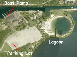 9698 N. Canal Drive
Homestead, FL 33033
GPS 25° 27'41.18" N 80° 20'37.67" W
( Entrance )
|
|
Go to map of beaches in Miami ~ Dade County
Indian Beach Park
4621 Collins Avenue
Miami Beach, FL 33140
GPS 25° 49'14.80" N 80° 07'20.71" W
( Entrance )
Indian Beach Park offers; Beach access, restrooms, tot lot ( playground ), large metered parking lot with 400 +/- spaces.
NOAA
Lummus Park
Miami Beach, FL 33139
This park stretches for 10 blocks in length along the beach.
The northern Boundary is;
Ocean Drive and 14th Place ~ GPS 25° 47'12.37" N 80° 07'46.09" W
The southern boundary is;
Ocean Drive and 5th Street ~ GPS 25° 46'29.00" N 80° 07'54.64" W
|
|
Go to map of beaches in Miami ~ Dade County
| Parking near Lummas Park ~ Parking Hotline 1-305-673-7275 |
| Address or Cross Streets | GPS | Parking |
| 5th Street & Collins Ave | 25° 46'29.18" N 80° 08'00.76" W | Municipal |
| 7th Street & Collins Ave |
25° 46'37.00" N 80° 07'58.54" W | Municipal |
| 12th Street & Drexel Ave |
25° 46'58.28" N 80° 07'59.10" W | Municipal |
| 16th Street & Collins Ave |
25° 47'20.82" N 80° 07'50.82" W | Municipal |
Marjory Stoneman Douglas Ocean Beach Park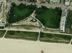 2nd Street & Ocean Drive
Miami Beach, FL 33139
GPS 25° 46'17.15" N 80° 07'57.08" W
|
|
Go to map of beaches in Miami ~ Dade County
Marjory Stoneman Douglas Ocean Beach Park offers; beach access, swimming, sunbathing, water fountain and restrooms. There is street side parking in the area.
Go to chart showing beach access locations in the City of Miami Beach
Clicking on the above link will take you to a chart showing beach access locations in The City of Miami Beach, Florida.
North Shore Open Space Park
( 8 ) Eigth Blocks in length
From: Collins & 79th street on the southern end
To: Collins & 87th street on the northern end
Miami, FL 33141
GPS 25° 52'04.94" N 80° 07'15.84" W
( Center of park on Collins Avenue )
|
|
|
Go to map of beaches in Miami ~ Dade County
Beach accesses over a large area, swimming, restrooms, showers, covered picnic pavilions ( first come basis ), rentable pavilions, snorkeling, beachcombing, shelling, picnic tables, grills. North Shore is easily accessible from Miami, Surfside, North Miami, Sunny Isles Beach and Golden Beach. Metered parking along north bound Collins Avenue. Public Parking lot at 81st Street and Collins Avenue north bound. Public Parking lot at 87 Terrace and Collins Avenue south bound. Metered parking for about 25 cars on the beachside of 87th Terrace also.
Oleta River State Park Beach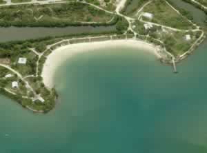 3400 Northeast 163rd Street
North Miami, FL 33160
GPS 25° 55'40.02" N 80° 08'10.31" W
( Entrance into park )
GPS 25° 54'29.07" N 80° 07'57.68" W
( Beach within the park )
|
|
|
Go to map of beaches in Miami ~ Dade County
No lifeguards on duty
Pier Park
99 Ocean Drive
Miami Beach, FL 33139
GPS 25° 46'09.52" N 80° 07'58.52" W
|
|
Go to map of beaches in Miami ~ Dade County
South Pointe Park
1 Washington Avenue
Miami, FL 33139
GPS 25° 46'02.29" N 80° 08'08.02" W
( Large parking lot )
|
|
Go to map of beaches in Miami ~ Dade County
Swimming, sunbathing, restrooms, outdoor showers, picnic areas, pier at inlet ( currently under construction 11-2011 )
Sunny Isles Beach Accesses Regulations say no surf fishing on Sunny Isle Beaches.
| Beach Access Address | GPS | Surface | Handicapped Accessible | Parking |
| NORTH ~ Hollywood Beach Accesses ~ Broward County | ||||
| 19333 Collins Avenue | 25° 57'24.13" N 80° 07'11.34"W | Paved | Yes | Lehman Causeway Lot |
| NE 192nd Street & Collins Avenue Ellen Wynne | 25° 57'17.55" N 80° 07'12.79"W | Paved | Yes | Lehman Causeway Lot |
| 19101 Collins Avenue William “Bill” Lone Beach Access | 25° 57'14.59" N 80° 07'13.04"W | Pavers | Yes | Lehman Causeway Lot |
| 189 Street & Collins Avenue Cecile Sippin Beach Access | 25° 57'04.49" N 80° 07'13.74"W | Pavers | Yes | Lehman Causeway Lot |
| 18801 Collins Avenue Varadaro IV Beach Access | 25° 56'57.60" N 80° 07'14.27"W | Concrete | Yes | Lehman Causeway Lot |
| 18001 Collins Avenue Simon Dezer Beach Access | 25° 56'34.00" N 80° 07'15.71"W | Pavers | Yes | Lehman Causeway Lot |
| 178th Street & Collins Avenue Walter Bresslour Beach Access | 25° 56'28.99" N 80° 07'16.17"W | Pavers | Yes | Lehman Causeway Lot |
| 17555 Collins Avenue Pinnacle | 25° 56'22.99" N 80° 07'16.42"W | Gravel | No | Lehman Causeway Lot |
| Gilbert Samson Oceanfront Park | ||||
| 17275 Collins Avenue Florida Ocean Club | 25° 56'11.05" N 80° 07'17.24"W | Brick | Yes | Pier Park Lot |
| 17201 Collins Avenue Irving Diamond Beach Access | 25° 56'06.32" N 80° 07'17.51"W | Brick | Yes | Pier Park Lot |
| 17001 Collins Avenue Jade on the beach | 25° 55'59.24" N 80° 07'17.95"W | Pier Park Lot | ||
| 16501 Collins Avenue Pier Park | 25° 55'47.62" N 80° 07'18.81"W | Pavers | Yes | At the Access |
| 16425 Collins Avenue Oceania | 25° 55'37.54" N 80° 07'19.65"W | Concrete | Yes | Pier Park Lot |
| 16001 Collins Avenue | 25° 55'29.66" N 80° 07'19.71"W | Concrete | ||
| Collins Avenue & Bayview Drive | 25° 55'20.90" N 80° 07'20.20"W | Concrete | ||
| SOUTH ~ Towards Surfside & Bal Harbour | ||||
NOAA
Go to map of beaches in Miami ~ Dade County
Virginia Key Beach
Virginia Key, FL 33149
GPS 25° 44'15.70" N 80° 09'43.92" W
( Entrance )
|
|
Is fishing allowed here?
Go to map of beaches in Miami ~ Dade County
Virginia Key Beach ~ Historic
Virginia Key, FL 33149
GPS 25° 44'03.85" N 80° 09'33.91" W
( Entrance )
|
|
No fishing unfortunately.
Go to map of beaches in Miami ~ Dade County
36th Street Park
Collins Ave and 36th Street
Miami Beach, FL 33140
GPS 25° 48'34.46" N 80° 07'21.52" W
|
|
Go to map of beaches in Miami ~ Dade County
53rd Street Park / Beach View Park
5300 Block Collins Ave
Miami Beach, FL 33140
GPS 25° 49'52.35" N 80° 07'18.05" W
( Entrance to parking lot )
|
|
Go to map of beaches in Miami ~ Dade County
Useful Links
| Beaches in Miami ~ Dade County Florida |
|
|
| Areas in Miami ~ Dade County Florida include; Alameda, Allapattah, Andover, Atlantic Heights, Aventura, Bal Harbour, Bay Harbor Islands, Biscayne Park, Brownsville, Buena Vista, Bunche Park, Carol City, Coconut Grove, Coral Gables, Coral Terrace, Country Club, Country Walk, Cutler, Cutler Bay, Cutler Ridge, Doral, East Perrine, Eastern Shores, Edison Center, El Portal, Fisher Island, Florida City, Fountainebleau, Gables by the Sea, Gables Estates, Gladeview, Glenvar Heights, Golden Beach, Golden Glades, Goulds, Hialeah, Hialeah Gardens, Homestead, Indian Creek Village, Islandia, Ives Estates, Kendale Lakes, Kendall, Key Biscayne, Keystone Islands, Lake Lucerne, Lakes by the Bay, Leisure City, Lemon City, Liberty Square, Lindgren Acres, Little River, Ludlam, Medley, Miami, Miami Beach, Miami Gardens, Miami Lakes, Miami Shores, Miami Springs, Naranja, Norland, North Bay Village, North Miami, North Miami Beach, Ojus, Olympia Heights, Opa-locka, Palm Springs Estates, Palmetto Bay, Palmetto Estates, Perrine, Pinecrest, Pinewood, Princeton, Richmond Heights, San Souci Estates, Scott Lake, Shenandoah, South Miami, South Miami Heights, Sunny Isles Beach, Sunset, Surfside, Sweetwater, Tamiami, The Crossings, The Hammocks, Three Lakes, University Park, Virginia Gardens, West Little River, West Miami, West Perrine, Westchester and Westview. |
| Areas of Salt and Brackish Water Miami Dade County Florida include; Atlantic Ocean, Biscayne Bay, Card Sound, Indian Creek, Intracoastal Waterway, Little Card Sound, Normandy Waterway, Snapper Creek Canal and Tatum Waterway. |
![]() Home
Home ![]() About
About ![]() Sitemap
Sitemap ![]() Credits
Credits
![]() Privacy
Privacy ![]() Advertise
Advertise ![]() Contact
Contact ![]()
